
Length 500.6 km | ||
 | ||
Counties Mercer County, Pennsylvania | ||
The transcontinental Interstate 80 (I-80) is designated across northern Pennsylvania as the Keystone Shortway, officially the Z.H. Confair Memorial Highway. This route was built mainly along a completely new alignment, not paralleling any earlier U.S. Routes, as a shortcut to the tolled Pennsylvania Turnpike and New York State Thruway. It does not serve any major cities in Pennsylvania, and serves mainly as a cross-state route on the Ohio-New York City corridor. Most of I-80's path across the state goes through hilly and mountainous terrain, with relatively flat areas playing home to the freeway toward the western tier of the state.
Contents
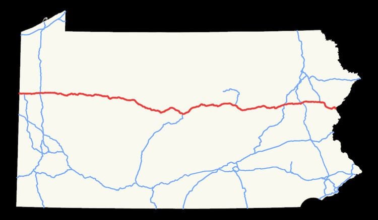
- Map of Z H Confair Memorial Hwy Pennsylvania USA
- Route description
- Western Pennsylvania
- Centre Clinton and Union counties
- Northeastern Pennsylvania
- History
- Toll proposal
- References
Map of Z. H. Confair Memorial Hwy, Pennsylvania, USA
Route description
Interstate 80 intersects cities such as DuBois, Sharon, Hazleton, and Stroudsburg.
Western Pennsylvania
I-80 enters the Western Pennsylvania area which encompasses Mercer, Venango, Butler, Clarion, Jefferson, and Clearfield Counties from the state of Ohio. I-80 intersects I-376 (serving the Pittsburgh International Airport and on to Downtown Pittsburgh) and I-79 (serving Erie to the north and Pittsburgh to the south) in Mercer County in Shenango and Findley Township respectively. Jefferson County at mile marker 73 is known for the city of Punxsutawney, the location of the famous groundhog Punxsutawney Phil who predicts the weather on Groundhog Day. In Clearfield County, I-80 reaches its highest elevation east of the Mississippi River, 2,250 feet (690 m), although other interstate highways east of the Mississippi, including I-26 in North Carolina and Tennessee, reach higher elevations. This point is just east of Exit 111. A sign prominently displays this unusual fact about the Interstate. At mile marker 101, I-80 passes by the city of Dubois.
Centre, Clinton, and Union counties
I-80 enters Centre County around mile marker 138 and intersects I-99 at exit 161, the main connecting point to the Pennsylvania Turnpike (I-76 and I-70) and the Pennsylvania State University. US 220 is concurrent between exits 161 and 178 where it heads towards Lock Haven.
At mile marker 199, I-80 approaches the Williamsport area, the venue of the Little League World Series in Union County. I-80 intersects I-180 at exit 212.
Northeastern Pennsylvania
I-80 enters the Northeastern Pennsylvania area to include points Northumberland County and east to New Jersey. In Montour County at mile marker 224, it approaches the Bloomsburg area, home to the Bloomsburg University of Pennsylvania, which is part of the Pennsylvania State System of Higher Education. I-80 also passes by the Wilkes-Barre/Scranton area in Luzerne County. At exit 260, a connection can be made via I-81 to Harrisburg to the south and Binghamton, NY to the north.
I-80 intersects I-476 at exit 274 in Carbon County for connections to Allentown and Philadelphia to the south and I-380 for a connection to I-84 to New England and Scranton. Around mile marker 305, I-80 approaches Stroudsburg and East Stroudsburg, home to the East Stroudsburg University of Pennsylvania and the ski resort areas generally known as the Poconos. After passing by the Delaware Water Gap, I-80 enters the state of New Jersey via the Delaware Water Gap Toll Bridge.
History
The corridor now served by I-80 was originally to be a branch of the Pennsylvania Turnpike from Sharon to Stroudsburg. Planning was shifted to the Pennsylvania Department of Highways in 1956 with the passage of the National Interstate and Defense Highways Act.
In early plans for the Interstate Highway System, the connection across northern Pennsylvania would have paralleled U.S. Route 6N and U.S. Route 6 from what became Interstate 90 near West Springfield, Pennsylvania east to Scranton. (From Scranton east to Hartford, Connecticut, Interstate 84 was built parallel to US 6.) From Scranton a route went southeast along U.S. Route 611 to the Stroudsburg area, and then east along U.S. Route 46 to near New York City. On May 22, 1957, a request by Pennsylvania to move the corridor south was approved by the Federal Highway Administration. (The Scranton-Stroudsburg connection was kept, and the new alignment merged with it west of Stroudsburg.) However, when the initial numbers were assigned later that year, they were drawn on a 1947 map, and so the corridor across northern Pennsylvania became part of Interstate 84, while the Scranton-New York route became Interstate 82. (I-80 ran along the Pennsylvania Turnpike - later Interstate 80S - to Harrisburg, where it split into I-80S to Philadelphia and I-80N (later Interstate 78) to New York.) This was corrected the next year, as the Keystone Shortway became part of I-80, and the southern route became I-80S (later I-76) and I-78. I-84 was truncated to Scranton, and the Scranton-Stroudsburg connection became Interstate 81E (later renumbered Interstate 380).
The first section of present I-80 to open was the Delaware Water Gap Toll Bridge, opened December 16, 1953. This had been built as part of U.S. Route 611 and connected back to its old alignment soon after crossing into Pennsylvania. Construction on the rest of I-80 began in 1959 and was completed in 1970.
In 1993, exit 43 (now exit 284) of I-80, which serves the Pocono Raceway, was designated the Richard Petty Interchange in honor of the NASCAR legend that drove the #43 car.
On March 7, 2011, the supporting wall on the eastbound I-80 bridge over Sullivan Trail in Tannersville collapsed from snow and rain. As a result, eastbound I-80 was reduced to one lane and Sullivan Trail was closed.
On July 10, 2014, a criminal rock throwing incident known as the I-80 rock throwing took place along I-80 in Union County, critically injuring and permanently disfiguring a passenger. Four local youths were responsible.
Toll proposal
In an effort to keep the Pennsylvania Turnpike system under public control, in June 2007, the Pennsylvania Turnpike Commission proposed tolling Interstate 80 as a means of raising transportation revenue. It is seeking the permission to put tolls on the highway through a Federal Highway Administration pilot program that allows three states to place tolls on interstates. Missouri's Interstate 70 and Virginia had already taken two of the spots. Under the plan, the PTC would assume all maintenance and toll-taking operations on I-80. The plan calls for up to ten toll plazas along the length of I-80 in Pennsylvania with a toll rate of 8 cents per mile (5.0 ¢/km), which would be comparable to the rate on the Pennsylvania Turnpike following a projected toll increase. Originally, I-80 was part of the PTC's 1,000 Mile Turnpike system, but with the passage of the Interstate Highway Act in 1954, the PTC abandoned the 1,000-mile (1,600 km) system and only maintained the original east–west Turnpike and its Northeastern Extension. Currently the only toll on I-80 in Pennsylvania is at the Delaware Water Gap bridge between Pennsylvania and New Jersey. Tolling on I-80 was to be completed by 2010. On October 15, 2007, the lease for the Pennsylvania Turnpike Commission to toll I-80 was signed.
This plan faced opposition from Northern Pennsylvania politicians who feared tolls would hurt the economy in the region and who did not want their tolls going toward funding mass transit. Congressmen John E. Peterson and Phil English proposed a federal transportation bill that would ban the tolling of I-80. The chief executive officer of the Pennsylvania Turnpike Commission promised that the tolls would be used on highway projects in Pennsylvania and not on mass transit. On December 12, 2007, the FHWA rejected the plan, and returned Pennsylvania's application for tolling I-80 with questions asking why the state should place tolls on the highway.
On September 11, 2008, the Federal Highway Administration rejected Pennsylvania's application to toll Interstate 80 for the second time.
On April 6, 2010, the Federal Highway Administration rejected this application for the third time.