
Type Highway SA/VIC border end near Mount Gambier Length 1,717 km | Opened 1955 SA/WA border end near Eucla | |
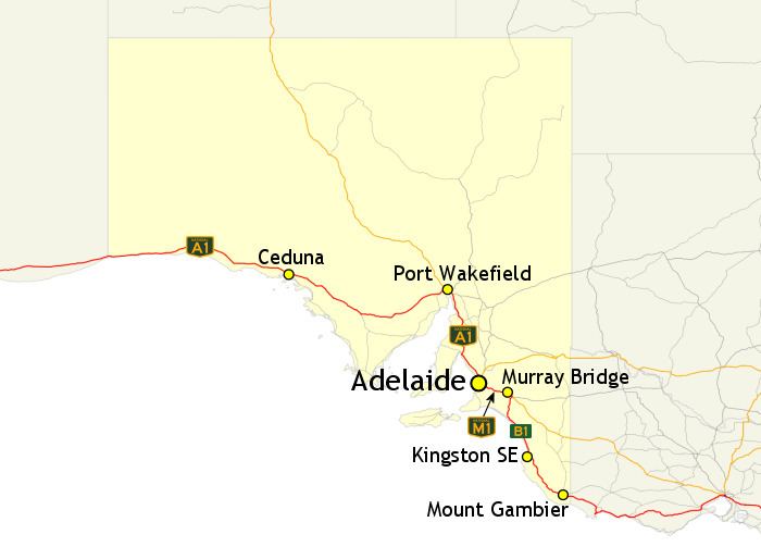 | ||
Route number(s) B1(south of Murray Bridge) National Highway M1(Murray Bridge to Glen Osmond) A1(Glen Osmond to Waterloo Corner) National Highway A1(Waterloo Corner to Eucla) | ||
In South Australia, Highway 1 is a 1,717-kilometre (1,067 mi) long route that follows the coastline of the state, from the Victorian border near Mount Gambier to the Western Australian border near Eucla. Highway 1 continues around the rest of Australia, joining all mainland state capitals, and connecting major centres in Tasmania. All roads within the Highway 1 system are allocated a road route numbered 1, M1, A1, or B1, depending on the state route numbering system, and parts are concurrent with National Highway routes. In South Australia, most of the highway is designated as route A1, with multi-lane, dual-carriage-way sections generally designated route M1. South-east of Tailem Bend, it is designated route B1.
Contents
History
Highway 1 was created as part of the National Route Numbering system, adopted in 1955. The route was compiled from an existing network of state and local roads and tracks.
Route description
In South Australia, the highway connects: