
State Texas Lowest elevation 0 ft (0 m) Area 4,299 km² Population 5.628 million (2007) | Highest elevation 430 ft (131 m) Time zone CST (UTC-6) Metropolitan area 26,060 km² | |
 | ||
Country United States of America Principal cities ListHoustonThe WoodlandsSugar LandBaytownConroe | ||
Greater houston tx dance recital video and photography production services
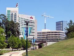
Houston–The Woodlands–Sugar Land is a nine-county metropolitan area defined by the Office of Management and Budget. It is located along the Gulf Coast region in the U.S. state of Texas. The metropolitan area is colloquially referred to as "Greater Houston" and is situated in Southeast Texas.
Contents
- Greater houston tx dance recital video and photography production services
- Geography
- Geology
- Components of the metropolitan area
- Municipalities CDPs and other communities
- Demographics
- Economy
- College sports Division I
- Events
- Culture
- Media
- Colleges and universities
- Highways
- Mass transit
- Airports
- Intercity rail
- Intercity bus
- Politics
- References
Houston–The Woodlands–Sugar Land is the fifth-largest metropolitan area in the United States and the second-largest in Texas (after Dallas–Fort Worth) with a population of 6,490,180, as of U.S. Census Bureau's July 1, 2010 estimates.
The population of the metropolitan area is centered in the city of Houston—the largest economic and cultural center of the American South, with a population of 2.1 million.
Houston is among the fastest-growing metropolitan areas in the United States. The Houston-The Woodlands-Sugar Land metro area was the fastest growing metro area numerically during the 2013-2014 census year, with 156,371 people added The area grew 25.2% between the 1990 and 2000 censuses—adding more than 950,000 people—while the nation's population increased 13.2% over the same period. From 2000 to 2007, the area grew by 912,994 people. From 2000 to 2030, the metropolitan area is projected by Woods & Poole Economics to rank fifth in the nation in population growth—adding 2.66 million people. In 2009, Milken Institute/Greenstreet Real Estate Partners ranked the then-named Houston–Sugar Land–Baytown MSA as the fifth-best performing metropolitan area; the Houston area had moved up 11 spaces from the previous year's ranking. It is a part of the Texas Triangle megapolitan area.
Greater houston tx dance recital video and photography production services
Geography
According to the United States Census Bureau, the Houston–The Woodlands–Sugar Land metropolitan statistical area has a total area of 10,062 square miles (26,060 km²), 8,929 sq mi (23,130 km2) is land area, while 1,133 sq mi (2,930 km2) is water area, slightly smaller than Massachusetts and slightly larger than New Jersey.
The OMB lumps the Houston-The Woodlands-Sugarland MSA with four micropolitan statistical areas to form the Houston-The Woodlands, TX Combined Statistical Area.: Bay City, Brenham, El Campo, and Huntsville.
The metropolitan area is located in the Gulf Coastal Plains biome, and its vegetation is classified as temperate grassland. Much of the metro area was built on forested land, marshes, swamp, or prairie—all of which can still be seen in surrounding areas. The Houston area land mass is very diverse. There is forested land and hills to the north, beaches and grasslands to the south, swamps and marshlands to the east, rice fields and praires to the west.
Much of the Houston metropolitan area is very flat, making flooding a recurring problem for some areas.
Geology
Underpinning Houston's land surface are unconsolidated clays, clay shales, and poorly cemented sands up to several miles deep. The region's geology developed from stream deposits formed from the erosion of the Rocky Mountains. These sediments consist of a series of sands and clays deposited on decaying organic matter that, over time, transformed into oil and natural gas. Beneath these tiers is a water-deposited layer of halite, a rock salt. The porous layers were compressed over time and forced upward. As it pushed upward, the salt dragged surrounding sediments into dome shapes, often trapping oil and gas that seeped from the surrounding porous sands. This thick, rich soil also provides a good environment for rice farming in suburban outskirts into which the city continues to grow near Katy. Evidence of past rice farming is even still evident in developed areas as an abundance of rich, dark, loamy top soil exists.
The Houston region is generally earthquake-free. While the city of Houston contains over 150 active surface faults (some have estimated as many as 300 active faults) with an aggregate length of up to 310 miles (500 km), the clay below the surface precludes the buildup of friction that produces ground-shaking in earthquakes. These faults generally move at a smooth rate in what is termed "fault creep".
Components of the metropolitan area
As defined by the Office of Management and Budget, the metropolitan area of Houston–The Woodlands–Sugar Land encompasses nine counties in Texas. They are listed below with population figures as of the 2010 U.S. Census.
Municipalities, CDPs, and other communities
Five "principal" communities are designated within Houston–The Woodlands–Sugar Land metropolitan area. The Woodlands is a CDP; the rest are cities:
Demographics
As of 2011 Greater Houston has four of Texas' ten wealthiest communities, which include the wealthiest community, Hunters Creek Village, the fourth-wealthiest community, Bunker Hill Village, the fifth-wealthiest community, West University Place, and the sixth-wealthiest community, Piney Point Village.
Economy
Among the ten most populous metropolitan areas in the U.S., Houston ranked first in employment growth rate and second in nominal employment growth. In 2006, the Houston metropolitan area ranked first in Texas and third in the U.S. within the category of "Best Places for Business and Careers" by Forbes.
The Houston–The Woodlands-Sugar Land MSA's gross metropolitan product (GMP) in 2005 was $308.7 billion, up 5.4% from 2004 in constant dollars—slightly larger than Austria's gross domestic product. By 2012, the GMP has risen to $449 billion, the fourth-largest of any metropolitan area in the United States.[4] Only 26 nations other than the United States have a GDP exceeding Houston's GAP. Mining, which in Houston is almost entirely oil and gas exploration and production, accounts for 11% of Houston's GAP—down from 21% as recently as 1985. The reduced role of oil and gas in Houston's GAP reflects the rapid growth of other sectors—such as engineering services, health services, and manufacturing.
The area's economic activity is centered in Houston, the county seat of Harris County. Houston is second to New York City in Fortune 500 headquarters. The city has attempted to build a banking industry, but the companies originally started in Houston have since merged with other companies nationwide. Banking, however, is still vital to the region.
Galveston Bay and the Buffalo Bayou together form one of the most important shipping hubs in the world. The Port of Houston, the Port of Texas City, and the Port of Galveston are all major seaports located in this Greater Houston area. The area is also one of the leading centers of the energy industry, particularly petroleum processing, and many companies have large operations in this region. The metropolitan area also comprises the largest petrochemical manufacturing area in the world, including for synthetic rubber, insecticides, and fertilizers. The area is also the world's leading center for building oilfield equipment. The region is also a major center of biomedical research, aeronautics, and high technology.
Much of the metro area's success as a petrochemical complex is enabled by its busy man-made ship channel, the Houston Ship Channel. Because of these economic trades, many residents have moved to the Houston area from other U.S. states, as well as hundreds of countries worldwide. Unlike most places, where high fuel prices are seen as harmful to the economy, they are generally seen as beneficial for Houston, as many are employed in the energy industry. Baytown, Pasadena/La Porte, and Texas City have some of the area's largest petroleum/petrochemical plants, though major operations can be found in Houston, Anahuac, Clute, and other communities. Galveston has the largest cruise ship terminal in Texas (and the 12th-largest in the world). The island, as well the Clear Lake Area, are major recreation and tourism areas in the region.
Houston is home to the Texas Medical Center—the largest medical center in the world. Galveston is home to one of only two national biocontainment laboratories in the United States.
The University of Houston System's annual impact on the Houston-area's economy equates to that of a major corporation: $1.1 billion in new funds attracted annually to the Houston area, $3.13 billion in total economic benefit, and 24,000 local jobs generated. This is in addition to the 12,500 new graduates the UH System produces every year who enter the workforce in Houston and throughout Texas. These degree-holders tend to stay in Houston; after five years, 80.5% of graduates are still living and working in the region.
Sugar Land is home to the second-largest economic activities and third-largest city in the metropolitan area. Sugar Land has the most important economic center in Fort Bend County. The city holds the Imperial Sugar (its namesake), Nalco Champion, and Western Airways headquarters. Engineering firms and other related industries have managed to take the place as an economic engine.
College sports (Division I)
Greater Houston is home to five NCAA Division I programs, with four located within Houston proper. The University of Houston and Rice University play in Division I (FBS). The University of Houston plays in the American Athletic Conference, while Rice belongs to Conference USA. Both schools were once part of the Southwest Conference. Texas Southern University, which is a member of the Southwestern Athletic Conference, plays in Division I (FCS). Houston Baptist University currently plays in Division I (FCS), mainly in the Southland Conference. Rice and Houston Baptist are widely noted for their student-athlete graduation rates, which number at 91% for Rice (tied for highest in the nation according to a 2002 Sports Illustrated issue on best college sports programs) and 80% for HBU.
Events
Houston is or has been home to various nationally known sporting events. The most notable is the Houston Livestock Show and Rodeo, which is the world's largest livestock exhibition and rodeo event. Other events of importance on greater Houston include the Shell Houston Open (a PGA Tour event), the U.S. Men's Clay Court Championships (ATP tour), the Houston Marathon, and the Texas Bowl college football bowl game. Houston has also played host to two Super Bowls (VIII) and (XXXVIII), the 1968, 1986, and 2004 MLB All-Star Games, the 2005 World Series, and the 1989, 2006, 2013 NBA All-Star Games. Houston has also played host to various high school and college sporting events, including the Big 12 Championship Game and hosted the 2011 NCAA Men's Final Four, 2010 NCAA Men's Regional Finals, and 2010 MLS All-Star Game. Houston was also considered a candidate for the 2012 and 2016 Olympic Games. Houston is slated to host Super Bowl LI in 2017.
Culture
Houston's concentration of consular offices ranks third in the nation and first in the South, with 90 countries represented. Houston has a sizable Hispanic community. CNN/Money and Money magazine have recognized cities in the Greater Houston area the past three years as part of its 100 Best Places to Live in the United States. In 2005, Sugar Land, southwest of Houston in northeast Fort Bend County, was ranked 46th in the nation, and one of only three Texas cities among the Top 100. In 2006, the magazine recognized Sugar Land again, this time as the third-best city on its list. Also making the 2006 list were League City (65th) in northern Galveston County and The Woodlands (73rd) in southern Montgomery County. In 2007, another Houston suburb, Friendswood, made the list ranked 51st in the nation. The 2006 list only includes cities with at least 50,000 residents, and the 2007 list contains only cities with less than 50,000 residents.
Greater Houston is widely noted for its ethnic diversity and strong international community. In its 2010 publication "Urban Elite", A.T. Kearney added the city to their list of the 65 most important world cities and ranks Houston 35th, as "...a magnet for a diverse population and business services...". The Globalization and World Cities Study Group and Network ranks Houston as a Beta- World City, "an important world city instrumental to linking their region or state to the world economy."
Media
Houston–The Woodlands–Sugar Land metropolitan area is served by a public television station and one public radio station. KUHT (HoustonPBS) is a PBS member station and is the first public television station in the United States. Houston Public Radio is listener-funded radio and comprises one NPR member station, KUHF (KUHF News). The University of Houston System owns and holds broadcasting licenses to KUHT and KUHF. The stations broadcast from the Melcher Center for Public Broadcasting, located on the campus of the University of Houston.
The Houston area is served by the Houston Chronicle, its only major daily newspaper with wide distribution. The Hearst Corporation, which owns and operates the Houston Chronicle, bought the assets of the Houston Post—its long-time rival and main competition—when Houston Post ceased operations in 1995. The Houston Post was owned by the family of former Lieutenant Governor Bill Hobby of Houston. The only other major publication to serve the city is the Houston Press—a free alternative weekly with a weekly readership of more than 300,000.
The Galveston County Daily News, founded in 1842, is that city's primary newspaper and the oldest continuously printed newspaper in Texas. It currently serves as the newspaper of record for Galveston, as well as Galveston County. Radio station KGBC, on air since 1947, has also served as a local media outlet.
Colleges and universities
Five separate and distinct state universities are located within Houston–The Woodlands–Sugar Land metropolitan area. The University of Houston is a nationally recognized Tier One research university, and is the flagship institution of the University of Houston System. The third-largest university in Texas, the University of Houston has nearly 40,000 students on its 667-acre campus in southeast Houston. The University of Houston–Clear Lake and the University of Houston–Downtown are stand-aloneuniversities; they are not branch campuses of the University of Houston. The metropolitan area is home to two historically black colleges and universities: Texas Southern University and Prairie View A&M University. The University of Texas Medical Branch and Texas A&M University at Galveston, a branch campus of Texas A&M University, are located in Galveston.
Several private institutions of higher learning—ranging from liberal arts colleges to a nationally recognized research university—are located within the metropolitan area. The University of St. Thomas is a Catholic institution known for small classes (an average of 14 students per class). Houston Baptist University, located in the Sharpstown area, was founded in 1960. Rice University is one of the leading teaching and research universities of the United States and ranked the nation's 17th-best overall university by U.S. News & World Report.
Three community college districts exist with campuses in and around Houston. The Houston Community College System serves most of Houston. The northwestern through northeastern parts of the metropolitan area are served by various campuses of the Lone Star College System, while the southeastern portion of the city and some surrounding areas are served by San Jacinto College. Eastern portions of the area and small sections of the city are served by Lee College. Portions of Fort Bend County are served by Wharton County Junior College. Portions of Galveston County are served by College of the Mainland and Galveston College. Portions of Brazoria County are served by Alvin Community College and Brazosport College. Blinn College serves portions of Austin County. The Houston Community College and Lone Star College systems are within the 10 largest institutions of higher learning in the United States.
Highways
Houston’s freeway system includes 575.5 miles (926.2 km) of freeways and expressways in the 10-county metro area. The State of Texas plans to spend $65 billion on Houston area highways by 2025. Houston freeways are heavily traveled and often under construction to meet the demands of continuing growth.
The Greater Houston area has a hub-and-spoke freeway structure with multiple loops. The innermost is Interstate 610, forming a roughly 42-mile (70 km)-circumference loop around downtown. The nearly square Loop 610 is quartered into "North Loop", "South Loop", "West Loop", and "East Loop". The roads of Beltway 8 and their freeway core, the Sam Houston Tollway, are the next loop, at a diameter around 83 miles (134 km). A proposed highway project, State Highway 99 (the Grand Parkway), would form a third loop outside of Houston. Currently, a completed portion of State Highway 99 runs from U.S. Highway 290, northwest of Houston, to U.S. Highway 59 in Sugar Land, southwest of Houston, and was completed in 2013. Another segment of State Highway 99 from Interstate 10 south to Farm-to-Market Road 1405 in Chambers County was completed in 2008. The next portion to be constructed is from the current terminus at U.S. Highway 290 to U.S. Highway 59 in Montgomery County. Freeways also include the Westpark Tollway, which runs from U.S. Hwy 59 to Texas Hwy 99 and the Fort Bend Parkway, which runs from U.S. Hwy 90-A to Texas Hwy 6 in Missouri City. A new interstate, Interstate 69, will start at the Mexico–US border, go through the Greater Houston area, and continue on to Michigan at the Canada–US border. All of Interstate 69 has been completed in the Greater Houston area.
Mass transit
The Metropolitan Transit Authority of Harris County, Texas, or METRO, provides public transportation in the form of buses, trolleys, and lift vans.
METRO began running light rail service (METRORail) on January 1, 2004. Currently, the track is rather short — about 22.7 miles (20.6 km) from Northline Transit Center Station through downtown Houston to the Texas Medical Center and Reliant Park, and lines from downtown to the East End and the University of Houston/Lower 3rd Ward. Still, the system is traveled by about 61,000 people daily, giving it the second-highest ridership per track mile in the nation. The Uptown Light Rail Line has been converted to a BRT Line and began construction in the late 2nd quarter of 2016. The BRT Line will run between the former NW Mall (which is in the process of redevelopment) and the WestPark TC. METRO's various forms of public transportation still do not connect multiple suburbs to the inner city (defined by the 610 loop), causing Houstonians to rely on the automobile as a primary source of transportation. The problem is one due the lack of a central metropolitan area transportation authority, primarily due to a few suburban counties refusing to cooperate with METRO. For example, there are multiple coach bus services that run into downtown Houston. METRO is in the late planning stages of the US 90 Commuter line which will service the Ft Bend County and SW Harris County suburban region. Prior to the opening of METRORail, Houston was the largest large major city in the United States without a rail transit system.
Following a successful referendum held locally in 2004, METRO is currently in the beginning design phases of a 10-year expansion plan to add five more sections to connect to the current rail system. An 8.3-mile (13.4-km) expansion has been approved to run the service from Uptown through Texas Southern University, ending at the University of Houston campus.
Airports
Houston's largest airport (and Texas's second-largest), George Bush Intercontinental Airport, is located in north Houston. Continental Airlines was headquartered in downtown Houston. The southeast of Houston has William P. Hobby Airport, the second-largest commercial passenger airport. Houston's third-largest airport is Ellington Field, which houses several National Guard and Air National Guard units, as well as a United States Coast Guard air station and the Lyndon B. Johnson Space Center's fleet of jets that are used to train astronauts. Sugar Land has the Sugar Land Regional Airport, which is the fourth-largest airport in the metropolitan area. Both Sugar Land Regional and Ellington Field serve as reliever airports for the Houston Airport System.
Intercity rail
Amtrak provides intercity rail service to the Houston station.
Intercity bus
Greyhound Bus Lines operates services from three bus stations in the City of Houston:
In addition, Greyhound operates services from two stops
Greyhound also operates services to stops within other cities in the Greater Houston area, including:
Three Megabus stations additionally serve the Houston area:
Politics
Politically, the Greater Houston area has historically been divided between areas of strength of the Republican and Democratic parties.
The city of Houston has historically voted Democratic except for its affluent western and west-central portions, including the River Oaks, Westchase, Memorial, and Uptown areas, as well as the Kingwood and Clear Lake City master-planned communities on Houston's far northeast and southeast sides, respectively. All these areas, populated mostly by wealthy WASPS, favor and are almost entirely represented both in Congress and in the Texas Legislature by Republicans. Democrats' strongest areas are within Loop 610, and in the largely poor and minority northern, eastern, and southern portions of Houston. Most of these areas have sizable Hispanic populations, though some northern and southern parts of the city have mostly notable African American communities. Democrats are also stronger in the more liberal Neartown area, which is home to a large artist and LGBT community, and Alief, which houses a sizable Asian American population. In 2008, almost every county in the region voted for Republican John McCain; only Harris County was won by Democratic candidate Barack Obama, by a small margin (51%–49%). Galveston has long been a staunch Democratic stronghold, with the most active Democratic county establishment in the state.
Houston's suburbs are also politically divided. Such examples: