
Country United States Demonym(s) Rosenberger Zip code 77471 Local time Wednesday 5:07 PM | Elevation 105 ft (32 m) Time zone Central (CST) (UTC-6) Population 33,188 (2013) | |
 | ||
Weather 28°C, Wind S at 19 km/h, 44% Humidity Points of interest Rosenberg Railroad Museum | ||
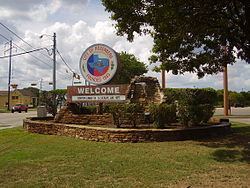
Welcome to rosenberg texas
Rosenberg is a city in the U.S. state of Texas, within the Houston–The Woodlands–Sugar Land metropolitan area and Fort Bend County. The population was 30,618 at the 2010 census, up from 24,043 at the 2000 census. As of 2015, the population had risen to an estimated 35,510.
Contents
- Welcome to rosenberg texas
- Map of Rosenberg TX USA
- History
- Geography
- Climate
- Demographics
- Government and infrastructure
- Public schools
- Private schools
- Public libraries
- Parks and recreation
- Transportation
- Notable people
- References
Map of Rosenberg, TX, USA
The community holds the Fort Bend County fair in October. Rosenberg sits adjacent to the city of Richmond, the Fort Bend County seat.
History
Rosenberg is named after Henry Rosenberg, who migrated from Switzerland to the United States in 1843. He was the first president of the Gulf, Colorado and Santa Fe Railway.
Geography
Rosenberg is located in central Fort Bend County at 29°33′9″N 95°48′18″W (29.552388, -95.804899), on the south side of the Brazos River. It is bordered to the northeast by Richmond, to the south by Pleak, and to the southwest by Beasley.
The Southwest Freeway (I-69 and US-59) runs through the south side of Rosenberg, bypassing the city center. The freeway leads northeast 32 miles (51 km) to downtown Houston, and US-59 continues southwest 92 miles (148 km) to Victoria and beyond.
According to the United States Census Bureau, Rosenberg has a total area of 22.5 square miles (58.4 km2), of which 22.5 square miles (58.2 km2) is land and 0.04 square miles (0.1 km2), or 0.25%, is water.
Climate
The climate in this area is characterized by hot, humid summers and generally mild to cool winters. According to the Köppen Climate Classification system, Rosenberg has a humid subtropical climate, abbreviated "Cfa" on climate maps.
Demographics
At the 2000 census, there were 24,043 people, 7,933 households and 5,976 families residing in the city. The population density was 1,131.7 per square mile (436.8/km²). There were 8,438 housing units at an average density of 397.2 per square mile (153.3/km²). The racial makeup of the city was 65.69% White, 8.53% African American, 0.37% Native American, 0.38% Asian, 0.04% Pacific Islander, 22.17% from other races, and 2.81% from two or more races. Hispanic or Latino of any race were 54.96% of the population.
There were 7,933 households of which 41.3% had children under the age of 18 living with them, 53.4% were married couples living together, 15.7% had a female householder with no husband present, and 24.7% were non-families. 20.8% of all households were made up of individuals and 8.1% had someone living alone who was 65 years of age or older. The average household size was 3.00 and the average family size was 3.48.
30.9% of the population were under the age of 18, 10.8% from 18 to 24, 30.0% from 25 to 44, 18.5% from 45 to 64, and 9.8% who were 65 years of age or older. The median age was 30 years. For every 100 females there were 98.6 males. For every 100 females age 18 and over, there were 95.2 males.
The median household income was $35,510 and the median family income was $39,965. Males had a median income of $28,723 versus $21,945 for females. The per capita income for the city was $14,814. About 13.6% of families and 16.1% of the population were below the poverty line, including 20.7% of those under age 18 and 12.9% of those age 65 or over.
Government and infrastructure
The Texas Department of Criminal Justice (TDCJ) operates the Rosenberg District Parole Office in a nearby unincorporated area.
The United States Postal Service Rosenberg Post Office is located at 2103 Avenue G.
Mayor Cynthia A. McConathy was elected Mayor in May 2015. Prior to becoming Mayor, she had served as Councilor At Large, Position 2 since May 2011.
Public schools
Rosenberg is served by the Lamar Consolidated Independent School District.
Several elementary schools are in Rosenberg and serve Rosenberg: Arredondo, Bowie, Jackson, Taylor Ray and Travis.
In addition, Hutchison, Long, Seguin, and Smith Elementary Schools, which are all in Richmond, serve small portions of Rosenberg. In addition, Williams Elementary School in unincorporated Fort Bend County serves a small section of Rosenberg.
Some of Rosenberg is served by Wessendorf Middle School, Lamar Junior High School, and Lamar Consolidated High School. Other parts are served by Navarro Middle School, George Junior High School, and B.F. Terry High School. All of those schools are in Rosenberg. Some parts are served by Antoinette Reading Junior High and George Ranch High School, in an unincorporated area. Small portions are served by Briscoe Junior High School and Foster High School.
Private schools
Public libraries
Fort Bend County Libraries operates the George Memorial Library, the main library, in Richmond. The main library was originally located in Rosenberg, near the Polly Ryon hospital. The library moved to Richmond in 1986. The library underwent extensive renovations in 2013 and reopened with new technology, media rooms, and room design.
Parks and recreation
The City of Rosenberg operates nine municipal parks within the city limits.
Fort Bend County operates the Bud O'Shieles Community Center in Rosenberg. The two acre center includes an auditorium, meeting centers, and centers for elderly people.
Transportation
Greyhound Bus Lines serves the Rosenberg Station at Raceway gas station.