
Founded 1837 Website www.co.grant.wi.gov Population 51,069 (2013) | Area 3,064 km² | |
 | ||
Points of interest Wyalusing State Park, Nelson Dewey State Park, Stonefield, Potosi Brewery, The Mining Museum and Rollo Destinations | ||
Grant County is a county located in the U.S. state of Wisconsin. As of the 2010 census, the population was 51,208. Its county seat is Lancaster.
Contents
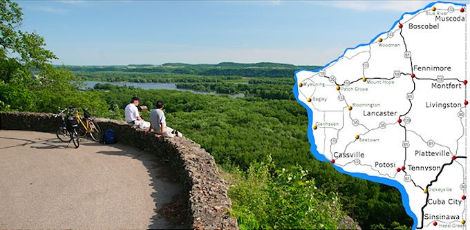
- Map of Grant County WI USA
- Native American period
- Spanish period
- French period
- British period
- United States period
- Geography
- Airports
- Adjacent counties
- Demographics
- Government and infrastructure
- Cities
- Census designated places
- Ghost town
- Notable people
- References
Map of Grant County, WI, USA
Grant County comprises the Platteville, WI Micropolitan Statistical Area. It is in the tri-state area of Illinois, Iowa, and Wisconsin, and is crossed by travelers commuting to Madison from a number of eastern Iowan cities, and by residents of northern Illinois traveling to the Twin Cities or La Crosse, Wisconsin.
Native American period
What is now Grant County was largely uninhabited prior to contact with Europeans, as it was a border region between the territories of the Kickapoo, Menominee, and Illinois tribes. The only Native American group to have a permanent settlement in the area was the Meskwaki, sometimes known as the Fox, who had a temporary village in what is now the extreme northeast of the county during the mid-1700s.
Spanish period
Between 1520 and 1620 this area was nominally ruled by Spain, though no Spaniard or anyone who claimed loyalty to Spain had ever come within five hundred miles of the region during this time, and as such, Spanish authority went completely unfelt in what is now Grant County, Wisconsin.
French period
The first Frenchmen to reach what is now Grant County were Jacques Marquette and Louis Joliet who explored the region in the spring of 1673, when they set out from what would later become Green Bay. No permanent settlement was made. In 1680 Louis Hennepin also passed through the region that would later become Grant County, also making no permanent settlement. In 1689 Nicholas Perrot passed through the territory and claimed it for the King of France. The first known settlement by a European came in 1725 when a trading post was established by Pierriere Marin. Later the French would abandon it.
British period
The British technically ruled the region during the period in between the French and Indian War and the American Revolution, though no effort was made to settle or administer the region which would eventually become Grant County. After the French abandoned the trading post established by Marin, the next person of European descent to see what is now Grant County was Captain Jonathan Carver, an English colonial from Connecticut who passed through what is now Grant County in 1776 during an attempt to discover the Pacific Ocean.
United States period
In 1783 the British government acknowledged the jurisdiction of the United States over the land east of the Mississippi River, including what is now Grant County. There were no permanent settlers of either European or Native American descent in what is now Grant County since the French trading post established by Marin was abandoned, both Native Americans of the region and the European and White American fur traders who passed through were nomadic, and left no records. Grant County was created as part of Wisconsin Territory in 1837. It was named after an Indian trader; his first name, origins, and eventual fate are all unknown.
Geography
According to the U.S. Census Bureau, the county has a total area of 1,183 square miles (3,060 km2), of which 1,147 square miles (2,970 km2) is land and 36 square miles (93 km2) (3.1%) is water.
Airports
Adjacent counties
Demographics
As of the census of 2000, there were 49,597 people, 18,465 households, and 12,390 families residing in the county. The population density was 43 people per square mile (17/km²). There were 19,940 housing units at an average density of 17 per square mile (7/km²). The racial makeup of the county was 98.23% White, 0.52% Black or African American, 0.13% Native American, 0.46% Asian, 0.01% Pacific Islander, 0.14% from other races, and 0.50% from two or more races. 0.56% of the population were Hispanic or Latino of any race. 52.0% were of German, 9.2% English, 8.8% Irish, 6.6% American and 6.4% Norwegian ancestry according to Census 2000.
There were 18,465 households out of which 30.50% had children under the age of 18 living with them, 56.10% were married couples living together, 7.50% had a female householder with no husband present, and 32.90% were non-families. 26.00% of all households were made up of individuals and 12.10% had someone living alone who was 65 years of age or older. The average household size was 2.51 and the average family size was 3.03.
In the county, the population was spread out with 23.70% under the age of 18, 14.60% from 18 to 24, 24.80% from 25 to 44, 21.60% from 45 to 64, and 15.30% who were 65 years of age or older. The median age was 36 years. For every 100 females there were 103.00 males. For every 100 females age 18 and over, there were 102.00 males.
Government and infrastructure
The Wisconsin Secure Program Facility (WSPF), a Wisconsin Department of Corrections prison for men, is located in Boscobel in Grant County.