
Website www.iowacounty.org Founded 1829 | Area 1,989 km² Population 23,749 (2013) Unemployment rate 4.0% (Apr 2015) | |
 | ||
Destinations Points of interest House on the Rock, Governor Dodge State Park, Pendarvis - Wisconsin, Blue Mound State Park, Tower Hill State Park | ||
Iowa County is a county in the U.S. state of Wisconsin. As of the 2010 census, the population was 23,687. Its county seat and largest city is Dodgeville. When created, it was part of the Michigan Territory.
Contents
- Map of Iowa County WI USA
- History
- Geography
- Rivers and streams
- Airport
- Adjacent counties
- Demographics
- Parks and recreation
- Cities
- Census designated place
- Ghost towns
- Notable people
- References
Map of Iowa County, WI, USA
Iowa County is part of the Madison, Wisconsin, Metropolitan Statistical Area.
History
The county organized under the Michigan Territory government in 1830. It was named for the Iowa tribe.
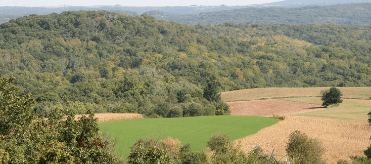
Geography
According to the U.S. Census Bureau, the county has an area of 768 square miles (1,990 km2), of which 763 square miles (1,980 km2) is land and 5.4 square miles (14 km2) (0.7%) is water. It is drained by tributaries of the Pecatonica River, which has its headwaters in the county.
Rivers and streams
Airport
Adjacent counties
Demographics
As of the census of 2000, there were 22,780 people, 8,764 households, and 6,213 families residing in the county. The population density was 30 people per square mile (12/km²). There were 9,579 housing units at an average density of 13 per square mile (5/km²). The racial makeup of the county was 98.70% White, 0.17% Black or African American, 0.11% Native American, 0.34% Asian, 0.01% Pacific Islander, 0.11% from other races, and 0.55% from two or more races. 0.33% of the population were Hispanic or Latino of any race. 33.6% were of German, 17.2% Norwegian, 11.6% English, 11.3% Irish and 7.9% American ancestry according to Census 2000.
There were 8,764 households, out of which 34.60% had children under the age of 18 living with them, 59.50% were married couples living together, 7.60% had a female householder with no husband present, and 29.10% were non-families. 24.30% of all households were made up of individuals and 10.10% had someone living alone who was 65 years of age or older. The average household size was 2.56 and the average family size was 3.06.
In the county, the population was spread out with 27.10% under the age of 18, 6.60% from 18 to 24, 30.40% from 25 to 44, 22.50% from 45 to 64, and 13.30% who were 65 years of age or older. The median age was 37 years. For every 100 females there were 99.30 males. For every 100 females age 18 and over, there were 97.70 males.
Parks and recreation
The county has several parks, including Arena Pines-Sand Barrens State Natural Area, Arena Pines-Sand Barrens State Natural Area, Pine Cliff State Natural Area, Blue Mound State Park, Tower Hill State Park, Black Hawk Lake Recreation Area and Governor Dodge State Park.