
Founded 1850 Population 17,717 (2013) | Area 1,526 km² Unemployment rate 4.0% (Apr 2015) | |
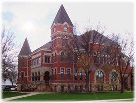 | ||
Website co.richland.wi.us/index.shtml University University of Wisconsin–Richland | ||
Richland County is a county in the U.S. state of Wisconsin. As of the 2010 census, the population was 18,021. Its county seat is Richland Center. The county was created from the Wisconsin Territory in 1842 and organized in 1850. It is named for the high quality of its soil. Some rural areas in the county have their power provided by the Richland Electric Cooperative.
Contents
- Map of Richland County WI USA
- Geography
- Airport
- Adjacent counties
- Demographics
- City
- Villages
- Census designated places
- Ghost towns
- References
Map of Richland County, WI, USA
Geography
According to the U.S. Census Bureau, the county has a total area of 589 square miles (1,530 km2), of which 586 square miles (1,520 km2) is land and 3.1 square miles (8.0 km2) (0.5%) is water.
Airport
Richland Airport (93C) serves the county and surrounding communities.
Adjacent counties
Demographics
As of the census of 2000, there were 17,924 people, 7,118 households, and 4,833 families residing in the county. The population density was 31 people per square mile (12/km²). There were 8,164 housing units at an average density of 14 per square mile (5/km²). The racial makeup of the county was 98.39% White, 0.15% Black or African American, 0.26% Native American, 0.21% Asian, 0.03% Pacific Islander, 0.28% from other races, and 0.68% from two or more races. 0.93% of the population were Hispanic or Latino of any race. 37.7% were of German, 12.5% Norwegian, 10.3% Irish, 9.5% English and 8.8% American ancestry according to Census 2000. 97.1% spoke English, 1.1% German and 1.1% Spanish as their first language.
There were 7,118 households out of which 30.50% had children under the age of 18 living with them, 56.30% were married couples living together, 7.70% had a female householder with no husband present, and 32.10% were non-families. 27.20% of all households were made up of individuals and 13.40% had someone living alone who was 65 years of age or older. The average household size was 2.48 and the average family size was 3.01.
In the county, the population was spread out with 25.20% under the age of 18, 8.40% from 18 to 24, 25.50% from 25 to 44, 23.70% from 45 to 64, and 17.20% who were 65 years of age or older. The median age was 39 years. For every 100 females there were 98.20 males. For every 100 females age 18 and over, there were 94.90 males.