
Founded 1837 Population 17,773 (2013) | Area 2,054 km² Unemployment rate 3.7% (Apr 2015) | |
 | ||
Website www.claytoncountyia.gov Destinations Points of interest Pikes Peak State Park, Carter House, Lady Luck Casino Marquette, Nelson Dewey State Park, Eagles Landing Winery | ||
Relax enjoy and experience clayton county iowa
Clayton County is a county located in the U.S. state of Iowa. As of the 2010 census, the population was 18,129. Its county seat is Elkader. The county was established in 1837 and was named in honor of John M. Clayton, United States Senator from Delaware and later Secretary of State under President Zachary Taylor.
Contents
- Relax enjoy and experience clayton county iowa
- Map of Clayton County IA USA
- Visit the city of marquette clayton county iowa 2014
- Geography
- National protected areas
- Geology
- 2010 census
- 2000 census
- Townships
- Population ranking
- References
Map of Clayton County, IA, USA
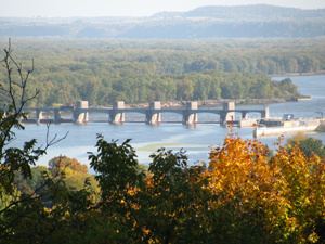
Visit the city of marquette clayton county iowa 2014
Geography
According to the U.S. Census Bureau, the county has a total area of 793 square miles (2,050 km2), of which 779 square miles (2,020 km2) is land and 14 square miles (36 km2) (1.8%) is water. It is the fifth-largest county in Iowa by area.
National protected areas
Geology
Clayton County is part of the Driftless Area, a region that completely missed being ice-covered during the last ice age. Streams have deeply carved valleys, while the Mississippi River has spectacular bluffs.
2010 census
The 2010 census recorded a population of 18,129 in the county, with a population density of 23.272/sq mi (8.985/km2). There were 8,999 housing units, of which 7,599 were occupied.
2000 census
As of the census of 2000, there were 18,678 people, 7,375 households, and 5,132 families residing in the county. The population density was 24 people per square mile (9/km²). There were 8,619 housing units at an average density of 11 per square mile (4/km²). The racial makeup of the county was 98.93% White, 0.14% Black or African American, 0.22% Native American, 0.11% Asian, 0.01% Pacific Islander, 0.19% from other races, and 0.41% from two or more races. 0.76% of the population were Hispanic or Latino of any race.
There were 7,375 households out of which 30.90% had children under the age of 18 living with them, 59.70% were married couples living together, 6.10% had a female householder with no husband present, and 30.40% were non-families. 26.30% of all households were made up of individuals and 13.30% had someone living alone who was 65 years of age or older. The average household size was 2.47 and the average family size was 2.98.
In the county, the population was spread out with 25.40% under the age of 18, 6.50% from 18 to 24, 26.00% from 25 to 44, 23.60% from 45 to 64, and 18.50% who were 65 years of age or older. The median age was 40 years. For every 100 females there were 97.60 males. For every 100 females age 18 and over, there were 95.50 males.
The median income for a household in the county was $34,068, and the median income for a family was $40,199. Males had a median income of $27,165 versus $19,644 for females. The per capita income for the county was $16,930. About 5.70% of families and 8.60% of the population were below the poverty line, including 9.60% of those under age 18 and 9.40% of those age 65 or over.
Townships
Clayton County is divided into these townships:
Population ranking
The population ranking of the following table is based on the 2010 census of Clayton County.
† county seat