
Length 357 km | ||
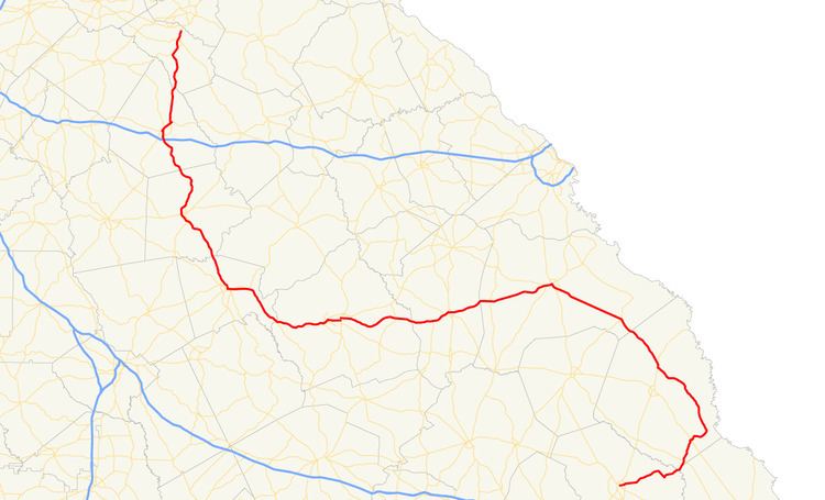 | ||
State Route 24 (SR 24) is a 221.8-mile-long (357.0 km) state highway that travels south-to-north in an S-shaped curve through portions of Bulloch, Screven, Burke, Jefferson, Washington, Baldwin, Putnam, Morgan, and Oconee counties in the east-central part of the U.S. state of Georgia. The highway connects Statesboro with the Watkinsville area, via Waynesboro, Louisville, Sandersville, Milledgeville, Eatonton, and Madison.
Contents
- Map of GA 24 Georgia USA
- Statesboro to Waynesboro
- Waynesboro to Milledgeville
- Milledgeville to Watkinsville
- National Highway System
- History
- Future
- Davisboro spur route
- Washington County spur route
- Eatonton business loop
- Madison bypass route
- Madison spur route
- Watkinsville business loop
- References
Map of GA-24, Georgia, USA
Parts of the highway between Milledgeville and Sandersville are proposed to be included in the Fall Line Freeway, a divided highway that is to span the state from Columbus to Augusta. The Fall Line Freeway is planned to be included in Interstate 14, a freeway that is planned to extend from Natchez, Mississippi to Augusta.
Statesboro to Waynesboro
SR 24 begins at an intersection with US 80/SR 26 (East Northside Drive) in Statesboro, within Bulloch County. The highway travels to the east-northeast on East Main Street and intersects US 301 Byp./SR 73 Byp. (Veterans Memorial Parkway), a bypass around the southern and eastern parts of the city. SR 24 continues to the east-northeast, leaves town, and crosses over the Ogeechee River into Screven County. In Oliver, it intersects SR 17 (Scarsboro Highway). Then, in Newington, it intersects SR 21. In the main part of town, it meets SR 21 Bus., the former routing of SR 21. The highway curves to the northwest and travels through rural areas of the county and has a brief concurrency with US 301/SR 73 (Burton's Ferry Highway) north-northeast of Sylvania. After traveling through Hiltonia, it enters Burke County. In Sardis, it intersects SR 23 (Charles Perry Avenue). The highway continues to the northwest toward Waynesboro. Just before entering town, it intersects US 25 Byp./SR 121 Byp., a bypass around most of the eastern part of town. Approximately 2,000 feet (610 m) later, it enters the city limits of town and intersects US 25/SR 121. The three highways travel concurrently into the main part of town. There, they intersect SR 56/SR 80 (6th Street). At this intersection, SR 24 turns left and begins the westerly part of its routing.
Waynesboro to Milledgeville
SR 24 follows SR 56/SR 80 to the west-southwest. Just outside the city limits, SR 56 departs to the south-southwest, and then SR 80 splits off to the northwest on George Massey Road. After that, SR 24 travels to the west-southwest and enters Vidette. There, it intersects SR 305 (Railroad Avenue). Shortly after leaving town, it enters Jefferson County. In Louisville. Just inside the city limits is an intersection with US 1/SR 4 (Jefferson Davis Highway). At East 9th Street, SR 24 turns to the right and travels to the northwest. Two blocks later, it intersects US 1 Bus./US 221/SR 4 Bus. (Peachtree Street). At this intersection, SR 24 turns to the left. The four highways travel to the southwest. Then, at East Broad Street, US 1 Bus./SR 4 Bus. splits off to the southeast, while US 221/SR 24 continue to the southwest. At Rocky Comfort Creek, they leave town. About 2,000 feet (610 m) later, SR 171 (Grange Road) joins the concurrency. The three highways cross over the Ogeechee River. Southwest of that crossing, SR 24 splits off to the west and enters Washington County. In Davisboro, it intersects SR 231 (Tree Nursery Road). After a long, gradual curve, the highway travels toward Sandersville. At Ridge Road, just east of the city limits, the road turns to the right and heads north for less than 1 mile (1.6 km). It meets the western terminus of SR 88 (Fall Line Freeway), where it turns left and takes on the Fall Line Freeway designation. SR 24 acts as a bypass of most of the northern part of town. It enters the city limits and has an intersection with SR 15 (Sparta Road). After that intersection, the route curves to the southwest. Just over 1 mile (1.6 km) after leaving the city limits it meets the western terminus of SR 242. Then, it has an intersection with both the northern terminus of SR 68 (Tennille–Macon Road) and the southern terminus of SR 24 Spur (Yank Brown Road). After that, the highway begins curving to the northwest. There, the Fall Line Freeway designation ends, because it is planned to be built on new highway. Just before leaving the county, it meets the northern terminus of SR 272. It crosses over Gumm Creek and enters Baldwin County. It travels to the northwest and intersects SR 22 (Sparta Highway). The two highways begin a concurrency to the west. Then, they cross over the Oconee River into Milledgeville. Three blocks east-northeast of Georgia College, they meet the northern terminus of SR 49 (East Hancock Street) and the northern terminus of SR 112 (South Elbert Street). At Montgomery Street, SR 22/SR 24 turn to the west and skirt along the northern edge of Georgia College. At the northwestern corner of the college, they intersect US 441 Bus./SR 243 (North Clark Street). At this intersection, SR 243 meets its northern terminus, while US 441 Bus./SR 22/SR 24 begin a concurrency to the west. One block later, SR 22 splits off to the west-southwest on West Montgomery Street, while US 441 Bus./SR 24 travel to the north-northwest. At this intersection, SR 24 begins its northern section.
Milledgeville to Watkinsville
Farther to the northwest, next to Hatcher Square Mall Shopping Center, the two highways intersect US 441/SR 29 (Roberson Mill Road). At this intersection, US 441 Bus. and SR 29 both meet their northern terminus, and US 441/SR 24 travel to the north-northwest. In fact, the two highways are concurrent for the rest of SR 24's length. Farther to the northwest, they cross over the Little River into Putnam County. In the southern part of Eatonton, they intersect US 129/SR 44 (Gray Road). This intersection also marks the southern terminus of US 441 Bus./SR 24 Bus. (Oak Street). US 129 joins the concurrency for the rest of SR 24's length. Northwest of there, they intersect SR 16 (Monticello Road). The concurrency curves to the northeast and meets the northern terminus of US 441 Bus./SR 24 Bus. (North Jefferson Avenue). On the northern edge of the Oconee National Forest, they meet the northern terminus of what used to be SR 300 (Union Chapel Road NW). Then, they enter Morgan County. The highways continue to the north-northwest and enter Madison. There, they have an interchange with Interstate 20 (I-20). Approximately 2,500 feet (760 m) later, they meet the southern terminus of US 129 Byp./US 441 Byp./SR 24 Byp. (Brooks Pennington Memorial Parkway). About 4,000 feet (1,200 m) later, they meet the southern terminus of SR 24 Spur (Ward Road). Then, US 278/SR 12/SR 83 (Eatonton Highway) join the concurrency next to Walton Park. The concurrency passes Hill Park and reach Washington Street, where SR 83 splits off to the northwest. The highways pass by Madison Municipal Airport and meet the northern terminus of US 129 Byp./US 441 Byp./SR 24 Byp. At this intersection, US 278/SR 12 splits off to the east, while US 129/US 441/SR 24 continue to the north. After leaving town, they pass by Youngblood Lake and cross over the Apalachee River into Oconee County. The concurrency passes by Heritage Park and travels through Bishop. They meet the eastern terminus of SR 186 just north of the city limits. Just before skirting along the western edge of Watkinsville, they meet the southern terminus of US 129 Bus./US 441 Bus./SR 24 Bus. (Macon Highway). The concurrency has an interchange with SR 53 (Experiment Station Road). To the north-northeast, they intersect US 129 Bus./US 441 Bus./SR 15/SR 24 Bus. (Macon Highway). At this intersection, US 129 Bus./US 441 Bus./SR 24 Bus., as well as SR 24, all reach their northern terminus. After here, US 129/US 441, now concurrent with SR 15 travel toward Athens.
National Highway System
All of SR 24 north of Sandersville is included as part of the National Highway System, a system of roadways important to the nation's economy, defense, and mobility.
History
Initially, SR 24 traveled from Louisville to Watkinsville. It was extended into Augusta on what is US 1/SR 4. Between Louisville and Waynesboro, it was redesignated SR 20. Between Waynesboro and Augusta, there was no state route number.
Future
Parts of SR 24, between Milledgeville and Sandersville, are proposed to be included in the Fall Line Freeway, and may be included in I-14, a future Interstate Highway, that is proposed to connect Natchez, Mississippi with Augusta, Georgia.
Davisboro spur route
State Route 24 Spur (SR 24 Spur) was a spur route that existed entirely within the east-central part of Washington County. Its entire route was inside the city limits of Davisboro.
It began in downtown Davisboro and ended at SR 24 in the northern part of the city.
It was designated in 1940. In 1943, its entire length was redesignated as SR 231.
Washington County spur route
State Route 24 Spur (SR 24 Spur) is a 2.7-mile-long (4.3 km) spur route that exists entirely within the central part of Washington County. Its entire route is west of Sandersville and is known as Yank Brown Road for its entire length.
It begins at an intersection with the SR 24 mainline (West Church Street) west of Sandersville. This intersection also marks the northern terminus of SR 68 (Tennille–Macon Road). The highway travels to the north-northeast and meets its northern terminus, an intersection with Deepstep Road on the northwestern edge of Sandersville's city limits.
SR 24 Spur is not part of the National Highway System, a system of roadways important to the nation's economy, defense, and mobility.
The entire route is in Washington County.
Eatonton business loop
State Route 24 Business (SR 24 Bus.) is a 3.8-mile-long (6.1 km) business route of SR 24 that exists entirely within the city limits of Eatonton in the central part of Putnam County.
It begins at an intersection with US 129/US 441/SR 24/SR 44 in the southern part of Eatonton. At this intersection, SR 24 Bus. travels in a northerly direction concurrent with SR 44, along with US 129 Bus./US 441 Bus., which begin at this intersection, as well. The four highways curve to the north-northwest along Oak Street and pass the Uncle Remus Golf Course. They curve to the northeast before curving again to the north-northwest. At East Sumter Street, SR 16/SR 44 split off to the northeast. SR 16 joins the concurrency for one block and then splits off to the southwest on West Marion Street. US 129 Bus./US 441 Bus./SR 24 Bus. continue to the north-northwest and curve to the north. Just before intersecting US 129/US 441/SR 24 in the northern part of town, the concurrency has one final curve to the northwest. At US 129/US 441/SR 24, all three highways meet their northern terminus.
SR 24 Bus. is not part of the National Highway System, a system of roadways important to the nation's economy, defense, and mobility.
The entire route is in Eatonton, Putnam County.
Madison bypass route
State Route 24 Bypass (SR 24 Bypass) is a 4.2-mile-long (6.8 km) bypass route that exists entirely within the central part of Morgan County. Parts of the highway are inside the city limits of Madison.
It begins at an intersection with US 129/US 441/SR 24 in the southern part of Madison. At this intersection, SR 24 Byp. travels in a northeasterly direction, concurrent with US 129 Byp./US 441 Byp., which begin at this intersection, as well. The three highways leave the city limits and then briefly re-enter it. They curve to the north-northeast and re-enter the city limits again. Then, they skirt along the western edge of Heritage Park. After that, they curve to the north-northwest and curve to the north-northeast and leave the city limits and meet their northern terminus, an intersection with US 129/US 278/US 441/SR 12/SR 24, just north of town.
SR 24 Byp. is not part of the National Highway System, a system of roadways important to the nation's economy, defense, and mobility.
The entire route is in Morgan County.
Madison spur route
State Route 24 Spur (SR 24 Spur) is a 0.4-mile-long (0.64 km) spur route that exists entirely within the central part of Madison in the central part of Morgan County. It is known as Ward Road for its entire length.
It begins at an intersection with US 129/US 441/SR 24 (Eatonton Road). The highway travels in a northwestern curve and meets its northern terminus, an intersection with US 278/SR 12/SR 83.
SR 24 Spur is not part of the National Highway System, a system of roadways important to the nation's economy, defense, and mobility.
The entire route is in Madison, Morgan County.
Watkinsville business loop
State Route 24 Business (SR 24 Bus.) exists entirely within the central part of Oconee County. Most of the route is inside the city limits of Watkinsville.
It begins at an intersection with US 129/US 441/SR 24 just southwest of Watkinsville. At this intersection, SR 24 Bus. travels in a northeasterly direction on Macon Highway, concurrent along with US 129 Bus./US 441 Bus., which begin at this intersection, as well. The three highways enter the city limits and parallel a Norfolk Southern Railway line for about 2 miles (3.2 km). The concurrency curves to the north and very gradually bends to the north-northwest and intersect SR 15 (Greensboro Highway), which joins the concurrency. At Experiment Station Road, they meet the eastern terminus of SR 53. The highways curve to a nearly northern routing and cross over Calls Creek. Then, they leave the city limits and curve to the northwest, where they meet their northern terminus, an intersection with US 129/US 441/SR 24, just northwest of town. At this intersection, SR 15 turns to the right onto US 129/US 441/SR 24 north.
SR 24 Bus. is not part of the National Highway System, a system of roadways important to the nation's economy, defense, and mobility.
The entire route is in Oconee County.