
Demonym European | Dependencies 4 dependencies | |
 | ||
Area 10,180,000 km (3,930,000 sq mi) (6th) Population 742,452,000 (2013; 3rd) Population density 72.9/km (188/sq mi) (2nd) Countries 50 sovereign states5 with limited recognition | ||
Europe is traditionally defined as one of seven continents. Physiographically, it is the northwestern peninsula of the larger landmass known as Eurasia (or the larger Afro-Eurasia); Asia occupies the eastern bulk of this continuous landmass and all share a common continental shelf. Europe's eastern frontier is delineated by the Ural Mountains in Russia. The southeast boundary with Asia is not universally defined, but the modern definition is generally the Ural River or, less commonly, the Emba River. The boundary continues to the Caspian Sea, the crest of the Caucasus Mountains (or, less commonly, the Kura River in the Caucasus), and on to the Black Sea. The Bosporus, the Sea of Marmara, and the Dardanelles conclude the Asian boundary. The Mediterranean Sea to the south separates Europe from Africa. The western boundary is the Atlantic Ocean. Iceland, though on the Mid-Atlantic Ridge and nearer to Greenland (North America) than mainland Europe, is generally included in Europe for cultural reasons and because it is over twice as close to mainland Europe than to mainland North America. There is ongoing debate on where the geographical centre of Europe falls.
Contents
- Overview
- Peninsula of peninsulas
- Geology
- Population
- Rivers
- Major islands
- Plains and lowlands
- Mountain ranges
- Temperature and precipitation
- Landlocked countries
- Countries consisting solely of islands or parts of islands
- Countries that share a name with their capital
- Countries whose capital is not the most populous
- References
Overview
Some geographical texts refer to a Eurasian continent given that Europe is not surrounded by sea and its southeastern border has always been variously defined for centuries.
In terms of shape, Europe is a collection of connected peninsulas and nearby islands. The two largest peninsulas are mainland Europe and Scandinavia to the north, divided from each other by the Baltic Sea. Three smaller peninsulas—Iberia, Italy and the Balkans—emerge from the southern margin of the mainland. The Balkan peninsula is separated from Asia by the Black and Aegean Seas. Italy is separated from the Balkans by the Adriatic Sea, and from Iberia by the Mediterranean Sea, which also separates Europe from Africa. Eastward, mainland Europe widens much like the mouth of a funnel, until the boundary with Asia is reached at the Ural Mountains and Ural River, the Caspian Sea and Caucasus Mountains.
Land relief in Europe shows great variation within relatively small areas. The southern regions are mountainous, while moving north the terrain descends from the high Alps, Pyrenees and Carpathians, through hilly uplands, into broad, low northern plains, which are vast in the east. An arc of uplands also exists along the northwestern seaboard, beginning in southwestern Ireland, continuing across through western and northern Great Britain, and up along the mountainous, fjord-cut spine of Norway.
This description is simplified. Sub-regions such as Iberia and Italy contain their own complex features, as does mainland Europe itself, where the relief contains many plateaus, river valleys and basins that complicate the general trend. Iceland and the British Isles are special cases. The former is of North Atlantic volcanic formation, while the latter consist of upland areas once joined to the mainland until cut off by rising sea levels.
Peninsula of peninsulas
Europe is sometimes called a "peninsula of peninsulas", to draw attention to the fact that Europe is a relatively small, elongated appendage to Asia, and that a large part of Europe is made up of peninsulas.
Partial list of European peninsulas
Geology
Europe's most significant geological feature is the dichotomy between the highlands and mountains of Southern Europe and a vast, partially underwater, northern plain ranging from the United Kingdom in the west to the Ural Mountains in the east. These two halves are separated by the mountain chains of the Pyrenees and the Alps/Carpathians. The northern plains are delimited in the west by the Scandinavian mountains and the mountainous parts of the British Isles. The major shallow water bodies submerging parts of the northern plains are the Celtic Sea, the North Sea, the Baltic Sea complex, and the Barents Sea.
The northern plain contains the old geological continent of Baltica, and so may be regarded as the "main continent", while peripheral highlands and mountainous regions in south and west constitute fragments from various other geological continents.
The geology of Europe is hugely varied and complex, and gives rise to the wide variety of landscapes found across the continent, from the Scottish Highlands to the rolling plains of Hungary.
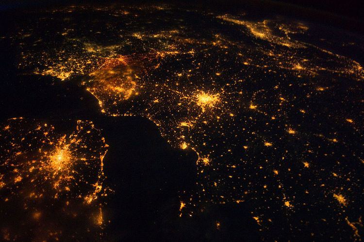
Population
Figures for the population of Europe vary according to which definition of European boundaries is used. The population within the standard physical geographical boundaries was 731 million in 2005 according to the United Nations. In 2010 the population is 857 million, using a definition which includes the whole of the transcontinental countries of Russia and Turkey. Population growth is comparatively slow, and median age comparatively high in relation to the world's other continents.
Rivers
The longest rivers in Europe with their approximate lengths:
Major islands
Iceland, Faroe Islands, Great Britain, Ireland, Balearic Islands, Corsica, Sardinia, Sicily, Malta, Cyprus, Ionian Islands, Crete, Aegean Islands, Åland Islands, Gotland, Saaremaa, Svalbard, Hinnøya, Senja, Zealand, Fyn and North Jutlandic Island.
See also List of European islands by area and List of European islands by population
Plains and lowlands
Mountain ranges
Some of Europe's major mountain ranges are:
Land area in different classes of European mountainous terrain (classification from UNEP-WCMC):
Temperature and precipitation
The high mountainous areas of Europe are colder and have higher precipitation than lower areas, as is true of mountainous areas in general. Europe has less precipitation in the east than in central and western Europe. The temperature difference between summer and winter gradually increases from coastal northwest Europe to southeast inland Europe, ranging from Ireland, with a temperature difference of only 10 °C from the warmest to the coldest month, to the area north of the Caspian Sea, with a temperature difference of 40 °C. January average range from 13 °C in southern Greece to -20 °C in the northeastern part of European Russia.
Western Europe and parts of Central Europe generally fall into the temperate maritime climate (Cfb), the southern part is mostly a Mediterranean climate (mostly Csa, smaller area with Csb), the north-central part and east into central Russia is mostly a humid continental climate (Dfb) and the northern part of the continent is a subarctic climate (Dfc). In the extreme northern part (northernmost Russia; Svalbard), bordering the Arctic Ocean, is tundra climate (Et). Mountain ranges, such as the Alps and the Carpathian mountains, have a highland climate with large variations according to altitude and latitude.
Landlocked countries
If Nagorno-Karabakh Republic is considered a country (it is a non-UN member states recognised only by non-UN member states), it is landlocked by Armenia.
Notes:
- Liechtenstein is doubly landlocked.
- Switzerland, Liechtenstein, Austria, Czech Republic, Slovakia, Hungary, Serbia, and Macedonia constitute a contiguous landlocked agglomeration of eight countries in Central Europe and the Balkans, stretching from Geneva all the way to Greece.
- All other landlocked countries (Luxembourg, Andorra, Vatican, San Marino, Belarus, Moldova, Azerbaijan, and Kazakhstan) are "standalone" landlocked countries, not bordering any other such European one (the emphasis is necessary, since Kazakhstan borders Turkmenistan, Uzbekistan, and Kyrgyzstan, thus forming a vast landlocked expanse in Central Asia)
Countries consisting solely of islands or parts of islands
Countries that share a name with their capital
Countries whose capital is not the most populous
Note: Italy's capital, Rome, is the country's largest city if only the municipality (comune) is considered. Greater Milan is the largest Metropolitan Area in Italy.
Brussels is considered to be the largest city of Belgium, according to the population of the Brussels-Capital Region. The population of the City of Brussels is ~175,000. Antwerp is the biggest city of the country.