
Population 6,151,810,000 (2013) Dependencies 17 Area 84.98 million km² | Countries 147 Languages 4,725 | |
 | ||
Demonym Afro-Eurasian, Afroeurasian, Eurafrasian Time zones UTC-1 (Cap-Vert)UTC+12 (Siberia) | ||
Social studies video vocab afro eurasia accessible preview
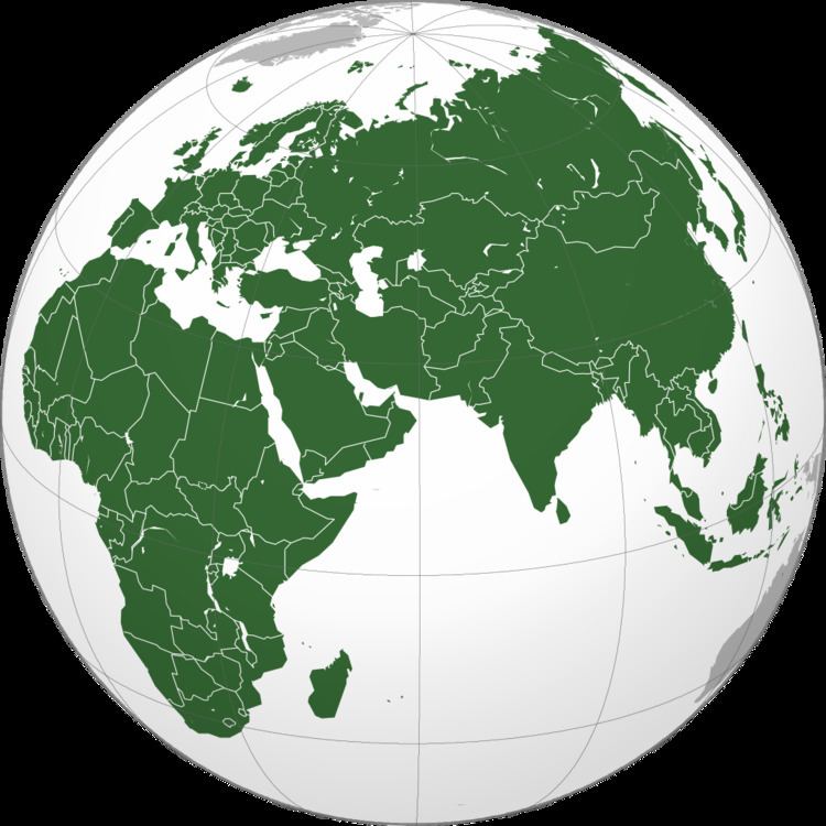
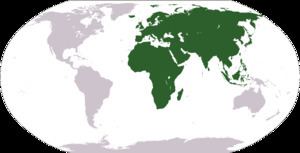
Afro-Eurasia, Afroeurasia, or Eurafrasia, is the combination of Africa and Eurasia (a further combination of the continents of Europe and Asia) which together form the largest contiguous landmass on Earth. The term is a portmanteau of the names of its constituent parts.
Contents
- Social studies video vocab afro eurasia accessible preview
- Related terms
- Geology
- Divisions
- Geographical areas
- Extreme points
- References
Afro-Eurasia encompasses 84,980,532 square kilometers (32,811,166 sq mi), a little over half the world's land area, and has a population of approximately 6 billion people, roughly 86% of the world population.
Related terms
The following terms are used for similar concepts:
Geology
Although Afro-Eurasia is typically considered to comprise two or three separate continents, it is not a proper supercontinent. Instead, it is the largest present part of the supercontinent cycle.
The oldest part of Afro-Eurasia is probably the Kaapvaal Craton, which together with Madagascar and parts of India and western Australia formed part of the first supercontinent Vaalbara or Ur around 3 billion years ago. It has made up parts of every supercontinent since. At the breakup of Pangaea around 200 million years ago, the North American and Eurasian Plates together formed Laurasia while the African Plate remained in Gondwana, from which the Indian Plate split off. This impacted southern Asia around 50 million years ago and began the formation of the Himalayas. (Around the same time, it also fused with the Australian Plate.) The Arabian Plate broke off of Africa around 30 million years ago and impacted the Iranian Plate between 19 and 12 million years ago, ultimately forming the Alborz and Zagros chains of Iranian Plate. After this initial connection of Afro-Eurasia, the Betic corridor along the Gibraltar Arc closed a little less than 6 million years ago, fusing Northwest Africa and Iberia together. This led to the nearly complete desiccation of the Mediterranean Basin, the Messinian salinity crisis. Eurasia and Africa were then again separated: the Zanclean Flood around 5.33 million years ago refilled the Mediterranean Sea through the Strait of Gibraltar and the Red Sea and Gulf of Suez Rifts further divided Africa from the Arabian Plate.
Today, Africa is now joined to Asia only by a narrow land bridge (which has been split by the Suez Canal at the Isthmus of Suez) and remains separated from Europe by the Straits of Gibraltar and Sicily. Paleogeologist Ronald Blakey has described the next 15 to 100 million years of tectonic development as fairly settled and predictable. In that time, Africa is expected to continue drifting northward. It will close the Strait of Gibraltar around 600,000 years from now, closing and quickly evaporating the Mediterranean Sea. No supercontinent will form within the settled time frame, however, and the geologic record is full of unexpected shifts in tectonic activity that make further projections "very, very speculative". Three possibilities are known as Novopangaea, Amasia, and Pangaea Ultima. In the first two, the Pacific closes and Africa remains fused to Eurasia, but Eurasia itself splits as Africa and Europe spin towards the west; in the last, the trio spin eastward together as the Atlantic closes.
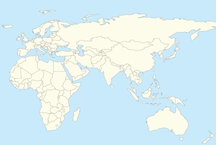
Divisions
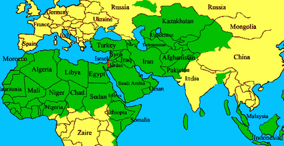
Normally Afro-Eurasia is divided at the Suez Canal into Africa and Eurasia, the latter of which can be subdivided into Europe and Asia. It has also been divided into Eurasia-North Africa and Sub-Saharan Africa for cultural and historical reasons.
Geographical areas
Extreme points
This is a list of the points that are farther north, south, east or west than any other location on Afro-Eurasia.
Afro-Eurasia (including islands)
Afro-Eurasia (mainland)
¹ If the Azores are included as part of Afro-Eurasia, Flores is the westernmost part of the continent.
² According to the International Date Line.