
Country United States Area code(s) 301 Elevation 727 m Population 321 (2013) | Time zone Eastern (EST) (UTC-5) FIPS code 24-00225 Zip code 21520 Local time Tuesday 11:49 PM | |
 | ||
Weather 11°C, Wind SW at 19 km/h, 99% Humidity | ||
Accident (ˈæk.sə.dɛnt) is a town in Garrett County, Maryland, United States. The population was 325 at the 2010 census. The town is home to Northern Garrett High School. According to the book Labels for Locals by Paul Dickson, a person from Accident is called an "Accidental".
Contents
Map of Accident, MD 21520, USA
History
Accident, Garrett County, Maryland was one of the early settlements in the far west of Maryland.
When Lord Baltimore opened up the area he called Monocacy Manor to settlement in the early 1770s, Brooke Beall secured permission to survey 778 acres (3.15 km2). It will never be known for certain how Beall came to choose this particular spot, but the surveyor was given clear instructions where to start. He was to begin "in the center between two bounded white oak trees, standing on the North Side of the South fork of Bear Creek in or near a glade about one Hundred yards from said Run, about one or two Miles above a Lick known by the name of the "Cole Mine Lick", about four miles (6 km) above the mouth of Broad Creek and about one mile (1.6 km) East of a Ridge of the Negro Mountain." John Hanson, Jr., later a delegate to the Continental Congress, and President of the United States in Congress Assembled, on April 14, 1774, surveyed the land, finding that it only contained 682 acres (2.76 km2). For the next twelve years nothing was done with the survey. Revolution intervened, and it was not until February 15, 1786, that the land was granted by means of a patent to William Deakins. The following year the surrounding countryside was surveyed into military lots by Francis Deakins, lots that were meant as compensation for the soldiers who served from Maryland during the War of independence. Each soldier who served for two years received one lot of 50 acres (200,000 m2), officers received four lots of 50 acres (200,000 m2) each.
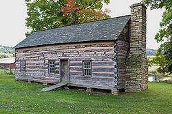
Kaese Mill was listed on the National Register of Historic Places in 1984. The James Drane House was listed in 1985.
Geography
Accident is located at 39°37′41″N 79°19′12″W (39.628074, -79.319996).
According to the United States Census Bureau, the town has a total area of 0.49 square miles (1.27 km2), all land.
2010 census
As of the census of 2010, there were 325 people, 141 households, and 86 families residing in the town. The population density was 663.3 inhabitants per square mile (256.1/km2). There were 173 housing units at an average density of 353.1 per square mile (136.3/km2). The racial makeup of the town was 97.8% White, 0.6% Native American, 0.3% Asian, 0.6% from other races, and 0.6% from two or more races. Hispanic or Latino of any race were 0.6% of the population.
There were 141 households of which 33.3% had children under the age of 18 living with them, 45.4% were married couples living together, 11.3% had a female householder with no husband present, 4.3% had a male householder with no wife present, and 39.0% were non-families. 32.6% of all households were made up of individuals and 19.1% had someone living alone who was 65 years of age or older. The average household size was 2.30 and the average family size was 2.99.
The median age in the town was 34.5 years. 26.2% of residents were under the age of 18; 10.1% were between the ages of 18 and 24; 25.3% were from 25 to 44; 22.8% were from 45 to 64; and 15.7% were 65 years of age or older. The gender makeup of the town was 45.5% male and 54.5% female.
2000 census
As of the census of 2000, there were 353 people, 138 households, and 96 families residing in the town. The population density was 711.1 people per square mile (272.6/km²). There were 162 housing units at an average density of 326.3 per square mile (125.1/km²). The racial makeup of the town was 99.72% White and 0.28% from two or more races.
There were 138 households out of which 37.7% had children under the age of 18 living with them, 54.3% were married couples living together, 12.3% had a female householder with no husband present, and 30.4% were non-families. 28.3% of all households were made up of individuals and 21.7% had someone living alone who was 65 years of age or older. The average household size was 2.56 and the average family size was 3.14.
In the town, the population was spread out with 29.2% under the age of 18, 7.1% from 18 to 24, 22.4% from 25 to 44, 18.4% from 45 to 64, and 22.9% who were 65 years of age or older. The median age was 38 years. For every 100 females there were 73.9 males. For every 100 females age 18 and over, there were 73.6 males.
The median income for a household in the town was $22,500, and the median income for a family was $40,556. Males had a median income of $25,250 versus $18,750 for females. The per capita income for the town was $11,950. About 10.9% of families and 17.5% of the population were below the poverty line, including 17.3% of those under age 18 and 24.1% of those age 65 or over.