
Prominence 80 ft (24 m) | Topo map USGS Davis Parent range Allegheny Mountains | |
 | ||
Elevation 3360+ ft (1024+ m) NGVD 29 Listing U.S. state high point 32nd Similar Backbone Mountain, Ebright Azimuth, Mount Davis, Charles Mound, White Butte | ||
Maryland high point hoye crest backbone mountain our lady of the pines tiny church
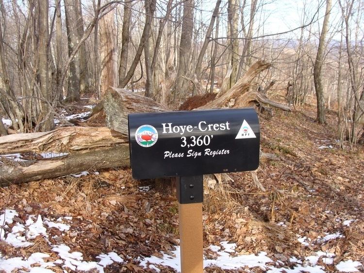
Hoye-Crest is a summit along Backbone Mountain just inside of Garrett County, Maryland, USA. It is the highest natural point in Maryland at an elevation of 3,360 feet (1,020 m).
Contents
- Maryland high point hoye crest backbone mountain our lady of the pines tiny church
- Map of Hoye Crest 8 Red House MD 21550 USA
- Panoramic view near hoye crest highest peak in maryland
- Accessing Hoye CrestEdit
- References
Map of Hoye-Crest, 8, Red House, MD 21550, USA
The location, named for Captain Charles E. Hoye (1876-1951), founder of the Garrett County Historical Society, offers a view of the North Branch Potomac River valley to the east. The Maryland Historical Society placed a historical marker at the summit during a dedication ceremony in September 1952.
Panoramic view near hoye crest highest peak in maryland
Accessing Hoye-CrestEdit
There is no vehicular access to Hoye-Crest. The best route by foot is a hike along the Maryland High Point Trail, from a point along U.S. Route 219 just south of Silver Lake, West Virginia at 39°14′43″N 79°29′30″W. The trail ascends Backbone Mountain along an old logging road on Monongahela National Forest property to the West Virginia-Maryland state line. The distance is about one mile each way. The trail then heads north along the state line to the high point. Hoye-Crest sits on private property (Western Pocahontas Properties), though access is permitted.