
 | ||
Jack johnson plastic jesus fall line spring wind
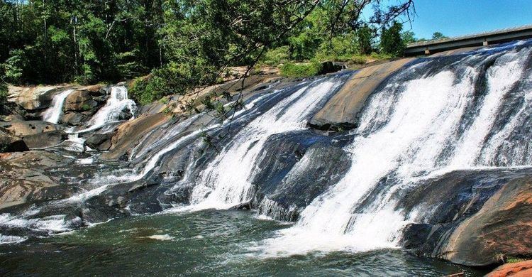
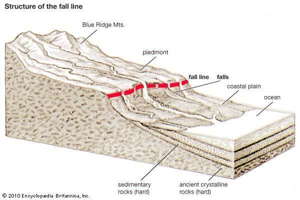
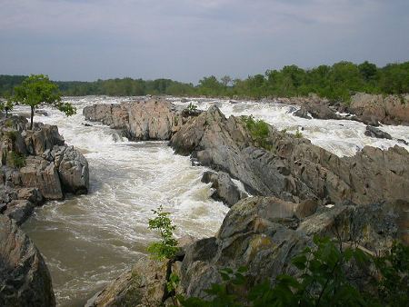
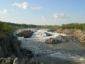
A fall line (or fall zone) is the geomorphologic break that demarcates the border between an upland region of relatively hard crystalline basement rock and a coastal plain of softer sedimentary rock. A fall line is typically prominent when crossed by a river, for there will often be rapids or waterfalls. Many times a fall line will recede upstream as the river cuts out the uphill dense material, often forming “c”-shaped waterfalls. Because of these features riverboats typically cannot travel any farther inland without portaging, unless locks are built there. On the other hand, the rapid change in elevation of the water, and the resulting energy release, makes the fall line a good location for water mills, grist mills, and sawmills. Because of the need for a river port leading to the ocean, and a ready supply of water power, settlements often develop where rivers cross a fall line.
Contents
- Jack johnson plastic jesus fall line spring wind
- Fall line
- Geography
- Atlantic Seaboard Fall Line
- Canada
- References
Fall line
Geography
The slope of fall zones on rivers played a role in settlement patterns. For example, the fall line represents the inland limit of navigation on many rivers. As such, many fall line cities grew around transferring people and goods between land-based and water-based transportation at this point. Also, fall lines proved useful for hydroelectric dams such as those at Rochester, New York (on the Niagara Escarpment), at Columbia, South Carolina, and at Conowingo, Maryland, on the Susquehanna River (on the Atlantic Seaboard fall line). Cities established along fall lines in the United States include:
Atlantic Seaboard Fall Line
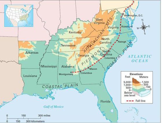
The Atlantic Seaboard Fall Line, or Fall Zone, is a 900-mile (1,400 km) escarpment where the Piedmont and Atlantic coastal plain meet in the eastern United States. Much of the Atlantic Seaboard fall line passes through areas where no evidence of faulting is present.
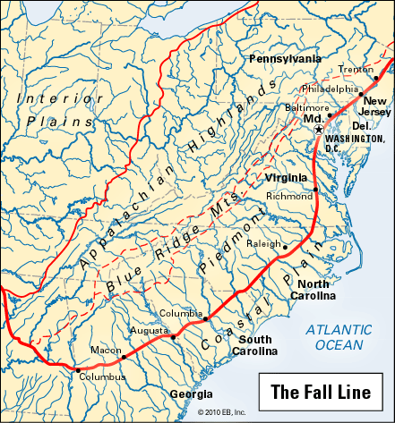
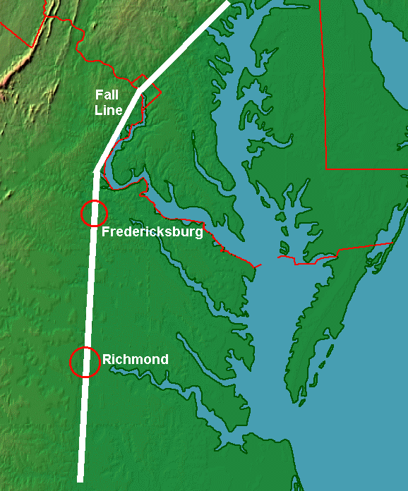
The fall line marks the geologic boundary of hard metamorphosed terrain—the product of the Taconic orogeny—and the sandy, relatively flat outwash plain of the upper continental shelf, formed of unconsolidated Cretaceous and Tertiary sediments. Examples of the Fall Zone include the Potomac River's Little Falls (Potomac River) and the rapids in Richmond, Virginia, where the James River falls across a series of rapids down to the tidal estuary of the James River. Columbia, South Carolina is similar as well with the Congaree River.
Prior to advancements in navigation technology, including the development of locks, the fall line marked the upstream limit of navigability on many rivers, where obstacles such as rapids and waterfalls impeded further travel, exemplified by the Little Falls of the Potomac River. This geographical feature led to the establishment of numerous cities at points where rivers intersect with the fall line. Many of these fall line cities are connected by U.S. Route 1.