
- elevation 820 ft (250 m) - average 1,366 cu ft/s (39 m/s) Discharge 38.68 m³/s Country United States of America | - elevation 0 ft (0 m) - min 18 cu ft/s (1 m/s) Length 253 km | |
 | ||
- max 39,400 cu ft/s (1,116 m/s) Bridges High Bridge, Martin Luther King Jr. Memorial Bridge, Charles Hardaway Marks Bridges | ||
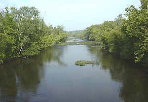
Along the appomattox river from olde towne to fleet st petersburg va
The Appomattox River is a tributary of the James River, approximately 157 miles (253 km) long, in central and eastern Virginia in the United States, named for the Appomattocs Indian tribe who lived along its lower banks in the 17th century. It drains a cotton and tobacco-growing region of the Piedmont and coastal plain southwest of Richmond.
Contents
- Along the appomattox river from olde towne to fleet st petersburg va
- Map of Appomattox River Virginia USA
- Kayak bass fishing on the appomattox river 2
- CourseEdit
- HistoryEdit
- RecreationEdit
- References
Map of Appomattox River, Virginia, USA
The English colonists in Virginia at first tried to rename the Appomattox as the "Bristoll River", however this name did not catch on, while the native one did. There are numerous historical spelling variants, such as Apamatuck, Apamutiky, Appamattuck, Appomattake, and Apumetecs, among others.
Kayak bass fishing on the appomattox river 2
CourseEdit
The Appomattox River rises in the Piedmont of northeastern Appomattox County, approximately 10 miles (16 km) northeast of the town of Appomattox. It flows generally southeast through the Appomattox-Buckingham State Forest to Farmville. From Farmville it flows in a large arc northeast then southeast across the coastal plain, passing southwest of Richmond and passing through the Lake Chesdin reservoir. It flows through Petersburg, its head of navigation, through the Tri-cities area, then joins the James River from the west at City Point in Hopewell.
HistoryEdit
In April 1865 during the Appomattox Campaign of the American Civil War, the Confederate forces attempted to burn the High Bridge over the river northwest of Burkeville in order to escape the pursuing Union Army after the fall of Petersburg. The Union capture of the bridge was a contributing factor in the forcing of General Robert E. Lee's surrender at nearby Appomattox Court House, ending the war in Virginia.
RecreationEdit
The river is a popular destination for whitewater rafting and canoeing, particularly down stream of the small Abutment Dam (which is itself only a couple miles down stream of Chesdin Dam) in the village of Matoaca to Petersburg near Virginia State University.