
Length 76 km | ||
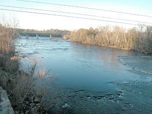 | ||
May 2011 striper fishing saluda congaree river www palmettokayakfishing com
The Congaree River is a short but wide river in South Carolina in the United States; It flows for only 47 miles (78 km). The river serves an important role as the final outlet channel for the entire Lower Saluda and Lower Broad watersheds, before merging with the Wateree River just north of Lake Marion to form the Santee River.
Contents
- May 2011 striper fishing saluda congaree river www palmettokayakfishing com
- Map of Congaree River South Carolina USA
- Floating down the congaree river in columbia sc
- CrossingsEdit
- References
Map of Congaree River, South Carolina, USA
It is formed in Columbia by the confluence of the Saluda and Broad rivers near the Piedmont fall line. It serves as part of the boundary between Richland, Calhoun, and Lexington counties. The only cities near the river are Columbia on the east, and Cayce and West Columbia on the west.
Despite the vast bottomland swamp below Columbia, the Congaree is navigable along much of its length at high water by barge traffic. This travels upriver from the Port of Charleston (approximately 100 miles (167 km) away0 through the Santee-Cooper Lakes to within 5 miles (8 km) of the fall line.
The Congaree National Park, one of the main recreational attractions of the river, is located about halfway down the river's course. The 22,200-acre (90 km²) park contains some of the last remaining old growth bottomland hardwood forest in North America. Recreational opportunities include hiking, biking, bird watching, botanical interests, and canoeing.
The river was named for the Congaree Indians who used to live along it.
Floating down the congaree river in columbia sc
CrossingsEdit
Below is a list of crossings from the river's origin in Columbia downstream to its confluence with the Wateree, where it forms the Santee River: