
Country United States Time zone Eastern (UTC-5) Local time Sunday 1:41 AM | Settled 1639 (Roger Ludlowe) Elevation 18 m Population 60,855 (2013) | |
 | ||
ZIP code 068240682506828 (General Electric)06890 (Southport)(formerly 06430, 06432, 06431, 06490, respectively) Weather -8°C, Wind W at 13 km/h, 51% Humidity Colleges and Universities | ||
Welcome to the town of fairfield connecticut
Fairfield is a town located in Fairfield County, Connecticut, United States. It borders the towns of Bridgeport, Trumbull, Easton, Weston, and Westport along the Gold Coast of Connecticut. As of the 2010 census, the town had a population of 59,404. In July 2006, Money magazine ranked Fairfield the ninth "best place to live" in the United States, and the best place to live in the Northeast.
Contents
- Welcome to the town of fairfield connecticut
- Map of Fairfield CT USA
- Fairfield connecticut tour
- Colonial era
- Towns created from Fairfield
- Revolutionary War
- Twentieth century
- Geography
- Neighborhoods
- Demographics
- Economy
- Taxes
- Large and distinctive companies
- Historic sites
- Arts entertainment and sports
- Parks and recreation
- Other points of interest
- Government
- Police Department
- Fire Department
- Education
- Media
- Transportation
- Places of worship
- References
Map of Fairfield, CT, USA
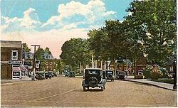
Fairfield connecticut tour
Colonial era
In 1635, Puritans and Congregationalists in the Massachusetts Bay Colony, were dissatisfied with the rate of Anglican reform, and sought to establish an ecclesiastical society subject to their own rules and regulations. The Massachusetts General Court granted them permission to settle in the towns of Windsor, Wethersfield, and Hartford which is an area now known as Connecticut.
On January 14, 1639, a set of legal and administrative regulations called the Fundamental Orders was adopted, and established Connecticut as a self-ruling entity. By 1639 these settlers had started new towns in the surrounding areas. Roger Ludlowe, framer of the Fundamental Orders, purchased the land presently called Fairfield, and established the name.
According to historian John M. Taylor: "Early in 1639 the General Court granted a commission to Ludlow to begin a plantation at Pequannocke. He was on that errand, with a few others from Windsor, afterwards joined by immigrants from Watertown and Concord. He bought a large tract of land from the Pequannocke sachems, - afterwards greatly enlarged by other purchases to the westward,- and recalling the attractive region beyond (Uncoa), which he had personally seen on the second Pequot expedition, he also “set down” there, having purchased the territory embraced in the present town of Fairfield, to which he gave its name."
Towns created from Fairfield
Fairfield was one of the two principal settlements of the Connecticut Colony in southeastern Connecticut (the other was Stratford). The town line with Stratford was set in May 1661 by John Banks, an early Fairfield settler, Richard Olmstead, and Lt. Joseph Judson, who were both appointed as a committee by the Colony of Connecticut. The town line with Norwalk was not set until May 1685.
Over time, it gave rise to several new towns that broke off and incorporated separately. The following is a list of towns created from parts of Fairfield.
Revolutionary War
When the American Revolutionary War began in the 1770s, Fairfielders were caught in the crisis as much as, if not more than, the rest of their neighbors in Connecticut. In a predominantly Tory section of the colony, the people of Fairfield were early supporters of the cause for independence. Throughout the war, a constant battle was being fought across Long Island Sound as men from British-controlled Long Island raided the coast in whaleboats and privateers. Gold Selleck Silliman, whose home still stands on Jennings Road, was put in charge of the coastal defenses.
In the spring of 1779, he was kidnapped from his home by Tory forces in preparation for a British raid on Fairfield County. His wife, Mary Silliman watched from their home as, on the morning of July 7, 1779, approximately 2,000 enemy troops landed on Fairfield Beach near Pine Creek Point and proceeded to invade the town. When they left the following evening, the entire town lay in ruins, burned to the ground as punishment for Fairfield's support of the rebel cause. 10 years later, President George Washington noted that after traveling through Fairfield that "the destructive evidences of British cruelty are yet visible both in Norwalk and Fairfield; as there are the chimneys of many burnt houses standing in them yet."
Fairfield recovered slowly from the burning, but soon after the end of the war its houses and public buildings had all been rebuilt.
Twentieth century
World War I brought Fairfield out of its agrarian past by triggering an unprecedented economic boom in Bridgeport, which was the center of a large munitions industry at the time. The prosperity created a housing shortage in the city, and many of the workers looked to Fairfield to build their homes. The trolley and later the automobile made the countryside accessible to these newly rich members of the middle class, who brought with them new habits, new attitudes, and new modes of dress. The prosperity lasted throughout the twenties.
By the time of the Wall Street Crash of 1929, the population had increased to 17,000 from the 6,000 it had been just before the war. Even during the Depression, the town kept expanding.
The grounding of a barge with two crewmen on Penfield Reef in Fairfield during a gale led to the 1st civilian helicopter hoist rescue in history, on November 29, 1945. The helicopter flew from the nearby Sikorsky Aircraft plant in Bridgeport, Connecticut.
Fairfield became the home of the corporate headquarters of General Electric (GE), one of the world's largest companies.
The opening of the Connecticut Turnpike in the 1950s brought another wave of development to Fairfield, and by the 1960s the town's residential, suburban character was firmly established.
Geography
The town is on the shore of Long Island Sound. According to the United States Census Bureau, the town has a total area of 31.3 square miles (81 km2), of which 30.0 square miles (78 km2) is land and 3.4 square kilometres (1.3 sq mi), or 4.15%, is water. The Mill River, the waters of which feed Lake Mohegan, flows through the town.
Fairfield consists of many neighborhoods. The best known are wealthy Southport, where General Electric Chief Executive Officer Jack Welch lived for many years, and Greenfield Hill, with its large areas, famous dogwood trees, and picturesque green with its white-spired Congregational church. Other well established neighborhoods include Stratfield, Tunxis Hill, the University area, Grasmere, Mill Plain, Knapp's Village, Melville Village, Holland Hill, and the Fairfield Beach area, which has recently undergone a renaissance with the construction of many new homes by residents wishing to live in proximity to the beach and downtown. Two shopping districts in town include the Post Road (U.S. 1) and Black Rock Turnpike.
Neighborhoods
Demographics
As of the census of 2010, there are 59,404 people in the town, organized into 20,457 households and 14,846 families. The population density is 1,927 people per square mile (744/km²). There are 21,648 housing units at an average density of 703 per square mile (277/km²). The racial makeup of the town is 91.6% White, 3.7% Asian, 1.8% African American, 0.06% Native American, 0.01% Pacific Islander, 1.2% from other races, and 1.6% from two or more races. 5.0% of the population are Hispanic or Latino of any race.
There are 20,457 households out of which 38.3% have children under the age of 18 living with them, 60.6% are married couples living together, 9.1% have a female householder with no husband present, and 27.4% are non-families. 22.3% of all households are made up of individuals and 15.1% have someone living alone who is 65 years of age or older. The average household size is 2.69 and the average family size is 3.19.
In the town, the population is spread out with 25.4% under the age of 18, 11.1% from 18 to 24, 21.1% from 25 to 44, 27.4% from 45 to 64, and 15.1% who are 65 years of age or older. The median age is 40 years. For every 100 females there are 90.5 males. For every 100 females age 18 and over, there are 85.6 males.
The median household income (in 2013 dollars) was $117,705 (these figures had risen to $103,352 and $121,749 respectively as of a 2007 estimate). Males have a median income of $69,525 versus $44,837 for females. The per capita income for the city is $55,733. 2.9% of the population and 1.8% of families are below the poverty line. Out of the total population, 2.8% of those under the age of 18 and 3.6% of those 65 and older are living below the poverty line.
Fairfield is notable for, among other things, its very low crime rate. There have been only three murders in the last five years in town. Money Magazine's 2006 Best Places to Live Survey ranks Fairfield as the second safest municipality in the United States.
In 2012, Fairfield was ranked #64 in Money Magazine's Best Places to live.
Economy
In May 2012, Moody's Investors Service revised the Town of Fairfield's $192 million General Obligation Bond debt from negative to stable. In June 2012, Moody's awarded Fairfield with an AAA bond rating which it maintains to this date.
Taxes
In 2005, the mill rate of Fairfield, CT was 16.67. The 2012-2013 taxes in Fairfield rose 4% to a mill rate of 23.37. The 2013-2014 mill rate which goes into effect on July 1 for fiscal year 2013-2014 also increased by 2.38% to 23.93.
Large and distinctive companies
Historic sites
Arts, entertainment, and sports
Parks and recreation
Fairfield residents enjoy a wealth of recreational opportunities, many of which stem from Fairfield's enviable location on the Long Island Sound.
Other points of interest
Government
The town government consists of the three-member Board of Selectmen, a Representative Town Meeting (RTM), a Board of Finance, a Board of Education, a Planning and Zoning Commission (TPZ), and many other politically appointed commissions, boards, and committees. The current First Selectman is Michael Tetreau (D).
The town has no criminal or civil court system and all trials are held and handled by the Bridgeport Superior Court system. However, the town does also offer access to a Juvenile Review Board (JRB) for certain juvenile cases outlined by the Fairfield Police Department.
In the Connecticut General Assembly, Fairfield is represented by three Republicans, Sen. Tony Hwang, Rep. Brenda Kupchick, and Rep. Laura Devlin, and one Democrat, Cristin McCarthy-Vahey.
Police Department
The Fairfield Police Department was created in 1926, approximately 287 years after the town was founded. I
Fire Department
The town of Fairfield is protected by the 95 career firefighters of the Fairfield Fire Department (FFD), and volunteer firefighters of the Southport Volunteer Fire Department and Stratfield Volunteer Fire Department. The career Fairfield Fire Department operates 5 Fire Stations, located throughout the town and utilize a fire apparatus fleet of 5 Engine Companies, 1 Ladder Company, 1 Rescue Company, 3 Fireboats, and 1 Shift Commander's Unit, as well as many special support, and reserve units. Each of the seven frontline pieces of fire apparatus are staffed by a total of three firefighters, except the shift commander's car which is staffed by an Assistant Chief and a chief's aide. The volunteer fire departments share quarters with the career firefighters at two of the Fire Stations, but only occasionally staff their apparatus and respond to calls. The volunteer fire departments operate a rescue unit, a tactical support unit, and a pumper/squad. The combined career and volunteer fire departments respond to approximately 9,500 emergency calls annually. The Southport Volunteer Fire Department has served the community since 1895. The Fairfield Fire Department has several stations and has served the community since 1920.
Below is a list of all the fire stations locations and apparatus in the town of Fairfield.
The FFD also operates a total of three reserve engines to place into service when front line apparatus is undergoing maintenance or repairs. Reserve Engine 6 and Reserve Ladder 1 are located at the quarters of Engine 1/Rescue 1; Reserve Engine 7 is located at the quarters of Engine 2/Ladder 2/Shift Commander; Reserve Engine 8 is located at the quarters of Engine 5. The Fairfield Fire Department also operates a Connecticut regional fire training school, located at 205 Richard White Way.
Education
Fairfield has two public high schools, Fairfield Warde and Fairfield Ludlowe; three public middle schools, Roger Ludlowe, Tomlinson, and Fairfield Woods Middle School; and eleven public elementary schools.
Fairfield has several Catholic schools, including two high schools, Fairfield Prep and Notre Dame, and two primary schools, St. Thomas Aquinas and Our Lady of the Assumption. A third Catholic primary school, Holy Family, was closed by the Diocese of Bridgeport at the end of the 2009-2010 academic year.
Non-religious private schools include Fairfield Country Day School and the Unquowa School.
Fairfield is also home to two post-secondary institutions, Fairfield University and Sacred Heart University.
Media
Fairfield Magazine (townvibe.com)
Fairfield County Catholic
Transportation
Fairfield is traversed by U.S. 1, Interstate 95, and the Merritt Parkway. It has three Metro-North Railroad stations, Fairfield Metro, Fairfield and Southport. The town is served by several public bus lines of the Greater Bridgeport Transit Authority.