
Incorporated May 28, 1835 Zip code 06880 Population 26,391 (2010) | State Connecticut Region South Western Region Elevation 26 ft (8 m) Local time Saturday 9:12 AM | |
 | ||
Weather 3°C, Wind N at 31 km/h, 85% Humidity University Connecticut Center for Massage Therapy-Westport | ||
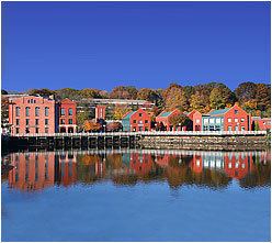
Westport is a coastal town of colonial origin located along Long Island Sound in Fairfield County, Connecticut, 47 miles (76 km) northeast of New York City in the United States. The town had a population of 26,391 according to the 2010 U.S. Census and in 2008 ranked the tenth wealthiest town in the U.S. with populations between 20,000 and 65,000, and second in the state.
Contents
- Map of Westport CT USA
- History
- Geography and environment
- Topology
- Neighborhoods
- Demographics
- Government
- Taxes
- Fire Department
- Public schools
- Private schools
- Scientific institutions
- Media
- Commerce and industry
- Nonprofits
- Architecture
- Parks and recreation
- Transportation
- In popular culture
- Notable people
- Sister cities
- References
Map of Westport, CT, USA
History
The earliest known inhabitants of the Westport area as identified through archaeological finds date back 7,500 years. Records from the first white settlers report the Pequot Indians living in the area which they called Machamux translated by the colonialists as beautiful land. Settlement by colonialists dates back to the five Bankside Farmers; whose families grew and prospered into a community that continued expanding. The community had its own ecclesiastical society, supported by independent civil and religious elements, enabling it to be independent from the Town of Fairfield. The settlers arrived in 1693, having followed cattle to the isolated area known to the Pequot as the "beautiful land". As the settlement expanded its name changed: it was briefly known as "Bankside" in 1693, officially named Green's Farm in 1732 in honor of Bankside Farmer John Green and in 1835 incorporated as the Town of Westport.
During the revolutionary war—on April 25, 1777, a 1,850 strong British force under the command of the Royal Governor of the Province of New York, Major General William Tryon landed on Compo Beach to destroy the Continental Army’s military supplies in Danbury. Minutemen from Westport and the surrounding areas crouched hiding whilst Tryon's troops passed and then launched an offensive from their rear. A statue on Compo beach commemorates this plan of attack with a crouching Minuteman facing away from the beach; looking onto what would have been the rear of the troops.
The Town of Westport was officially incorporated on May 28, 1835, with lands from Fairfield, Weston and Norwalk. Daniel Nash led 130 people of Westport in the petitioning of the Town of Fairfield for Westport’s incorporation. The driving force behind the petition was to assist their seaport’s economic viability that was being undermined by neighboring towns’ seaports. For several decades after that, Westport was a prosperous agricultural community distinguishing itself as the leading onion-growing center in the U.S. Blight caused the collapse of Westport's onion industry leading to the mills and factories replacing agricultural as the town's economic engine.
Agriculture was Westport’s first major industry. By the 19th century, Westport had become a shipping center in part to transport onions to market.
Starting around 1910 the town experienced a cultural expansion. During this period artists, musicians, and authors such as F. Scott Fitzgerald moved to Westport to be free from the commuting demands experienced by business people. The roots of Westport’s reputation as an arts center can be traced back to this period during which it was known as a "creative heaven."
In the 20th century a combination of industrialization, and popularity among New Yorkers attracted to fashionable Westport—which had attracted many artists and writers—resulted in farmers selling off their land. Westport changed from a community of farmers to a suburban development.
In the 1950s through to the 1970s, New Yorkers relocating from the city to the suburbs discovered Westport's culture of artists, musicians and authors. The population grew rapidly, assisted by the ease of commuting to New York City and back again to rolling hills and the "natural beauty of the town." By this time Westport had "chic New York-type fashion shopping" and a school system with a good reputation, both factors contributing to the growth.
By the 21st century, Westport had developed into a center for finance and insurance (23%), and professional, scientific and technical services (21%).
Geography and environment
According to the United States Census Bureau, Westport has a total area of 33.3 square miles (86 km2). 20.0 square miles (52 km2) or 60.02% of it is land and 13.3 square miles (34 km2) or 39.98% is water.
Westport is bordered by Norwalk on the west, Weston to the north, Wilton to the northwest, Fairfield to the east and Long Island Sound to the south.
Topology
Both the train station and a total of 26 percent of town residents live within the 100-year floodplain. The floodplain was breached in 1992 and 1996 resulting in damage to private property, the 1992 flooding of the train station parking lot and the implementation of flood mitigation measures that include town regulations that affect renovations and additions to building within the floodplain zone.
Neighborhoods
Demographics
As of the census of 2000, there were 26,644 people, 9,586 households, and 7,170 families residing in the town. The population density was 1,286.7 people per square mile (496.8/km²). There were 10,065 housing units at an average density of 503.0 per square mile (194.2/km²).
According to the 2010 Census, the population of Westport was 92.6% White, 4.0% Asian, 1.2% Black or African American, and 0.1% American Indian. Individuals from other races made up 0.6% of Westport's population while individuals from two or more races made up 1.6%. In addition, Hispanics of any race made up 3.5% of Westport’s population. About 29.8% of Westport residents were younger than age 18 as of 2010; higher than the U.S. average of 24%.
According to the 2000 Census, there were 9,586 households, of which 38.4% had children under the age of 18 living with them, 66.1% were married couples living together, 6.8% have a woman whose husband does not live with her, and 25.2% were non-families. 20.8% of all households were made up of individuals and 8.8% had someone living alone who was 65 years of age or older. The average household size was 2.66 and the average family size was 3.10.
In the town, the population was spread out with 27.9% under the age of 18, 2.7% from 18 to 24, 26.2% from 25 to 44, 28.0% from 45 to 64, and 15.1% who were 65 years of age or older. The median age was 41 years. For every 100 females there were 90.7 males. For every 100 females age 18 and over, there were 86.3 males.
According to a 2007 estimate, the median income for a household in the town was $147,391, and the median income for a family was $176,740. As of the 2000 Census, males had a median income of $100,000 versus $53,269 for females. The per capita income for the town was $73,664. 2.6% of the population and 1.5% of families were below the poverty line. Out of the total people living in poverty, 2.7% are under the age of 18 and 2.1% are 65 or older.
Westport was named the fifth top-earning city in the US, with a median family income of $193,540 and median home price of $1,200,000 in July 2008.
Government
The town switched to a Representative Town Meeting style governance in 1949. The government consists of a three-member Board of Selectmen, a Representative Town Meeting (RTM), a Board of Finance, a Board of Education, a Planning and Zoning Commission, and various other commissions, boards, and committees.
Taxes
In 2005, the mill rate for Westport was 12.97 and is expected to increase to 17.43 for fiscal year 2013.
Fire Department
The town of Westport is protected by the paid, full-time firefighters of the Westport Fire Department (WFD). Established in 1929, the Westport Fire Department currently operates out of 4 Fire Stations, located throughout the town, and maintains a fire apparatus fleet of 6 Engines, (4 first line and 2 reserve) 1 Truck, 1 Rescue, 1 Fireboat, 1 High Water Unit, 1 Utility Unit, and a Shift Commander's Unit. The fire department also has the Fairfield County Hazardous Materials Truck, housed at Westport Fire Headquarters. The Westport Fire Department responds to, on average, approximately 4,000 emergency calls annually.
Below is a complete listing of all fire station locations and apparatus in the town of Westport.
Public schools
Staples High School is Westport's only public high school.
The district has two middle schools (Grades 6 to 8) – Bedford Middle School and Coleytown Middle School – with a total of 1,321 students. In September 2009, Bedford Middle School was awarded the government-honored Blue Ribbon Award. In 2011, Out of 298 middle schools, Coleytown Middle and Bedford Middle schools were ranked No. 1 and No. 2 in the state, respectively.
There are five elementary schools (Kindergarten to Grade 5) with a total of 2,556 students:
There are a number of preschools in Westport, including Stepping Stones Pre-school, Greens Farms Nursery School, Saugatuck Nursery School, Earthplace Nursery School and the YMCA Childcare.
For the 2009–10 fiscal year, the school district's adopted budget is $110.6 million. The school district had an estimated $109.1 million budget for the 2009–10 fiscal year, giving it an average per pupil expenditure of $16,266. The average 2010 class size for kindergarten through first grade was 22 students and 25 students for second through fifth grade.
Private schools
Greens Farms Academy, located in the 1920s Vanderbilt estate overlooking Long Island Sound, is a K-12 private preparatory school located in the Greens Farms section of town. Pierrepont School, opened in 2002 on Sylvan Road, is a private K-12 school for gifted students.
The Westport Library features changing displays of art from area artists.
Scientific institutions
The Rolnick Observatory, operated by the Westport Astronomical Society, is open to the public for free on clear Wednesday and Thursday evenings. The observatory is located at 182 Bayberry Lane, on a former Nike missile site.
Earthplace, The Nature Discovery Center, is a natural history museum, nature center and wildlife sanctuary located at 10 Woodside Lane. The organization is dedicated to the promotion of public environmental education, preservation and conservation. Activities include maintaining a 62-acre (250,000 m2) open space wildlife sanctuary with trails, presenting public nature education programs, a water quality monitoring program, an interactive nature discovery area, a nursery school and summer camp.
Media
Westport's first newspaper dates back to the printing and publication of the first issue of The Saugatuck Journal on December 26, 1828.
Westport is served by both English-language newspapers and news websites including Westport News and WestportNow, as well as the Westport Minuteman. The town is also home to a monthly magazine Westport.
Commerce and industry
There are three periods in Westport's economic and industrial history. First was farming, then industry and manufacturing, and finally services: financial, professional, scientific, and technical.
Nonprofits
Architecture
This is a list of structures on the National Register of Historic Places in Westport:
Parks and recreation
Comprising 234 acres (0.95 km2), Sherwood Island State Park is located on Long Island Sound and includes beach access. Compo Beach and Burying Hill Beach are municipal beaches that are open to out-of-town visitors in the summer for a fee. The state's 9/11 memorial was put in Sherwood Island State Park in Westport; on a clear day the New York City skyline can be seen.
In 1960, Westport purchased Longshore Club Park.
In 2011, Paul Newman's estate gave land to Westport to be managed by the Aspetuck Land Trust.
In 2010, the historic Wakeman Farm was reopened to the public as the Wakeman Town Farm and Sustainability Center. The town's website describes as a "organic demonstration homestead open to the public. The Farm is a model facility created to educate the community with local healthy food production, responsible land stewardship, sustainable practices and community service orientation."
Transportation
Interstate 95, the Merritt Parkway, and U.S. 1, as well as the Saugatuck River, run through Westport.
Westport has two train stations, Green's Farms and Westport on the Metro-North Railroad's New Haven Line, which serves Stamford and Grand Central Terminal in New York City or New Haven-Union Station. This line is shared with Amtrak trains as it is part of the Northeast Corridor, but no Amtrak services stop at Green's Farms or Westport. The nearest Amtrak stations are at Bridgeport (10 miles) and Stamford (12 miles).
In popular culture
Music and musicals
Television
Literature and film – Westport has been the subject, inspiration, or location for written and cinematic works:
·Believed to be the setting of F. Scott Fitzgerald's "The Great Gatsby" as he lived in Westport at the time of writing. East Egg and West Egg are believed to be represented by the signs "Easton" and "Weston" on the two sides of Westport.
Notable people
Among the many famous actors, singers and other entertainers who have lived in town is Paul Newman who resided in Westport from 1960 until his death in 2008. Fala (1940–1952), President Franklin D. Roosevelt's dog, was an early Christmas gift from Mrs. Augustus G. Kellogg, a town resident. Actress Gene Tierney grew up in Greens Farms. Martha Stewart also lived in Westport at her historic estate of Turkey Hill. Saint Jean Donovan, a lay Roman Catholic missioner martyred in El Salvador in 1980 grew up in Westport and graduated from Staples High School. She is honored on the litany of saints by the Lutheran World Federation and by The Anglican Communion.
Sister cities
Westport currently has three sister cities: