
Founded 1821 Area 3,178 km² | Website www.erie.gov Population 919,866 (2013) Unemployment rate 5.3% (Apr 2015) | |
 | ||
Points of interest Albright–Knox Art Gallery Colleges and Universities University at Buffalo, Erie Community College, State University of New Y, Canisius College, Medaille College Destinations | ||
Erie County is a county in the U.S. state of New York. As of the 2010 census, the population was 919,040. The county seat is Buffalo. The county's name comes from Lake Erie, which in turn comes from the Erie tribe of Native Americans who lived south and east of the lake before 1654.
Contents
- Map of Erie County NY USA
- History
- Geography
- Adjacent counties and municipality
- National protected area
- Demographics
- Information about Erie County
- Elected officials
- Erie County Department of Parks Recreation and Forestry
- Heritage parks
- Waterfront parks
- Conservation parks
- Special purpose parks
- Forest management areas
- Cities
- Indian reservations
- References
Map of Erie County, NY, USA
Erie County is part of the Buffalo–Niagara Falls metropolitan area. The county's southern part is known as the Southtowns.
History
When counties were established in New York State in 1683, present-day Erie County was Indian territory and not part of New York. Significant European settlement began ca. 1800 after the Holland Land Company extinguished Indian claims to the land, acquired the title to eight western-most counties of Western New York, surveyed their holdings, established towns, and began selling lots. At this time, all of Western New York was part of Ontario County. In 1802, Genesee County was created out of Ontario County. In 1808, Niagara County was created out of Genesee County. In 1821, Erie County was created out of Niagara County, encompassing all the land between Tonawanda Creek and Cattaraugus Creek.
The first towns formed in present-day Erie County were the Town of Clarence and the Town of Willink. Clarence comprised the northern portion of Erie county, and Willink the southern part. Clarence is still a town, but Willink was quickly subdivided into other towns. When Erie County was established in 1821, it consisted of the towns of Amherst, Aurora, Boston, Clarence, Collins, Concord, Eden, Evans, Hamburg, Holland, Sardinia, and Wales.
The county has a number of properties on the National Register of Historic Places listings in Erie County, New York.
In 1861, the hamlet of Town Line in the Town of Lancaster, voted 85 to 40 to secede from the Union and join the Confederate States of America; it sent five soldiers for the Confederate Army, and did not officially rejoin the Union until January 1946. The Town Line Fire Department supports the slogan "Last of the Rebels" due to their Confederate ties.
Geography
According to the U.S. Census Bureau, the county has a total area of 1,227 square miles (3,180 km2), of which 1,043 square miles (2,700 km2) is land and 184 square miles (480 km2) (15%) is water.
Erie County is in the western portion of upstate New York, bordering on the lake of the same name. It is the most populous county in upstate New York outside of the New York City metropolitan area. The county also lies on the international border between the United States and Canada, bordering the Province of Ontario.
The northern border of the county is Tonawanda Creek. Part of the southern border is Cattaraugus Creek. Other major streams include Buffalo Creek (Buffalo River), Cayuga Creek, Cazenovia Creek, Scajaquada Creek, Eighteen Mile Creek and Ellicott Creek.
The county's northern half, including Buffalo and its suburbs, is relatively flat and rises gently up from the lake. The southern half, known as the Southtowns, is much hillier and is the northwesternmost foothills of the Appalachian Mountains.
The highest elevation in the county is a hill in the Town of Sardinia that tops out at around 1,940 feet (591 m) above sea level. The lowest ground is about 560 feet (171 m), on Grand Island at the Niagara River.
The Onondaga Escarpment runs through the northern part of Erie County.
Adjacent counties and municipality
National protected area
Demographics
As of the census of 2010, there were 919,040 people residing in the county. The population density was 910 people per square mile (351/km²). There were 415,868 housing units at an average density of 398 per square mile (154/km²). The racial makeup of the county was 82.18% White, 13.00% Black or African American, 0.61% Native American, 1.46% Asian, 0.02% Pacific Islander, 1.42% from other races, and 1.31% from two or more races. 3.27% of the population were Hispanic or Latino of any race. 19.6% were of German, 17.2% Polish, 14.9% Italian, 11.7% Irish and 5.0% English ancestry according to Census 2000. 91.1% spoke English, 3.0% Spanish and 1.6% Polish as their first language.
There were 380,873 households out of which 29.60% had children under the age of 18 living with them, 46.50% were married couples living together, 13.70% had a female householder with no husband present, and 36.10% were non-families. 30.50% of all households were made up of individuals and 12.50% had someone living alone who was 65 years of age or older. The average household size was 2.41 and the average family size was 3.04.
In the county, the population was spread out with 24.30% under the age of 18, 8.70% from 18 to 24, 28.40% from 25 to 44, 22.70% from 45 to 64, and 15.90% who were 65 years of age or older. The median age was 38 years. For every 100 females there were 91.60 males. For every 100 females age 18 and over, there were 87.80 males.
The median income for a household in the county was $38,567, and the median income for a family was $49,490. Males had a median income of $38,703 versus $26,510 for females. The per capita income for the county was $20,357. About 9.20% of families and 12.20% of the population were below the poverty line, including 17.30% of those under age 18 and 7.80% of those age 65 or over.
Information about Erie County
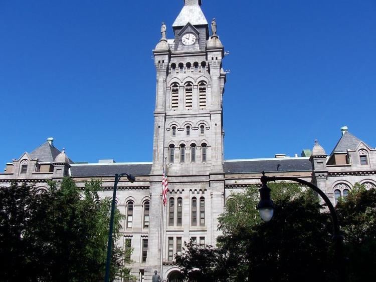
Erie County is home to the Buffalo Bills football team, the Buffalo Sabres hockey team, the Buffalo Bandits lacrosse team, and the Buffalo Bisons minor league baseball team. The city also features a zoo, a botanical garden, a science museum, an historical museum, and the famous Albright-Knox Art Gallery.
The Erie County Fair held every August in the Town of Hamburg, is one of the largest county fairs in the country.
Plans to merge Erie County with the City of Buffalo have been suggested, which proponents say would eliminate much of the extensive bureaucracy and political and municipal subdivisions among the various towns, cities, and villages in the county. The result would be a consolidated city-county controlled by a single government, effectively making Buffalo's borders and population contiguous with Erie County's. These plans have proven very controversial; opposition has come from residents of the rural villages on the borders of Erie County, who feel the plan would not benefit them, and the suburbs, which want to avoid the financial troubles of Buffalo and Erie County while simultaneously benefiting from the amenities of close proximity to a large population base.
Elected officials
The county legislature has 11 members. There are five Democrats, five Republicans and one Conservative Party (New York), who caucuses with the Republicans
Erie County Department of Parks, Recreation and Forestry
The Erie County Department of Parks, Recreation and Forestry was established in 1925 with four parks spanning 2,280 acres (9.2 km2). As of 2003, the county managed 38 properties, totaling approximately 11,000 acres (45 km2) of land. Management objectives include providing and maintaining recreational space and the conservation of the county's natural and historic resources.
A 2003 Master Plan identified several broad categories of parks operated by the county, including heritage parks, waterfront parks, conservation parks, special purpose parks and forest management areas.
Heritage parks
Erie County's heritage parks include the five original county parks that were established during the 1920s and 1930s. These parks are examples of multiple-use sites with significant scenic, natural and historic features. Each park has unique man-made structures of historical character, many constructed as part of the Works Progress Administration movement in the 1930s.
Waterfront parks
Waterfront parks include the significant scenic sites and recreational trail systems along the county’s Lake Erie shoreline.
Conservation parks
These largely-undeveloped parks are managed primarily for conservation of the natural environment and passive nature-based outdoor recreation activities. These lands are intended to generally remain in a natural state.
Special purpose parks
Special purpose parks have unique characteristics that provide specific recreational functions within the county's park system.
Forest management areas
Forest management areas are managed by the Erie County Bureau of Forestry, which was established in 1927. These areas include several thousand acres of mostly-coniferous plantation style forest, much of which was planted on abandoned farmland by the Civilian Conservation Corps in the 1930s. These areas are located mostly in the rural southern portion of the county.
These lands have limited recreation potential, mostly in the form of trails. Management of these lands is focused on natural resource conservation, in addition to potential commercial resource extraction of timber products or maple syrup.