
Country United States County Erie FIPS code 36-77871 Elevation 407 m Local time Friday 6:50 AM | State New York Time zone Eastern (EST) (UTC-5) GNIS feature ID 0979591 Population 3,005 (2010) | |
 | ||
Weather 0°C, Wind NW at 29 km/h, 91% Humidity Area 92.2 km² (92.2 km² Land / 10 ha Water) | ||
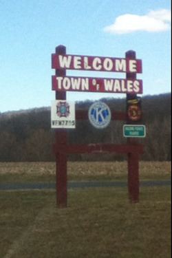
Wales is a town in Erie County, New York, United States. The town is one of the "Southtowns" of Erie County by virtue of its position in the southeast part of the county, southeast of Buffalo. As of the 2010 census the town had a population of 3,005.
Contents
- Map of Wales NY USA
- History
- Geography
- Demographics
- Notable people
- Communities and locations in Wales
- References
Map of Wales, NY, USA
History
The town was formed in 1818 from the town of Willink.
Originally a farming community, the town of Wales is documented through profiles of its churches, civic organizations, businesses, and individual citizens. Established in 1818, the town of 3,000 residents is located in a scenic area of Erie County amid woodlands and streams. Town boards over the years have been respectful of the residents' desire to maintain a small-town atmosphere and quality of life, and the transition to modern life has emphasized small, family-oriented businesses. Personal commitment and a spirit of volunteerism have prevailed in the community, as evidenced by its many interactive organizations.
The town is named because its hills and green fields reminded settlers of the nation of Wales.
Geography
According to the United States Census Bureau, the town has a total area of 35.6 square miles (92.3 km2), of which 35.6 square miles (92.2 km2) is land and 0.04 square miles (0.1 km2), or 0.14%, is water.
The east town line is the border of Wyoming County.
New York State Route 400 passes through the southwest part of the town.
Demographics
As of the census of 2000, there were 2,960 people, 1,116 households, and 841 families residing in the town. The population density was 83.1 people per square mile (32.1/km²). There were 1,165 housing units at an average density of 32.7/sq mi (12.6/km²). The racial makeup of the town was 98.58% White, 0.10% African American, 0.37% Native American, 0.37% Asian, 0.20% from other races, and 0.37% from two or more races. Hispanic or Latino of any race were 0.74% of the population.
There were 1,116 households out of which 34.6% had children under the age of 18 living with them, 64.3% were married couples living together, 7.2% had a female householder with no husband present, and 24.6% were non-families. 19.8% of all households were made up of individuals and 8.2% had someone living alone who was 65 years of age or older. The average household size was 2.65 and the average family size was 3.07.
In the town, the population was spread out with 24.9% under the age of 18, 6.4% from 18 to 24, 29.3% from 25 to 44, 27.8% from 45 to 64, and 11.6% who were 65 years of age or older. The median age was 39 years. For every 100 females there were 98.1 males. For every 100 females age 18 and over, there were 97.9 males.
The median income for a household in the town was $51,486, and the median income for a family was $59,350. Males had a median income of $40,125 versus $29,737 for females. The per capita income for the town was $21,616. About 2.1% of families and 3.6% of the population were below the poverty line, including 4.0% of those under age 18 and 3.5% of those age 65 or over.