
Country United States County Erie FIPS code 36-75121 Elevation 229 m Population 2,367 (2010) | State New York Time zone Eastern (EST) (UTC-5) GNIS feature ID 0967704 Area 12 km² Area code 716 | |
 | ||
ZIP code 14086, 14004, Formerly 14165 | ||
Town Line is a hamlet and census-designated place (CDP) in Erie County, New York, United States. The population was 2,367 at the 2010 census. It is part of the Buffalo–Niagara Falls Metropolitan Statistical Area.
Contents
Map of Town Line, NY, USA
The community is located on the boundary between the towns of Lancaster and Alden. Town Line is at the junction of Town Line Road and Broadway.
The Town Line Fire Department is located on the Lancaster side of the hamlet. It serves the portions of the towns of Lancaster and Alden.
Another community, Town Line Station, is about a mile to the north on Town Line Road.
History
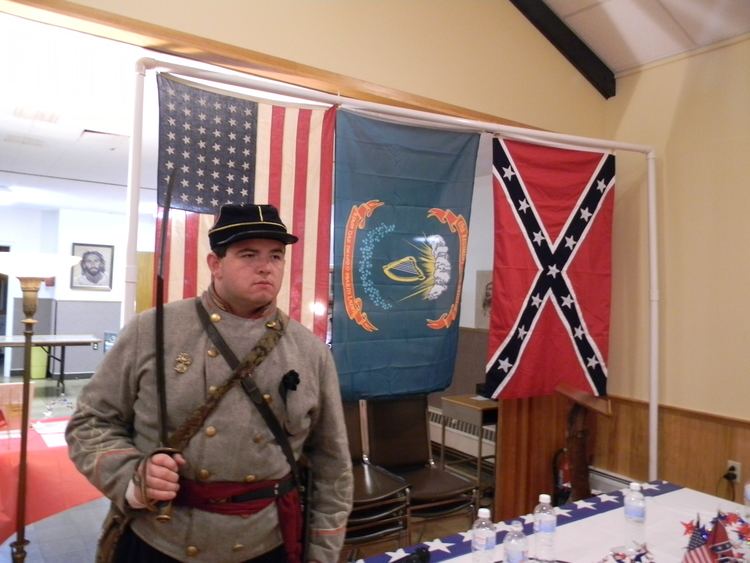
Oral lore says that in 1861, 125 men supposedly gathered in an informal meeting and passed by 85 to 40 a resolution to secede from the United States. Because Town Line was never an incorporated municipal entity in the first place and had no well-defined boundaries, the resolution had no legal effect; neither the Confederacy nor the Union ever formally recognized the action. The town historian says there are no written records of what happened. Several members of the German-American community fled to Canada; five residents crossed the Mason–Dixon line to fight with the Confederates in their Army of Northern Virginia, and twenty residents fought for the Union Army. Town Line held a ceremony on January 24, 1946, to "rejoin" the Union, along with a vote (overseen by Hollywood celebrity Cesar Romero) in which the residents voted, 90 to 23, to rescind the old vote.
Geography
Town Line is located at 42°53′6″N 78°33′30″W (42.884974, -78.558428).
According to the United States Census Bureau, the CDP has a total area of 4.6 square miles (12 km2), all land.
Demographics
As of the census of 2000, there were 2,521 people, 906 households, and 759 families residing in the CDP. The population density was 543.5 per square mile (209.8/km²). There were 925 housing units at an average density of 199.4/sq mi (77.0/km²). The racial makeup of the CDP was 99.29% White, 0.20% Native American, 0.16% Asian, 0.04% Pacific Islander, and 0.32% from two or more races. Hispanic or Latino of any race were 0.44% of the population.
There were 906 households out of which 32.0% had children under the age of 18 living with them, 74.4% were married couples living together, 6.5% had a female householder with no husband present, and 16.2% were non-families. 13.2% of all households were made up of individuals and 7.1% had someone living alone who was 65 years of age or older. The average household size was 2.78 and the average family size was 3.05.
In the CDP, the population was spread out with 23.9% under the age of 18, 6.1% from 18 to 24, 25.4% from 25 to 44, 31.1% from 45 to 64, and 13.5% who were 65 years of age or older. The median age was 42 years. For every 100 females there were 101.2 males. For every 100 females age 18 and over, there were 99.4 males.
The median income for a household in the CDP was $51,548, and the median income for a family was $57,054. Males had a median income of $36,589 versus $30,000 for females. The per capita income for the CDP was $21,957. About 3.6% of families and 3.8% of the population were below the poverty line, including 5.9% of those under age 18 and 2.7% of those age 65 or over.