
Founded 1841 Website www.wyomingco.net | Area 1,544 km² Population 41,531 (2013) Congressional district 27th | |
 | ||
Points of interest Letchworth State Park, Silver Lake State Park, Letchworth State Park Upper Falls, Buffalo Audubon Society, Beaver Meadow Audubon Destinations | ||
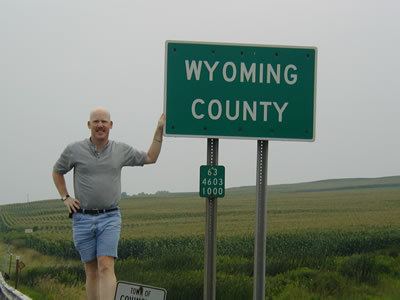
Wyoming County is a county in the U.S. state of New York in the state's western area. As of the 2010 census, the population was 42,155. The county seat is Warsaw. The name is from a modified Delaware Indian word meaning "broad bottom lands". Wyoming County was formed from Genesee County in 1841.
Contents
- Map of Wyoming County NY USA
- History
- Geography
- Adjacent counties
- Demographics
- Government
- State and federal government
- Politics
- Points of interest
- Census designated places
- Hamlets
- Notable residents
- References
Map of Wyoming County, NY, USA
History
As with the rest of Western New York, Wyoming County was part of disputed territory throughout the 17th and 18th centuries, with Massachusetts Bay Colony, Connecticut Colony, Pennsylvania Colony, New York Colony, and (to a lesser extent) New France; New York's claims would not be recognized until the Treaty of Hartford was ratified in 1786 and would not be actively asserted until the Holland Purchase.
In regard to New York's claim, as of 1683 the present Wyoming County was part of Albany County. This was an enormous county, including the northern part of New York State as well as all of the present State of Vermont and, in theory, extending westward to the Pacific Ocean. This county was reduced in size on July 3, 1766, by the creation of Cumberland County, and further on March 16, 1770, by the creation of Gloucester County, both containing territory now in Vermont.
On March 12, 1772, what was left of Albany County was split into three parts, one remaining under the name Albany County. One of the other pieces, Tryon County, contained the western portion (and thus, since no western boundary was specified, theoretically still extended west to the Pacific). The eastern boundary of Tryon County was approximately five miles west of the present city of Schenectady, and the county included the western part of the Adirondack Mountains and the area west of the West Branch of the Delaware River. The area then designated as Tryon County now includes 37 counties of New York State. The county was named for William Tryon, colonial governor of New York.
In the years prior to 1776, most of the Loyalists in Tryon County fled to Canada. In 1784, following the peace treaty that ended the American Revolutionary War, the name of Tryon County was changed to Montgomery County in order to honor the general, Richard Montgomery, who had captured several places in Canada and died attempting to capture the city of Quebec, replacing the name of the hated British governor.
In 1789, Ontario County was split off from Montgomery as part of the establishment of the Morris Reserve.
Almost all of the land west of the Genesee River, including all of present-day Wyoming County, was part of the Holland Land Purchase in 1793 and was sold through the Holland Land Company's office in Batavia, starting in 1801.
Genesee County was created by a splitting of Ontario County in 1802 to govern the land acquired in the Holland Purchase. This was much larger than the present Genesee County, however. It was reduced in size in 1806 by creating Allegany County; again in 1808 by creating Cattaraugus, Chautauqua, and Niagara counties. Niagara County at that time also included the present Erie County.
In 1821, portions of Genesee County were combined with portions of Ontario County to create Livingston and Monroe counties.
Genesee County was further reduced in size in 1824 by creating Orleans County.
Finally, in 1841, Wyoming County was created from the southern half of Genesee County, the northwest corner of Allegany County, and a small portion of the northeast corner of Cattaraugus County.
Geography
According to the U.S. Census Bureau, the county has a total area of 596 square miles (1,540 km2), of which 593 square miles (1,540 km2) is land and 3.5 square miles (9.1 km2) (0.6%) is water.
Wyoming County is in the western part of New York State, east of Buffalo and slightly west of due south of Rochester. The county is in the Holland Purchase Region.
The county is largely rural, dotted with small towns. Even the county seat, Warsaw is quite small. The land surface is generally broken and hilly, and the soil fertile. Much of the area is wooded, used for timber. Some that are predominantly maple are tapped each spring for the production of maple syrup. Agriculture dominates the county. Apple orchards were once a major agricultural endeavor, but only a few are left. The area is well known for outdoor sports, being an excellent area for fishing, hunting, and snowmobiling.
An active geologic fault runs down the Dale valley through Linden, to the east of Batavia and out into Lake Ontario. Movement of the fault is an occasional source of minor earthquakes, which, at most, have toppled a couple chimneys. The Dale Valley has been developed as a source of salt by way of brine wells, for the chemical industry. A pipeline moves the brine to Niagara Falls.
The county is bounded on the southeast by the Genesee River, and drained by tributaries of that stream, as well as Tonawanda, Buffalo, and other creeks. An important tributary of the Genesee River, Oatka Creek, has its source in the Town of Gainesville, a town of the county.
Adjacent counties
Demographics
At the 2000 census, there were 43,424 people, 14,906 households and 10,717 families residing in the county. The population density was 73 per square mile (28/km²). There were 16,940 housing units at an average density of 29 per square mile (11/km²). The racial makeup of the county was 91.84% White, 5.52% Black or African American, 0.27% Native American, 0.37% Asian, 0.02% Pacific Islander, 1.32% from other races, and 0.67% from two or more races. 2.94% of the population were Hispanic or Latino of any race. 31.7% were of German, 12.5% English, 10.9% Irish, 10.2% Polish, 9.3% American and 7.7% Italian ancestry according to Census 2000. 97.1% spoke English and 1.8% Spanish as their first language.
There were 14,906 households of which 34.20% had children under the age of 18 living with them, 58.30% were married couples living together, 9.20% had a female householder with no husband present, and 28.10% were non-families. 23.20% of all households were made up of individuals and 10.20% had someone living alone who was 65 years of age or older. The average household size was 2.62 and the average family size was 3.08.
Age distribution was 24.10% under the age of 18, 8.20% from 18 to 24, 32.80% from 25 to 44, 22.80% from 45 to 64, and 12.20% who were 65 years of age or older. The median age was 37 years. For every 100 females there were 118.30 males. For every 100 females age 18 and over, there were 122.40 males.
The median household income was $39,895, and the median family income was $45,088. Males had a median income of $31,973 versus $22,252 for females. The per capita income for the county was $17,248. About 5.80% of families and 8.40% of the population were below the poverty line, including 11.60% of those under age 18 and 5.80% of those age 65 or over.
Government
Wyoming County is somewhat unusual among New York counties in that it remains governed by a 16-member Board of Supervisors, consisting of the town supervisor of each town in its territory.
State and federal government
Wyoming County is part of:
Politics
In state and national politics, Wyoming County is one of the most Republican counties in New York, a state that characteristically votes Democratic. In both the 2004 and 2008 U.S. Presidential elections, it was the second-reddest county in New York, behind Hamilton County. In fact, the only Democrat to carry the county since the Civil War has been Lyndon Baines Johnson in 1964, during an election when no county in the Empire State supported Republican Barry Goldwater. In 2004, George W. Bush carried Wyoming County by a 30.9 percent margin over John Kerry, with Kerry carrying the state by an 18.3 percent margin. In 2008, John McCain won the county by a 26.1 percent margin over Barack Obama, with Obama defeating McCain statewide by 26.7 percent. In New York's 2006 U.S. Senatorial election, Wyoming County voted for John Spencer by a 4% margin over Hillary Clinton, with Clinton being reelected by a 36% margin over Spencer. In 2012, Wyoming County again selected a Republican for this seat, being one of only two counties (the other being neighboring Allegany County) to vote in favor of Republican candidate Wendy Long rather than Democratic incumbent Kirsten Gilibrand.