
Country United States County Erie Area code(s) 716 Elevation 188 m Local time Sunday 4:35 PM | State New York Time zone Eastern (EST) (UTC-5) FIPS code 36-75000 Population 73,567 (2010) | |
 | ||
Weather 9°C, Wind SW at 21 km/h, 66% Humidity University The Salon Professional Academy Buffalo | ||
Tonawanda (formally, the Town of Tonawanda) is a town in Erie County, New York, United States. As of the 2010 census, the town had a population of 73,567. The town is at the north border of the county and is the northern suburb of Buffalo. It is sometimes referred to, along with its constituent village of Kenmore, as "Ken-Ton". The town was established in 1836, and up to 1903 it included what is now the city of Tonawanda.
Contents
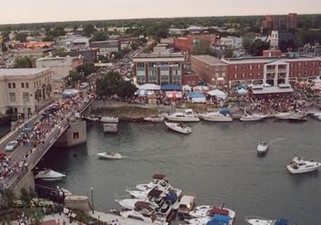
- Map of Tonawanda NY USA
- History
- Geography
- Adjacent cities and towns
- Major highways
- Demographics
- Environmental issues
- Landmarks
- Education
- Communities and locations
- References
Map of Tonawanda, NY, USA
History
This area was under French control from the 17th century until ceded to the British after the French and Indian War.
The first settlers arrived around 1805. Rapid growth began after the construction of the Erie Canal, completed in 1825. Tonawanda occupies the northwest corner of Erie County and is bounded on the north by the Erie Canal, which here follows Tonawanda Creek.
The town of Tonawanda was established in 1836, by separation from the town of Buffalo (now part of the city of Buffalo). At that time it included land that later became part of the town of Grand Island (established 1852) and the entire city of Tonawanda (established 1903).
In 1899, Kenmore incorporated as a village of the town.
Geography
According to the United States Census Bureau, the town has a total area of 20.3 square miles (52.5 km2), of which 18.7 square miles (48.5 km2) is land and 1.5 square miles (4.0 km2), or 7.61%, is water.
The north border of the town is the city of Tonawanda and Tonawanda Creek, which is part of the Erie Canal, and the west border is the Niagara River. Ellicott Creek flows parallel to Tonawanda Creek in the northern part of the town, with a confluence just east of the Niagara River. The east border, marked by U.S. Route 62 (Niagara Falls Boulevard), is the town of Amherst. Forming the southern border is the village of Kenmore and the city of Buffalo.
Adjacent cities and towns
Major highways
Demographics
As of the census of 2010, there were 78,155 people, 33,278 households, and 21,164 families residing in the town. The population density was 4,156.3 people per square mile (1,605.1/km²). There were 34,634 housing units at an average density of 1,841.8 per square mile (711.3/km²). The racial makeup of the town was 93.01% White, 1.41% Black or African American, 0.30% Native American, 0.40% Asian, 1.30% Pacific Islander, 0.36% from other races, and 1.60% from two or more races. Hispanic or Latino of any race were 2.70% of the population.
There were 32,951 households out of which 22.8% had children under the age of 18 living with them, 43.1% were married couples living together, 11.6% had a female householder with no husband present, and 41.4% were non-families.
Environmental issues
In 2009, citizen environmental monitoring of air quality problems resulted in an investigation by the United States Environmental Protection Agency (EPA) into emissions from Tonawanda Coke Corporation (TCC), a producer of foundry coke located on River Road, Tonawanda. In 1998 TCC had been cited by the EPA for violations of oil spill prevention sections of the federal Clean Water Act following contamination of the nearby Niagara River. The investigations into air quality revealed TCC was using an unreported pressure-relief system to vent coke oven gases containing benzene direct to the atmosphere, operating a coke-quenching tower without pollution-control baffles, and dumping hazardous waste in the form of coal tar sludge.
In March 2013 TCC was convicted by a federal jury on 11 counts of violating the Clean Air Act (CAA) and three counts of violating the Resource Conservation and Recovery Act (RCRA). In March 2014 TCC was sentenced in federal court to pay a $12.5 million penalty and $12.2 million in community service payments for the violations. TCC's Environmental Control Manager, Mark L. Kamholz, was convicted of 11 counts of violating the CAA, one count of obstruction of justice and three counts of violating the RCRA, and was sentenced to one year in prison, 100 hours of community service, and a $20,000 fine.
In July 2014 DuPont was fined $440,000 for violations of the CAA at its plant at Sheridan Drive and River Road. The EPA found that the plant had inadequate pollution-control equipment, failed to maintain a monitoring system for the equipment, violated several reporting requirements and underreported air pollution on its annual statements. Emissions from the plant included methyl methacrylate and vinyl fluoride.
Landmarks
One of the Town of Tonawanda's best known landmarks is the blue Korean War-era Grumman F9F-6P Cougar Naval airframe displayed in Walter M. Kenney Field at the northwest corner of Brighton Road and Colvin Boulevard. The "blue jet," as it is often called, has been on loan to the town from the U.S. government since May 1959. Immediately behind the F9F-6P airframe is the Town of Tonawanda Veterans Memorial, dedicated on August 18, 2009. Retired U.S. Army General and former U.S. Secretary of State Colin L. Powell delivered the keynote address during the memorial's dedication ceremony before a crowd of more than 1,500.
The Town of Tonawanda Historical Society operates a museum out of a former German Evangelical Church constructed in 1849. This facility, located at 100 Knoche Road, is the oldest public building in the town.
Education
Tonawanda has two public high schools, Kenmore West Senior High School and Kenmore East High School.
The town is also home to St. Joseph's Collegiate Institute, Mt. St. Mary's and Cardinal O'Hara High School.