
Discharge 5.777 m³/s Cities Buffalo | - elevation 1,450 ft (442 m) - elevation 570 ft (174 m) Basin area 367.8 km² Country United States of America | |
 | ||
- right Buffalo Creek (New York), Cazenovia Creek | ||
The Buffalo River drains a 447-square-mile (1,160 km2) watershed in New York state, emptying into the eastern end of Lake Erie at the City of Buffalo. The river has three tributaries: Cayuga Creek, Buffalo Creek, and Cazenovia Creek.
Contents
- Map of Buffalo River Buffalo NY USA
- GeographyEdit
- TributariesEdit
- HistoryEdit
- Origin of the nameEdit
- Contamination and remediationEdit
- RecreationEdit
- References
Map of Buffalo River, Buffalo, NY, USA
The Buffalo River has been important to the development of western New York, including as the terminus for the Erie Canal beginning in 1825, and later as an industrial area with uses including grain elevators, steel mills and chemical production. When shipping began to bypass the Erie Canal in the 1950s, and later with the decline of heavy industry in the region, the transportation and industrial use of the river greatly declined and many adjacent factories and grain mills were abandoned. The river and adjacent sites have been the focus of efforts over several decades to improve water quality and restore habitat, most recently in 2011 with the commencement of the Buffalo River Restoration Project.
GeographyEdit
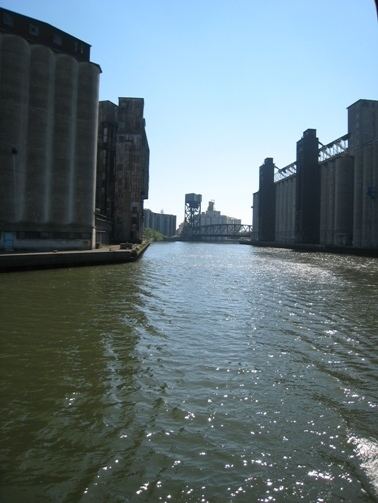
The Buffalo River flows westward from the point of confluence, passing through residential and heavily industrialized parts of the city. The river includes a 6.2-mile (10.0 km) federal navigation channel maintained by the United States Army Corps of Engineers at a depth of 23 feet (7.0 m) below lake level (along with an additional 1.4 miles [2.3 km] of the City Ship Canal). Because of this designation, bridges in the navigable part of the river are required to allow for passage of high vessels, and many of them are drawbridges. The very low hydraulic gradient of the river, along with the dredging, gives the river an estuarine-like character. Much of the shoreline is hardened by riprap, bulkheads and other structures, and little vegetation remains along the banks. The river enters the lake between a United States Coast Guard station and the Erie Basin Marina. The grounds of the Coast Guard station include the Buffalo Main Light, established in 1833 and listed on the National Register of Historic Places.
The mouth of the river where it meets the lake is part of the Port of Buffalo, and is navigable by larger vessels. The port was expanded to include the City Ship Canal and its extension, the Lehigh Valley Canal. Some of the canals have now been filled in. The ponds at Tifft Farm Nature Preserve in the southwest corner of the city originally were part of this canal system and were used by the Lehigh Valley Railroad as a terminal facility. They are no longer connected to the canal. The Army Corps of Engineers dredges the river and the City Ship Canal every two to three years, removing about 100,000 cubic yards (76,000 m3) of sediment. Dredging sediment is placed in a confined disposal facility located on Lake Erie near the former Bethlehem Steel facility. In 2011 and 2012 a more extensive dredging effort was undertaken as part of the Buffalo River Restoration Project to remove contaminated sediment from both the navigable waterway and from an upstream part of the Buffalo River that is not normally dredged.
TributariesEdit
Buffalo Creek is a meandering stream before it becomes the Buffalo River. It originates in the south part of Erie County and the western part of Wyoming County. The Erie County sources are in the Town of Holland before flowing northward through the other towns in the county. In Wyoming County, the sources are in the Towns of Arcade, Java, and Sheldon, before flowing into Erie County. The creek flows through Elma and West Seneca, before its confluence with Cayuga Creek in West Seneca.
Cayuga Creek is the northernmost tributary in the watershed. This 40-mile-long (64 km) creek begins in primarily farmland/wooded areas and passes through several residential communities, including Cheektowaga, Lancaster, and Depew, before its confluence with Buffalo Creek.
The East Branch of Cazenovia Creek begins in Sardinia and the West Branch begins in Concord. The land adjacent to these two branches is primarily agricultural and wooded areas, with the exception of several small residential communities. The two branches meet near East Aurora, after which Cazenovia Creek flows through the towns of Aurora, Elma, and West Seneca, and the city of Buffalo until its confluence with the Buffalo River.
HistoryEdit
The Buffalo Creek area is believed to have been held by the Neutral Nation prior to the 1650s, when the Seneca nation and its Iroquois allies conquered the territory during the Beaver Wars. In the spring of 1780, the British established an Indian village on Buffalo Creek for the mostly Seneca people who had been forced off their lands by the destructive Sullivan Expedition of 1779. They had fled to Fort Niagara for refuge with the British. After the war Buffalo Creek area was developed further as a Seneca settlement.
On July 8, 1788, Oliver Phelps and Nathaniel Gorham met with Indians of the Five Nations of the Iroquois Confederacy (including Mohawks, Oneidas, Onandagas, Cayugas, and Senecas) at Buffalo Creek to execute a deed or treaty for rights to their lands in New York State east of the Genesee River (see Phelps and Gorham Purchase). In 1838, the Treaty of Buffalo Creek dealt with the disposition of the remaining land in New York held by the nations of the Iroquois Confederation.
In 1825 the Buffalo River was the western terminus for the Erie Canal constructed through the Mohawk River valley in New York state. Entry to the river from the Canal was gained via the mouth of a small tributary, Little Buffalo Creek, which was excavated and stabilized to form the Commercial Slip leading from the Erie Canal. The Buffalo River formed the southwest boundary of the rough pentagon that enclosed the "Five Points" or "Canal Street" district, bounded on the northeast by the Erie Canal. When the Canal was completed in 1825, New York Governor Dewitt Clinton's vessel was towed from the Canal through the Commercial Slip and Buffalo River to Lake Erie. There in a celebration ceremony he poured Atlantic Ocean water into the Lake, and collected lake water to place in the ocean after his return trip to New York City.
Origin of the nameEdit
It is believed that the city of Buffalo was named after Buffalo Creek. There are several unsourced theories for the origin of the creek's name. Early French and Moravian explorers reported the abundance of buffalo on the south shore of Lake Erie, but their presence on the banks of Buffalo Creek is still a matter of debate, so the origin of the name of the creek is still uncertain. Neither the Native American name ("Place of the Basswoods") or the French name ("River of Horses") survived, so the current name likely dates to the British occupation that began with the capture of Fort Niagara in 1759. The British engineer John Montresor mentions the name Buffalo Creek four times in his journal of 1764, indicating that the name was in common use at that time. Numerous other Buffalo Creeks are feature names in the United States, many in eastern states. Scholars believe it is likely most were named after the animal, as was done with numerous Beaver Creeks, Otter Creeks, etc. The claim that the name is an Anglicized form of the name Beau Fleuve (beautiful river), which was supposedly an exclamation uttered by Louis Hennepin when he first saw the stream, is the least likely explanation, but very popular.
Contamination and remediationEdit
The Buffalo River and to a lesser degree its tributaries have been the site of heavy industry, although this has declined in recent decades. This, along with large combined sewer overflows along the river, has resulted in highly contaminated sediments and impaired water quality. In 1987, most of the Buffalo River along with the City Ship Canal was listed as one of 43 Great Lakes Areas of Concern in The Great Lakes Water Quality Agreement between the United States and Canada. In 2011 the Buffalo River Restoration Project commenced, which includes major dredging to remove contaminated sediment, habitat restoration, and site access projects. According to a statement by the Army Corps of Engineers in the spring of 2012, the project will result in the Buffalo River being removed from the list of Areas of Concern in three to five years.
RecreationEdit
The Buffalo office of the New York State Department of Environmental Conservation established the Buffalo River Urban Canoe Trail and published a guide in the 1990s describing the bridges, factories and other points of interest along the river. In 2011, Buffalo River Fest Park was opened along the river, including docks, a boardwalk, and a band stand.