
County Erie Time zone EST (UTC-5) Elevation 223 m Population 56,936 (2010) | State New York Incorporated 1812 Area code 716 Zip code 14075 Local time Wednesday 7:07 AM | |
 | ||
Weather -9°C, Wind NW at 27 km/h, 80% Humidity | ||
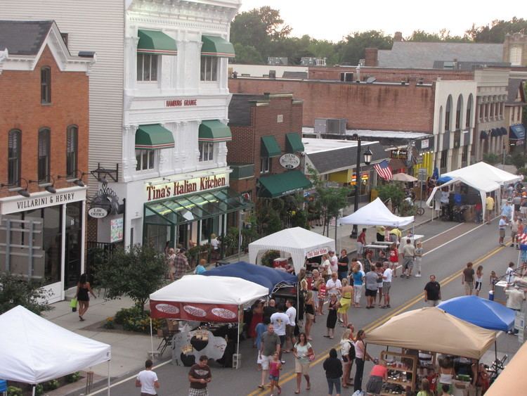
Hamburg is a town in Erie County, New York, United States. As of the 2010 census, the town had a total population of 56,936. It is named after the city of Hamburg, in Germany. The town is on the western border of the county and is south of Buffalo. Hamburg is one of the Southtowns in Erie County. The villages of Hamburg and Blasdell are in the town.
Contents
- Map of Hamburg NY 14075 USA
- History
- Geography
- Communities and locations
- Climate
- Demographics
- Arts and culture
- Parks and recreation
- Government
- Education
- Media
- Infrastructure
- References
Map of Hamburg, NY 14075, USA
History
Historical evidence shows that the area was settled originally by the Erie people. Around 1805 the settlement was known as "Barkerville", named after Zenas Barker, the postmaster. On the site of this building today is the Dock at the Bay. The first landowner in the area was John Cummings, who built the first grist mill in 1806.
The town of Hamburg was formed by government decree on March 20, 1812, from the (now defunct) town of Willink. The first town meeting took place on April 7, 1812, at Jacob Wright's tavern at Wright's Corners, which was renamed Abbott's Corners, and now Armor. One of the early noted activities of the town board in that same year was to place a $5 bounty on wolf hides, due to the complaints of the local settlers who were being bothered by them.
In 1815, mail routes were established. The earliest settlers in the area were from New England. Germans started arriving in the 1830s and set up many successful farms. On November 29, 1824, a meeting was held in Abbott's Corners at the home of early settler Seth Abbott. At a vote of those present, agreement was reached to form a library with the sum of $102.
By 1850, the town was reduced by the formation of the towns of Orchard Park and West Seneca. Around 1852, the Erie Railroad was built through the area. In 1868 the Erie County Fair came to the town and has been located there since then. In 1875 the weekly publication of the Erie County Independent began. This is now known as The Sun. Telephone service in the area started in 1886.
The village of Hamburg set itself off from the town in 1874 by incorporating as a village.
Starting in 1890 and to support the growing regional steel industry, Polish and Italians began to arrive in the area.
In 1897, a group of women known as the Nineteenth Century Club started a permanent free public library, known as the Hamburg Free Library. Until 1901 it was located in various rented buildings. The Hamburg Free Library was moved into a Carnegie library on Center Street on November 8, 1915, where it remained until 1966 when the current library at 102 Buffalo Street was opened.
In 1898, the community of Blasdell set itself apart from the town by incorporating as a village.
A trolley car system was established in the early 1900s.
The Kleis Site, containing the remnants of a 17th-century Iroquoian village and burial ground, was listed on the National Register of Historic Places in 1979.
In 2003, Joe Haptas, a spokesman for the animal rights group People for the Ethical Treatment of Animals (PETA), sent a letter to then-Town Supervisor Patrick Hoak and asked that the name of Hamburg be changed to "Veggieburg". PETA offered the Hamburg Central School District $15,000 worth of free veggie burgers as an incentive for the name change. Hoak declined the name change.
In July 2012, Main Street in the village of Hamburg from Lake Street to Buffalo Street was granted state approval for nomination as a national historic district.
Geography
According to the United States Census Bureau, 41.4 square miles (107.1 km2), of which 41.3 square miles (107.0 km2) is land and 0.03 square miles (0.07 km2), or 0.07%, is water.
Lake Erie forms the western border of the town, and Eighteen Mile Creek forms the southern boundary.
Communities and locations
Climate
Hamburg experiences a continental climate (Köppen Dfb), heavily influenced by lake-effect snow from Lake Erie.
Demographics
As of the census of 2000, there were 56,259 people, 21,999 households, and 15,157 families residing in the town. The population density was 1,362.7 people per square mile (526.1/km²). There were 22,833 housing units at an average density of 553.1 per square mile (213.5/km²). The racial makeup of the town was 97.93% White, 0.49% Black or African American, 0.20% Native American, 0.39% Asian, 0.01% Pacific Islander, 0.38% from other races, and 0.60% from two or more races. Hispanic or Latino of any race were 1.56% of the population.
There were 21,999 households out of which 32.3% had children under the age of 18 living with them, 55.7% were married couples living together, 10.1% had a female householder with no husband present, and 31.1% were non-families. 26.4% of all households were made up of individuals and 11.8% had someone living alone who was 65 years of age or older. The average household size was 2.51 and the average family size was 3.07.
In the town, the population was spread out with 24.8% under the age of 18, 6.9% from 18 to 24, 28.6% from 25 to 44, 24.6% from 45 to 64, and 15.1% who were 65 years of age or older. The median age was 39 years. For every 100 females there were 90.9 males. For every 100 females age 18 and over, there were 86.5 males.
The median income for a household in the town was $47,888, and the median income for a family was $56,974. Males had a median income of $41,440 versus $27,602 for females. The per capita income for the town was $21,943. About 3.2% of families and 4.5% of the population were below the poverty line, including 4.2% of those under age 18 and 6.9% of those age 65 or over.
Arts and culture
The Erie County Fair is situated on a 275-acre (111 ha) plot of land near the village of Hamburg. The fair, operated by Strates Shows, runs for twelve days in August and is the third-largest county fair in the United States.
Parks and recreation
The Seaway Trail, a National Scenic Byway, travels through Hamburg on New York Route 5, along the Lake Erie shoreline. The Lake Erie Seaway Trail Center, a seasonal visitors information center with exhibits and public waterfront access, is located in Hamburg.
Woodlawn Beach State Park, located on the shore of Lake Erie, was opened as a state park in 1996, and has been operated since 2011 by the town of Hamburg under a ten-year agreement with New York State.
Government
Hamburg is served by nine volunteer fire departments, including the Armor, Big Tree, Blasdell, Hamburg, Lake Shore, Lakeview, Newton-Abbott, Scranton, and Woodlawn fire companies. Newton-Abbott and Scranton also cover the portion of Interstate 90 that passes through the town.
The Hamburg Water Rescue Unit provides emergency services on Lake Erie, as well as inland creeks and waterways.
Advanced EMS and paramedic services are provided by the Rural/Metro Corporation.
Education
Hilbert College is in the town of Hamburg, north of the village of Hamburg. A portion of the south campus of Erie Community College is in the eastern part of the town.
The primary public school district in the town is the Frontier Central School District, consisting of Frontier Central High School, Frontier Middle School and four elementary schools. The district enrolls over 5,500 students.
Media
The town's weekly newspaper is the Hamburg Sun.
Infrastructure
The New York State Thruway (Interstate 90), U.S. Route 62, US 20, and NY Route 5 pass through the town. NY 75 runs through the village of Hamburg, temporarily concurrent with Route 62. U.S. 20A diverges from US 20 north of the village of Hamburg as both routes proceed to the east.
The town is served by five bus lines operated by the Niagara Frontier Transportation Authority (NFTA). A park and ride facility is located between NY 5 and NY 75 near Athol Springs.