
Address Tucson, AZ 85701, USA Established April 11, 1902 | Governing body U.S. Forest Service Phone +1 520-388-8300 | |
 | ||
Area 1,780,000 acres (7,200 km) Website Coronado National Forest Hours Open today · 8AM–4:30PMMonday8AM–4:30PMTuesday8AM–4:30PMWednesday8AM–4:30PMThursday8AM–4:30PMFriday8AM–4:30PMSaturdayClosedSundayClosed Profiles | ||
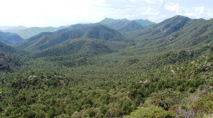
U s hwy 191 a road less traveled coronado national forest mt graham az
The Coronado National Forest includes an area of about 1.78 million acres (7,200 km2) spread throughout mountain ranges in southeastern Arizona and southwestern New Mexico.
Contents
- U s hwy 191 a road less traveled coronado national forest mt graham az
- Coronado national forest arizona
- Wilderness
- Campgrounds
- Huachuca National Forest
- References
It is located in parts of Cochise, Graham, Santa Cruz, Pima, and Pinal counties in Arizona, and Hidalgo County in New Mexico.
The National Forest is divided into five ranger districts. The districts themselves are not contiguous; each consists of multiple "sky island" mountain ranges.
The Santa Catalina Ranger District near the city of Tucson comprises the Santa Catalina and Rincon Mountains. Included in this area is the highest peak of the Santa Catalinas, Mount Lemmon, the rugged Pusch Ridge Wilderness Area, and the popular Sabino Canyon. Much of this district was part of Santa Catalina National Forest before its inclusion in Coronado.
The Safford Ranger District comprises the mountain ranges surrounding the city of Safford, Arizona. These five ranges are the Pinaleño, Galiuro, Santa Teresa, Winchester, and Greasewood Mountains. Included in this area is the highest peak of the Pinaleños, Mount Graham. Mount Graham National Forest was a formerly separate national forest, combined into Crook National Forest on July 1, 1908. In 1953 part of Crook was absorbed into Coronado.
The Nogales Ranger District comprises four mountain ranges north and west of Nogales, Arizona. These ranges are the Santa Rita, Tumacacori, Pajarito, and San Luis Mountains. Included in this area are Mount Hopkins, Mount Wrightson, and Madera Canyon, all located in the Santa Ritas. In the early 20th century this area included two national forests which were absorbed into Coronado: Santa Rita National Forest and Tumacacori National Forest.
The Douglas Ranger District comprises three mountain ranges north and east of Douglas, Arizona. These ranges are the Chiricahua, Dragoon, and Peloncillo Mountains. A portion of the Ranger District in the Peloncillos extends into New Mexico. The district comprises three formerly separate national forests: Chiricahua National Forest, Dragoon National Forest and Peloncillo National Forest, all combined into Coronado.
The Sierra Vista Ranger District comprises three mountain ranges west of Sierra Vista, Arizona. These ranges are the Huachuca, Patagonia, and Whetstone Mountains. Included in this area is the highest peak in the Huachucas, Miller Peak, and the region of the Huachucas known as Canelo Hills. The district includes the formerly separate Huachuca National Forest
¡Three Amigos! was partially filmed here in addition to Old Tucson Studios.
Coronado national forest arizona
Wilderness
The Coronado National Forest contains eight designated wilderness areas, with at least one in each Ranger District. Congress defines wilderness as an area "untrammeled by man." Common activities in the Coronado National Forest wilderness areas include hiking, horseback riding, camping, hunting, and fishing. The use of mechanized or motorized equipment, including bicycles, generators, and chain saws, is prohibited.
Campgrounds
Below is a table displaying all public campgrounds located within the Coronado National Forest. Most requiring a daily/nightly fee (see Coronado National Forest official website for accurate and current details), though some do not.
* Information is accurate as of Tuesday, 17 June 2008 at 13:39:50 EDT
Huachuca National Forest
Huachuca National Forest was established as the Huachuca Forest Reserve by the U.S. Forest Service in Arizona on November 6, 1906 with 314,125 acres (127,122 ha). It became a National Forest on March 4, 1907. On July 1, 1908 the entire forest was combined with Baboquivari National Forest and Tumacacori National Forest to establish Garces National Forest, and the name was discontinued. The lands are presently included in Coronado National Forest.