
Congressional district 2nd Website www.cochise.az.gov Founded 1881 | Area 16,107 km² Population 129,473 (2013) | |
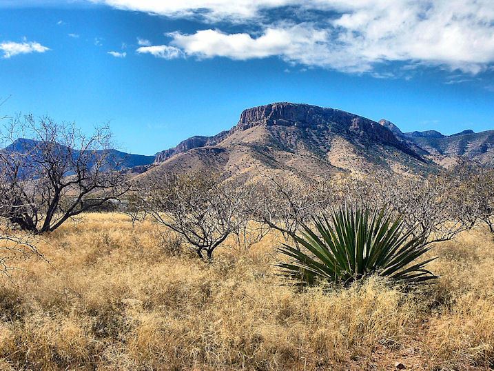 | ||
Points of interest Destinations | ||
Gaming the border a report from cochise county arizona
Cochise County is a county located in the southeastern corner of the U.S. state of Arizona. The population was 131,346 at the 2010 census. The county seat is Bisbee.
Contents
- Gaming the border a report from cochise county arizona
- Map of Cochise County AZ USA
- Visiting johnny ringo s grave site cochise county arizona
- History
- Geography
- Protected areas
- 2000 census
- 2010 census
- Politics
- Major highways
- Airports
- Cities
- Town
- Military sites
- County population ranking
- References
Map of Cochise County, AZ, USA
Cochise County comprises the Sierra Vista-Douglas, AZ Metropolitan Statistical Area. The county borders southwestern New Mexico and northwestern Sonora in Mexico.
Visiting johnny ringo s grave site cochise county arizona
History
Cochise County was created on February 1, 1881, out of the eastern portion of Pima County. It took its name from the legendary Chiricahua Apache war chief Cochise. The county seat was Tombstone until 1929 when it moved to Bisbee. Notable men who once held the position of County Sheriff were Johnny Behan, who served as the first sheriff of the new county, and who was one of the main characters during the events leading to and following the Gunfight at the O.K. Corral. Later, in 1886, Texas John Slaughter became sheriff. Lawman Jeff Milton and lawman/outlaw Burt Alvord both served as deputies under Slaughter.
A syndicated television series which aired from 1956 to 1958, Sheriff of Cochise starring John Bromfield, was filmed in Bisbee. The Jimmy Stewart movie Broken Arrow and subsequent television show of the same name starring John Lupton, which also aired from 1956 to 1958, took place (but was not filmed) in Cochise County.
J.A. Jance's Joanna Brady mystery series takes place in Cochise County, with Brady being the sheriff.
Beginning in the late 1950s, the small community of Miracle Valley was the site of a series of bible colleges and similar religious organizations, founded by television evangelist A. A. Allen. In 1982, Miracle Valley and neighboring Palominas were the site of a series of escalating conflicts between a newly arrived religious community and the county sheriff and deputies that culminated in the Miracle Valley shootout.
Geography
According to the U.S. Census Bureau, the county has a total area of 6,219 square miles (16,110 km2), of which 6,166 square miles (15,970 km2) is land and 53 square miles (140 km2) (0.9%) is water. Cochise County is close to the size of the States of Rhode Island and Connecticut combined.
Protected areas
2000 census
As of the 2000 census, there were 117,755 people, 43,893 households, and 30,768 families residing in the county. The population density was 19 people per square mile (7/km²). There were 51,126 housing units at an average density of 8 per square mile (3/km²). The racial makeup of the county was 76.66% White, 4.52% Black or African American, 1.15% Native American, 1.65% Asian, 0.26% Pacific Islander, 12.05% from other races, and 3.72% from two or more races. 30.69% of the population were Hispanic or Latino of any race. 25.35% reported speaking Spanish at home, while 1.31% speak German [1].
There were 43,893 households out of which 32.00% had children under the age of 18 living with them, 55.10% were married couples living together, 11.10% had a female householder with no husband present, and 29.90% were non-families. 25.30% of all households were made up of individuals and 10.10% had someone living alone who was 65 years of age or older. The average household size was 2.55 and the average family size was 3.07.
In the county, the population was spread out with 26.30% under the age of 18, 9.30% from 18 to 24, 26.00% from 25 to 44, 23.70% from 45 to 64, and 14.70% who were 65 years of age or older. The median age was 37 years. For every 100 females there were 101.60 males. For every 100 females age 18 and over, there were 101.20 males.
The median income for a household in the county was $32,105, and the median income for a family was $38,005. Males had a median income of $30,533 versus $22,252 for females. The per capita income for the county was $15,988. About 13.50% of families and 17.70% of the population were below the poverty line, including 25.80% of those under age 18 and 10.40% of those age 65 or over.
In 2000, the largest denominational group was the Catholics (with 25,837 adherents) and Evangelical Protestants (with 12,548 adherents). The largest religious bodies were The Catholic Church (with 25,837 members) and The Southern Baptist Convention (with 5,999 members).
2010 census
As of the 2010 United States Census, there were 131,346 people, 50,865 households, and 33,653 families residing in the county. The population density was 21.3 inhabitants per square mile (8.2/km2). There were 59,041 housing units at an average density of 9.6 per square mile (3.7/km2). The racial makeup of the county was 78.5% white, 4.2% black or African American, 1.9% Asian, 1.2% American Indian, 0.3% Pacific islander, 9.9% from other races, and 4.0% from two or more races. Those of Hispanic or Latino origin made up 32.4% of the population. In terms of ancestry, 16.2% were German, 11.6% were Irish, 9.8% were English, and 4.5% were American.
Of the 50,865 households, 30.4% had children under the age of 18 living with them, 50.0% were married couples living together, 11.5% had a female householder with no husband present, 33.8% were non-families, and 28.2% of all households were made up of individuals. The average household size was 2.46 and the average family size was 3.02. The median age was 39.7 years.
The median income for a household in the county was $44,876 and the median income for a family was $53,077. Males had a median income of $42,164 versus $31,019 for females. The per capita income for the county was $23,010. About 11.8% of families and 15.7% of the population were below the poverty line, including 23.2% of those under age 18 and 10.7% of those age 65 or over.
Politics
Cochise County leans strongly towards the Republican Party in Presidential elections. Although Bill Clinton carried the county narrowly in 1992, it has supported the Republican candidate by large margins in every other election since 1968, except for 1996 and 1976 when Clinton and Jimmy Carter each lost only narrowly. Although the county includes the relatively liberal town of Bisbee, as well as the city of Douglas, which has a large Latino population, this is outweighed by the heavily Republican tilt of the more populous Sierra Vista, which is adjacent to Fort Huachuca and thus has a heavy military presence.
In the United States House of Representatives, the county is part of Arizona's 2nd congressional district, which is represented by Republican Martha McSally; the majority of the district's population is in Tucson and its suburbs, which tend to be more moderate than Cochise County. In the Arizona Legislature, the county is part of the 14th district and is represented by Republican Gail Griffin in the State Senate and Republicans David Gowan and David Stevens in the State House of Representatives. This district also includes the entirety of Graham County and Greenlee County, as well as portions of Pima County.
Major highways
Airports
Bisbee Municipal Airport is owned by the City of Bisbee and located five nautical miles (9 km) southeast of its central business district
Sierra Vista Municipal Airport (IATA: FHU, ICAO: KFHU, FAA LID: FHU), a joint-use civil-military airport which shares facilities with Libby Army Airfield, is located on Fort Huachuca in Sierra Vista, a city and U.S. Army installation in Cochise County, Arizona, United States. The airport has three runways and one helipad. It is mostly used for military aviation for the surrounding military base.
There are no commercial flights out of Cochise County; the nearest commercial airport is at Tucson approximately 70 miles from Sierra Vista.
Cities
Town
Military sites
County population ranking
The population ranking of the following table is based on the 2010 census of Cochise County.
† county seat