
Elevation 8,282 ft (2,524 m) Width 11 mi (18 km) | Length 19 mi (31 km) Country United States | |
 | ||
Similar Mount Turnbull, Chiricahua Peak, Apache Peak, Miller Peak, Granite Mountain | ||
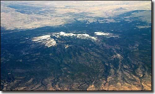
The Santa Teresa Mountains are a mountain range located within the Coronado National Forest and partly within the San Carlos Apache Indian Reservation, in western Graham County, Arizona. The highpoint of the range located in the Coronado National Forest section is 7,481 ft (2,280 m), however the high point of the entire range is Mt. Turnbull at 8,282 ft (2,524 m) elevation and is located on the reservation. Hiking or recreational activity in the San Carlos Indian Reservation section of the mountain range may require special permission and/or a permit at the cost of a small fee.
The Santa Teresa Wilderness area is in the range. It is attached north with the North Santa Teresa Wilderness.
Black Rock
Black Rock is an important landmark, in the eastern region of the range. It is important in the heritage of Native Americans.