
Topo map USGS Mount Hopkins Prominence 436 m | Elevation 2,617 m | |
 | ||
Similar Carr Peak, Miller Peak, Mount Glenn, Chiricahua Peak, Mount Wrightson | ||
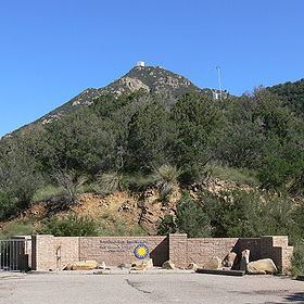
Mount Hopkins is a 8,553 feet (2,607 m) peak of the Santa Rita Mountains range, in Santa Cruz County, southern Arizona.
Contents
Map of Mt Hopkins, Arizona 85624, USA
The peak was named after Gilbert Hopkins, who was killed nearby during the Battle of Fort Buchanan in 1865.
It is in the Coronado National Forest and is bounded on three sides by the Mount Wrightson Wilderness.
Fred Lawrence Whipple ObservatoryEdit
The Fred Lawrence Whipple Observatory is located on the mountain. The prime mover for the mountain's observatory was Fred Whipple, a professor at Harvard University who was in charge of a small 25 inch mirror telescope in Cambridge, Massachusetts. In Cambridge the ambient light caused light pollution that limited the telescope's usefulness.
That led to engineer Tom Hoffman being appointed by Whipple to search for a site in the U.S. that would provide a clear view of the sky at a high elevation, with minimal surrounding light pollution. After searching many locations, southern Arizona with its dry air and high elevations, and the assistance of The University of Arizona, brought Hoffman to focus on Mt Hopkins. Whipple agreed, leaving the challenge of how to transport an 8 metres (26 ft) diameter glass mirror and build a telescope on an 8,583-foot (2,616 m) mountain that had no road.