
Elevation 7,221 ft (2,201 m) | Country United States | |
 | ||
Similar Sonoita Creek, Patagonia Lake State Park, Patagonia‑Sonoita Creek Preserve, Whetstone Mountains, Pajarito Mountains | ||
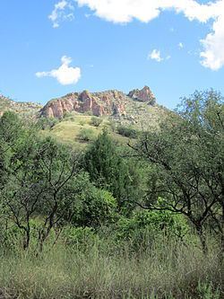
The Patagonia Mountains are a 15 miles (24 km) long mountain range within the Coronado National Forest, and in Santa Cruz County, Arizona.
Contents
Map of Patagonia Mountains, Arizona 85624, USA
Geography
The Santa Rita Mountains lie to the north across the Sonoita Valley. Both the Patagonias and the Santa Ritas are east of the Santa Cruz River Valley. Arizona State Route 82 winds through the Sonoita Valley along Sonoita Creek which flows between the Santa Ritas and the Patagonias. Patagonia Lake and the town of Patagonia are located in the Sonoita Valley.
The Sierra San Antonio are a continuation of the Patagonia Mountains southwards into Mexico, a mountain range of about 10 miles that tapers down to lower elevations.
The old mining camps and ghost towns of Mowry, Washington Camp, Harshaw, and Duquesne are located in the Patagonia Mountains.
Nogales, Arizona, and Nogales, Sonora, are in the valley to the southwest of the mountain range. The San Rafael Valley and Canelo Hills are to the east of the Patagonia Mountains.
Ecology
The connected Santa Rita, Patagonia, and Sierra San Antonio ranges are part of the Madrean Sky Islands ecoregion, the sky island mountain ranges region on the north of the Sierra Madre Occidental, the major cordillera and mountain ecoregion of central-western and northwestern Mexico.