
Incorporated 1848 Elevation 61 m Population 55,717 (2013) | State Massachusetts Settled 1640 Local time Saturday 4:08 PM | |
 | ||
Weather -5°C, Wind N at 34 km/h, 18% Humidity | ||
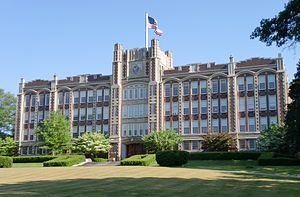
Hampton inn chicopee springfield chicopee massachusetts
Chicopee (/ˈtʃɪkəpi/ CHIK-ə-pee) is a city located on the Connecticut River in Hampden County, Massachusetts, United States of America. It is part of the Springfield, Massachusetts Metropolitan Statistical Area. As of the 2010 census, the city had a population of 55,298, making it the second largest city in Western Massachusetts after Springfield. The current mayor is Richard Kos.
Contents
- Hampton inn chicopee springfield chicopee massachusetts
- Map of Chicopee MA USA
- Name
- Nayasett Cabotville and Chicopee Falls
- Bicycles
- Willimansett
- Fairview
- Aldenville
- Partition from Springfield and modern history
- Geography
- Events
- Sites
- Economy
- Demographics
- College of Our Lady of the Elms
- Public schools K 12
- Private elementary
- Private secondary
- Notable people
- References
Map of Chicopee, MA, USA
Chicopee uses the nickname “Crossroads of New England” as part of a business-development marketing campaign. The name reflects the city's convenient location amongst a number of metropolitan areas and its transportation network. Four highways run through its boundaries: I-90, I-91, I-291, and I-391. State routes such as Route 33, 116, and 141, are major providers of regional linkage.
The communities of Chicopee Center (Cabotville), Chicopee Falls, Willimansett, Fairview, Smith Highlands, Aldenville, Burnett Road, and Westover are located in the city.
Name
The city is named after the Chicopee River, whose mouth empties into the Connecticut River on in its boundaries. "Chicopee" is a Nipmuc word, probably from chekee ("violent") and pe ("waters") in most Algonquian dialects, with reference to rapids. The Nipmucs were the indigenous people of the lands that today make up the City of Chicopee, prior to the arrival of European colonists.
Alternatively, chikkuppee ("of cedar") is the adjective form of chickkup ("cedar").
Nayasett (Cabotville and Chicopee Falls)
In 1636, William Pynchon purchased land from the Agawam Indians on the east side of the Connecticut River and moved from Roxbury to Springfield to found the first settlement in the area that comprises the territory of today's Chicopee Center (Cabotville). Both Cabotville and the Falls began as manufacturing centers (villages).
According to local historian Charles J. Seaver, the area above the falls was first settled in 1660. The land purchased from the Indians was divided into districts. Nayasett (Nipmuc for "at the small point/angle") was the name given to Chicopee Center and Chicopee Falls. The settlement in the upper district was at Skipmuck (possibly based on Nipmuc "Skipmaug," meaning "chief fishing place" or "Shipmuck," meaning "big watery place"), a place above the falls on the south side of the river.
A sawmill was the first river industry. The mill was built at Skenungonuck (Nipmuc for "green fields") Falls (now Chicopee Falls) in 1678 by Japhet Chapin, John Hitchcock and Nathaniel Foote. The mill was the first industrial site in Chicopee Falls. The saga of Factory Village really begins in the year 1786, when the property comprising two acres of land was leased to 10 local men with the understanding that they would build an iron foundry within two years. This was accomplished and the business flourished.
In 1823, Jonathan Dwight purchased the water privilege at Skenungonuck Falls in Chicopee. Five years later the textile mill had 14,000 spindles and nearly 500 looms, making it the second-largest operation in the state. By 1831, there were two giant dams, two waterpower canals and two manufacturing communities on the Chicopee River.
In 1848, Chicopee - which, for over two centuries had been a part of Springfield - was partitioned off into its own town. Political factions in Springfield wanted Springfield to remain a town, rather than become a city and take on a mayoral form of government. By partitioning off Chicopee, those political factions prevented Springfield from becoming a city for four years - Springfield was chartered as a city in 1852; however, Springfield lost 2/5 of its land area and nearly half of its population when Chicopee was created.
Before and after the partition, eight Chicopee River companies gained product recognition around the globe: Ames, Belcher, Lamb, Dwight, Stevens, Spalding, Fisk, and Duryea. Below the falls in the bend of the river at a place called Factory Village, an important chapter of the region's industrial history was played out.
Bicycles
During the late Nineteenth Century, Chicopee Falls became a major manufacturing center of bicycles. The town was the site of at least two bicycle factories: The Overman Wheel Company (1882 to about 1899), and the Spalding sporting goods company.
Albert H. Overman moved his bicycle production from Hartford to Chicopee Falls in 1883. The Overman company benefited the surging popularity of the safety bicycle during the bicycle boom of the 1890s. At its height in 1894 Overman's factory employed over 1,200 workers. The boom eventually went bust, as overproduction drove the price of bicycles down. By 1901 the Overman firm was out of business.
Chicopee adopted the motto "Industriae Variae", which means "Various Industries". Chicopee was home to many types of industries which include cotton mills, woolen mills, textiles, brass foundries and iron foundries, paper making, leather products like boots and shoes, the first lucifer matches, and ship building for the nearby South Hadley Canal, firearms company Crescent-Davis, which specialized in double barrel shotguns.
The Ames Manufacturing Company made many machines and bronze cannons, and more swords than any other American manufacturer at the time. Ames cast Thomas Ball's monumental bronze equestrian statue of George Washington, installed in Boston's Public Garden. The Stevens Arms plant (later Savage) was responsible for most of the Number 4 Enfields manufactured for the British under Lend-Lease. Chicopee was home to production of the first gasoline-powered automobile made in the United States, the Duryea.
Chicopee was the first city west of Boston to form a publicly funded public library. The Chicopee Public Library was formed by a donation to the city by the Cabotville Institute.
Willimansett
In 1641, Willian Pynchon expanded his 1636 holdings by buying the land from the Chicopee River north to the Willimansett (Nipmuc for "good berries place" or "place of red earth") Brook. Land sales in Chicopee were recorded in 1659, but apparently no homes were built immediately.
Winthrop McKinstry writes that the sons of Deacon Samuel Chapin appear to be the first home builders. Henry Chapin is believed to have constructed his at Exchange and West streets (lower Chicopee) in 1664, and Japhet Chapin north of what is now known as James Ferry Road (upper Chicopee) in 1673. It is apparent from McKinstry's book that the Chapin family dominated the area north of the Chicopee River for the settlement's first 70 years. Chicopee Street was part of the First Parish in Springfield.
By the 1750s, Quabbin Road (now McKinstry Avenue) allowed the farmers to access the meadows and fields on the plains at the top of the hill. The Chapins used the land in common for grazing livestock and built ice houses near several large ponds. The ponds were drained by several brooks which flowed into the Connecticut River.
At the end of the 19th century, the city voted to build the Willimansett Bridge, connecting Willimansett with Holyoke. The results were profound. Willimansett and Aldenville would develop close ties to Holyoke; even postal and telephone service were (and still are) tied to the "Paper City." The legislative act ordering the building of the bridge was passed in 1892. L.L. Johnson reports that the completion of the bridge was grandly celebrated.
By the 20th century, Willimansett village had developed into quintessential Americana with a high percentage of French Canadian inhabitants. In total, Chicopee became four distinct commercial and political sub-divisions, each with its own ethnic makeup representing its own special interests and, much too frequently, in conflict with each other.
Located between Fairview and Willimansett, the Smith Highlands section once had its own school (first and second grades), Holyoke Street Railway bus service from Ingham Street across Irene, Factory, and Prospect streets, and two locally owned markets. The former Robert's Pond swimming area was a popular summer attraction, and the fields where the current Bellamy Junior High School is located were a popular sledding and skiing location winters.
Fairview
Fairview is the northern-most neighborhood (village) in Chicopee and originally included the lands that are now part of Westover ARB. Primarily agricultural, Fairview was known for its tobacco farms. After 1939, Westover helped to rapidly develop the village into a residential and commercial district. Memorial Drive (Route 33) flows North-South connecting Chicopee Falls with South Hadley.
Aldenville
On August 18, 1870, Edward Monroe Alden purchased 600 acres of land just east of Willimansett for the sum of $9,000 with the intent to create a "little city on the hill," which would become Aldenville. In 1890, he began laying out streets which he named for family members and divided the land up into 60-by-170 feet lots. French-Canadian factory workers from Chicopee Falls, Cabotville (Chicopee Center), and Holyoke began to build up the community. Sold for a selling price of $150 with $10 down, the first house was bought and built by French-Canadian builder and carpenter Marcellin Croteau.
Partition from Springfield and modern history
The villages of Cabotville, Chicopee Falls, Willimansett, and Fairview (and the lands that would become Aldenville) remained a part of Springfield, Massachusetts from 1636 until 1848, when they were partitioned to form the Town of Chicopee. Political factions in Springfield had wished to keep Springfield a "town," instead of becoming a "city," which would give it a mayoral form of government. To keep Springfield sufficiently unpopulated to subvert a state regulation that would have required it to become a city, they partitioned Chicopee, which contained approximately 2/5 of Springfield's land area, and nearly half of its population.
Regardless of the partition, Springfield became a city only four years after the partition of Chicopee. Both cities continued to flourish for over a century after the partition.
On April 18, 1890, the community was granted a charter as a city by the Massachusetts General Court. George Sylvester Taylor (1822–1910) became Chicopee's first mayor on January 5, 1891.
Westover Field was created by a war-readiness appropriation signed by president Franklin D. Roosevelt in 1939. The site used to be tobacco crop fields east of and part of Fairview, east of Aldenview, and northern Willimansett. It was assigned to the United States Army Air Corps Northeast Air District. It was renamed Westover Air Force Base in 1948 after that Air Force's creation as a separate service. In 1974 SAC leadership turned the base over to the Air Force Reserve.
In 1991, St. Stanislaus Bishop and Martyr Church, located on Front Street, was proclaimed a minor basilica by Pope John Paul II.
Geography
Chicopee is located at 42°10′13″N 72°35′19″W (42.170159, -72.588630).
The city is made up of several neighborhoods; the result of the city's origin as a collection of four villages in the northernmost part of Springfield, which seceded from it in 1848. Chicopee Falls, Chicopee Center (Cabotville), Fairview, and Willimansett continued to develop. In the early 1900s, Aldenville developed as a distinct community. Since then, the city has filled in most of its open space resulting in a number of new neighborhoods. These neighborhoods include Chicomansett, Ferry Lane, Sandy Hill and the geographically isolated Burnett Road neighborhood.
The city is bordered by Holyoke to the northwest, West Springfield to the southwest, Springfield to the south, Ludlow to the east, Granby to the northeast and South Hadley to the north. Chicopee is located 29 miles (47 km) away from Hartford, 89 miles (143 km) away from Boston, 90 miles (140 km) from Albany and 140 miles (230 km) from New York City.
According to the United States Census Bureau, the city has a total area of 23.9 square miles (62 km2), of which 22.9 square miles (59 km2) is land and 1.0 square mile (2.6 km2) (4.31%) is water. The Chicopee River flows through the south part of the city, emptying into the Connecticut River. Many ponds, lakes, and streams are part of the Chicopee River or Connecticut River watersheds.
Willimansett, and portions of the Center and Falls are on low land, with Aldenville, Fairview, Westover, and the Burnett Road neighborhoods on an elevated plateau. At 288 feet, the highest elevation in the city is on Old Lyman Road, in the Fairview section.
Events
Sites
Economy
Chicopee is mostly a service economy with a mixture of small, local businesses and national chains. Reflecting the city's history, many business are Polish-American and include the Chicopee Provision Company, a major producer of Polish sausage kielbasa under the Blue Seal brand, and Millie's Pierogi, a producer of traditional Polish dumplings called pierogi.
Chicopee is the home base of Buxton Co., LLC, which "designs, manufactures, and markets personal leather goods, travel kits, and gifts collections for men and women." Founded as L.A.W. Novelty Co. in 1898, the firm changed its name to Buxton Co., LLC in 1921.
Chicopee is also home to Alden Credit Union, The Polish National Credit Union and Chicopee Savings Bank. Chicopee Savings Bank is run by Chicopee Bancorp, which operates trades as CBNK on the NASDAQ exchange.
The Chicopee River Business Park and Westover Business Park are within the city's boundaries.
Demographics
As of the census of 2000, there were 54,653 people, 23,117 households, and 14,147 families residing in the city. The population density was 2,389.7 people per square mile (922.7/km²). There were 24,424 housing units at an average density of 1,067.9 per square mile (412.3/km²). The racial makeup of the city was 89.82% White, 2.28% African American, 0.20% Native American, 0.87% Asian, 0.10% Pacific Islander, 4.90% from other races, and 1.84% from two or more races. Hispanic or Latino of any race were 8.76% of the population (12.8% Puerto Rican, 0.5% Dominican, 0.4% Mexican, 0.2% Colombian). Chicopee is the second largest municipality in Western Massachusetts, after Springfield (defining Western Massachusetts as Hampden, Hampshire, Franklin, and Berkshire counties).
There were 23,117 households out of which 26.5% had children under the age of 18 living with them, 42.6% were married couples living together, 14.2% had a female householder with no husband present, and 38.8% were non-families. 32.7% of all households were made up of individuals and 14.1% had someone living alone who was 65 years of age or older. The average household size was 2.32 and the average family size was 2.96.
In the city, the population was spread out with 22.6% under the age of 18, 8.5% from 18 to 24, 28.8% from 25 to 44, 22.5% from 45 to 64, and 17.6% who were 65 years of age or older. The median age was 39 years. For every 100 females there were 90.7 males. For every 100 females age 18 and over, there were 87.1 males.
The median income for a household in the city was $35,672, and the median income for a family was $44,136. Males had a median income of $35,585 versus $25,975 for females. The per capita income for the city was $18,646. About 9.6% of families and 12.3% of the population were below the poverty line, including 19.5% of those under age 18 and 9.3% of those age 65 or over.
College of Our Lady of the Elms
The College of Our Lady of the Elms is a four-year liberal arts college offering thirty-three academic majors. It was first founded in 1897 as a girls' preparatory academy in Pittsfield, the Academy of Our Lady of the Elms. In 1899, it moved to Chicopee as St. Joseph's Normal College. A charter for the school to operate as a women's liberal arts college was approved in 1928, and the name was changed to the College of Our Lady of the Elms. It began admitting men in 1998.
Public schools (K-12)
The City of Chicopee operates fifteen public schools within the Chicopee School District, serving 7800 students. Richard W. Rege is the superintendent. There are nine elementary schools, two middle schools, one early childhood center, and three high schools (Chicopee High School, Chicopee Comprehensive High School and Chicopee Academy).
Private elementary
Chicopee has a multitude of Catholic schools that are operated under the Diocese of Springfield. These schools include: Saint Joan of Arc School which serves Saint Rose de Lima Church on Grattan Street; and Saint Stanislaus School which serves the St. Stanislaus Bishop & Martyr's Parish Bishop and Martyr on Front Street.
Within the past decade, a number of private elementary schools and their associated parishes have closed. These include Assumption School which served the former Assumption of the Blessed Virgin Mary parish, Saint Patrick's School which served the former Saint Patrick's parish (closure of this parish is currently in dispute), Holy Name School which served Holy Name of Jesus parish, Mount Carmel School which served the Nativity of the Blessed Virgin Mary parish, and Saint George School which served Saint George's parish that merged with Saint Rose de Lima / Saint Joan of Arc School.
Private secondary
Holyoke Catholic High School was founded in 1963 at the campus of the former Saint Jerome High School in Holyoke. In 2002 it relocated to the campus of Saint Hyacinth Seminary in Granby. It moved to its current location in September 2008.