
Website www.hampshirecog.org Founded 1662 | Area 1,412 km² Population 159,596 (2013) | |
 | ||
Colleges and Universities Points of interest Eric Carle Museum of Picture B, Emily Dickinson Museum, Norwottuck Branch Rail Trail, Smith College Museum, J A Skinner State Park | ||
Hampshire County is a historical and judicial county located in the U.S. state of Massachusetts. It has no county government. Instead there is a Hampshire Council of Governments. As of the 2010 census, the population was 158,080. Its most populous municipality is Amherst, and its county seat is Northampton. The county is named after the county Hampshire, in England.
Contents
- Map of Hampshire County MA USA
- History
- Geography
- Adjacent counties
- 2000 census
- 2010 census
- Income
- Education
- Cities
- Former towns
- References
Map of Hampshire County, MA, USA
Hampshire County is part of the Springfield, MA Metropolitan Statistical Area.
History
Hampshire County was constituted in 1662 from previously unorganized territory comprising the entire western part of Massachusetts Bay Colony. It included the original towns of Springfield, Northampton, and Hadley. The original Hampshire County included territory that is now in modern-day Hampden County, Franklin County, and Berkshire County, as well as small parts of modern-day Worcester County. By 1683, three new towns (Westfield (now Southwick), Suffield, and Enfield) had been incorporated south of Springfield. These towns were partly or wholly in the modern state of Connecticut at the time of their incorporation and resulted in a border dispute between the Connecticut Colony and Massachusetts Bay Colony.
In 1731, Worcester County was created, which included the original town of Brookfield (incorporated in 1718 as part of Hampshire County). More territory was lost to Worcester County in 1742 when the town of Western (now Warren) was created and added to Worcester County. Further territorial losses occurred in 1749 when the towns of Enfield, Somers (split off from Enfield in 1734), and Suffield unilaterally joined Connecticut Colony. In 1761, Berkshire County was created resulting in even more territorial loss for Hampshire County. In 1811, Franklin County was split off from the northern part of Hampshire, and in the following year, Hampden County was split off from the southern part of Hampshire.
Like a number of Massachusetts counties, Hampshire County exists today both as a historical geographic region and a judicial district; it has no county government. Many former county functions were assumed by state agencies in 1999. The sheriff and some other regional officials with specific duties are still elected county-wide to perform duties within the region. The Hampshire Council of Governments, with elected councilors from 15 towns, provides many regional services, though otherwise there is no county council or commissioners. Together with Hampden County, Hampshire County municipalities belong to the Pioneer Valley Planning Commission.
Geography
According to the U.S. Census Bureau, the county has a total area of 545 square miles (1,410 km2), of which 527 square miles (1,360 km2) is land and 18 square miles (47 km2) (3.3%) is water.
Hampshire County is the middle section of the Pioneer Valley, and the northern tip of the Hartford-Springfield Knowledge Corridor.
Adjacent counties
Hampshire County is the only county in Massachusetts surrounded in all directions by other counties of Massachusetts: all other counties in the state are adjacent to at least one other state or the open ocean.
2000 census
As of the census of 2000, there were 152,251 people, 55,991 households, and 33,818 families residing in the county. The population density was 288 people per square mile (111/km²). There were 58,644 housing units at an average density of 111 per square mile (43/km²). The racial makeup of the county was 91.10% White, 1.96% Black or African American, 0.19% Native American, 3.40% Asian, 0.05% Pacific Islander, 1.50% from other races, and 1.80% from two or more races. 3.42% of the population were Hispanic or Latino of any race. 14.7% were of Irish, 12.8% Polish, 9.6% English, 9.5% French, 8.5% French Canadian, 6.9% Italian and 6.4% German ancestry according to Census 2000. 88.8% spoke English, 3.4% Spanish, 1.7% French and 1.4% Polish as their first language.
There were 55,991 households out of which 28.20% had children under the age of 18 living with them, 47.40% were married couples living together, 9.80% had a female householder with no husband present, and 39.60% were non-families. 28.60% of all households were made up of individuals and 10.20% had someone living alone who was 65 years of age or older. The average household size was 2.39 and the average family size was 2.96.
In the county, the population was spread out with 19.60% under the age of 18, 19.30% from 18 to 24, 26.80% from 25 to 44, 22.20% from 45 to 64, and 12.00% who were 65 years of age or older. The median age was 34 years. For every 100 females there were 87.40 males. For every 100 females age 18 and over, there were 83.90 males.
The median income for a household in the county was $46,098, and the median income for a family was $57,480. Males had a median income of $39,327 versus $30,362 for females. The per capita income for the county was $21,685. About 5.10% of families and 9.40% of the population were below the poverty line, including 8.20% of those under age 18 and 6.70% of those age 65 or over.
2010 census
As of the 2010 United States Census, there were 158,080 people, 58,702 households, and 34,480 families residing in the county. The population density was 299.8 inhabitants per square mile (115.8/km2). There were 62,603 housing units at an average density of 118.7 per square mile (45.8/km2). The racial makeup of the county was 88.7% white, 4.5% Asian, 2.5% black or African American, 0.2% American Indian, 1.5% from other races, and 2.5% from two or more races. Those of Hispanic or Latino origin made up 4.7% of the population. In terms of ancestry, 22.2% were Irish, 14.4% were French, 14.3% were Polish, 14.2% were English, 10.8% were German, 9.1% were Italian, 7.1% were French Canadian, and 2.6% were American.
Of the 58,702 households, 26.4% had children under the age of 18 living with them, 44.8% were married couples living together, 10.3% had a female householder with no husband present, 41.3% were non-families, and 29.7% of all households were made up of individuals. The average household size was 2.34 and the average family size was 2.89. The median age was 36.6 years.
The median income for a household in the county was $59,505 and the median income for a family was $80,891. Males had a median income of $52,686 versus $43,219 for females. The per capita income for the county was $28,367. About 6.2% of families and 11.7% of the population were below the poverty line, including 11.8% of those under age 18 and 7.8% of those age 65 or over.
Income
The ranking of unincorporated communities that are included on the list are reflective if the census designated locations and villages were included as cities or towns. Data is from the 2007-2011 American Community Survey 5-Year Estimates.
Education
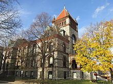
Hampshire County is notable for the presence within its borders of the "Five Colleges", comprising the University of Massachusetts flagship campus and four well-known private colleges:
A consortium, Five Colleges, Inc., provides easy course cross-registration and free bus service between the campuses.
Cities
Former towns
The following towns were disincorporated for the creation of the Quabbin Reservoir.