
Existed: c. 1946 – present Length 8.92 km | Constructed 1946 | |
 | ||
Counties | ||
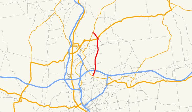
Route 33 is a state highway contained entirely within the city of Chicopee and the town of South Hadley in Massachusetts.
Contents
Map of MA-33, Chicopee, MA, USA
Route description
Route 33 begins at Route 141 just north of the Chicopee River in the Chicopee Falls section of the city. It crosses under the Massachusetts Turnpike, with the entrance ramps for Exit 5 just north of this. It passes west of Westover Joint Air Reserve Base before entering the town of South Hadley. Once in South Hadley, the road crosses U.S. Route 202, which leads westward towards Holyoke, as it turns northeast, ending at Route 116, the street itself continuing as Lyman Street.
References
Massachusetts Route 33 Wikipedia(Text) CC BY-SA