
Length 209.5 km | ||
 | ||
Major cities | ||
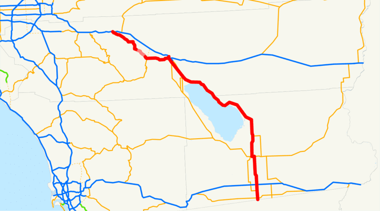
State Route 111 (SR 111) is a state highway in the U.S. state of California. It is the main north/south state highway and retail corridor through the Coachella Valley, a part of the Colorado Desert in the southeastern corner of the state and famous as a resort destination. It runs from the U.S.-Mexico border crossing in Calexico to Interstate 10 at White Water.
Contents
Map of CA-111, California, USA
Route description
This route is part of the California Freeway and Expressway System and is eligible for the State Scenic Highway System. However, this route is not designated by Caltrans as a scenic highway.
Highway 111 links virtually every desert resort city in the valley. It begins in Calexico at the international border where it meets with Calle Christobal Colon in Mexicali. State Route 111 (Imperial Ave) Begins before it intersects with SR 98. It then intersects with SR 86 in Heber. As Route 111 continues north through Imperial County, it enters El Centro, intersecting with I-8, which runs east to Yuma and west to San Diego before passing through the agricultural communities of Holtville, Brawley, Calipatria and Niland.
A nearly 40 mile (64 km) length of the highway dotted with date and citrus groves follows both the old Southern Pacific "Sunset Route" (now the main Union Pacific line between Los Angeles and Yuma, Arizona) and the eastern shore of the Salton Sea. Though some small settlements and a California state park line the shore, the area is eerily empty due to the sea's rapidly declining water quality. The small town of North Shore is all but abandoned as a tourist destination, though more than 3,400 residents were counted at the 2010 census.
SR 111 enters the southeast corner of the Coachella Valley as a two-lane highway. It used to run concurrently with SR 86 in Coachella but that is no longer the case since SR 86 has been moved over to the newer SR 86S expressway, which was then renamed SR 86. SR 111 continues northwest as a major arterial road, four lanes or wider, through Indio, La Quinta, Indian Wells, Palm Desert, Rancho Mirage, and Cathedral City. As it approaches this area, the northbound traffic is on Indian Canyon Rd., and the southbound is on Palm Canyon Rd. An alternate Route runs on Gene Autry Trail while then it continues west on Vista Chino Dr. Continuing west from Cathedral City, the highway enters Palm Springs, then swings north and then west to bypass downtown, while SR 111 Business passes through the congested downtown area. The highway widens from an arterial road to a divided expressway as it exits Palm Springs just northwest of San Rafael Drive. It ends at an interchange with Interstate 10 near the foot of San Jacinto Peak, just east of the San Gorgonio Pass.
History
SR 111 was first proposed in the early 1930s due to the area's growth bought on by the Southern Pacific Railroad.
A 1993 rerouting of the highway takes drivers away from the historic center of Palm Springs, but meets with its original alignment as Business Route 111 a few miles further south.
The northern terminus was so busy in the 1950s before the construction of the freeway that visitors returning home to Los Angeles might have waited as long as two hours to make the left turn on the two-lane road that was once multiplexed as US Highways 60, 70 and 99.
In 1995, Caltrans was allowed to relinquish any portion of Route 111 through a city for that city to maintain. The legislature opted to make the act an "urgency statute", effective immediately, so that the local governments could improve traffic bottlenecks along the route as soon as possible. The legislative definition of the route was amended in 1996 to exclude the portions in Rancho Mirage and Cathedral City, which had both been relinquished. Cathedral City completed a pedestrian-friendly redesign in 1998. The stretch through Rancho Mirage has the Coachella Valley's only synchronized traffic lights; they are set to 45 mph (70 km/h).
A 2003 law did not change the route, but clarified that the former highway through those cities could not be taken back by the state, and repealed the section added in 1995 allowing relinquisment to any city. Subsequently, in 2005, the legislature allowed relinquishment within Indian Wells, Indio, and Palm Desert, subject to the same conditions, and to the condition that the cities must maintain signs for the route. La Quinta was added to the list of eligible cities in 2007. As of late 2007, none of these four cities have taken over maintenance of Route 111.
In November 2005, signs on Verbenia Avenue at the highway's northern terminus and along Interstate 10 were replaced to reflect the street's name change to "Haugen-Lehmann Way", honoring two Riverside County sheriff's deputies gunned down by a sniper on that street in 1997.
In a similar move in December 2005, the stretch of SR111 through La Quinta was named the "Deputy Bruce Lee Memorial Highway". Lee was a Riverside County deputy sheriff in the city for many years and was killed in 2003 during an altercation with a mentally disturbed suspect. The suspect was able to take Lee's baton during the altercation and used it to bludgeon the officer.
Major intersections
Except where prefixed with a letter, postmiles were measured on the road as it was in 1964, based on the alignment that existed at the time, and do not necessarily reflect current mileage. R reflects a realignment in the route since then, M indicates a second realignment, L refers an overlap due to a correction or change, and T indicates postmiles classified as temporary (for a full list of prefixes, see the list of postmile definitions). Segments that remain unconstructed or have been relinquished to local control may be omitted. The numbers reset at county lines; the start and end postmiles in each county are given in the county column.