
Country United States FIPS code 06-08058 Elevation -34 m Zip code 92227 Area code Area codes 442 and 760 | State California Incorporated April 6, 1908 Area 19.9 km² Local time Thursday 12:34 PM Population 25,558 (2013) | |
 | ||
Weather 23°C, Wind N at 18 km/h, 17% Humidity | ||
7 2 magnitude easter earthquake in brawley california
Brawley (formerly, Braly) is a city in the Imperial Valley and within Imperial County, southern California, United States.
Contents
- 7 2 magnitude easter earthquake in brawley california
- Map of Brawley CA 92227 USA
- Geography
- History
- Climate
- 2010
- 2000
- Government
- Public safety
- Education
- Economy
- Notable people
- References
Map of Brawley, CA 92227, USA
The population was 24,953 at the 2010 census, up from 22,052 in 2000. The town has a significant cattle and feed industry, and hosts the annual Cattle Call Rodeo. Year-round agriculture is an important economic activity in Brawley. Summer daytime temperatures often exceed 105 °F (41 °C).
Geography
Brawley is located in the Colorado Desert and Lower Colorado River Valley regions. The city's elevation, like other Imperial Valley towns, is below sea level.
It is 13 miles (21 km) north of El Centro, about 70 miles west of Yuma, Arizona, 95 miles southeast of Palm Springs and 130 miles east of San Diego.
According to the United States Census Bureau, Brawley has a total area of 7.7 square miles (20 km2). All is land within the city limits, except for the Alamo River and New River that seasonally flow through the city. The New River has been reported as the most polluted river in North America.
History
The Imperial Land Company laid out the town in 1902 and named it Braly in honor of J.H. Braly, who owned the land. After Braly refused to permit the use of his name, the name was changed to Brawley. The first post office at Brawley opened in 1903.
Incorporated in 1908, it was a "tent city" of only 100 persons involved in railroads and the earliest introduction of agriculture. It had a population of 11,922 in 1950, but population growth was slow from the 1960s to the early 1990s.
Climate
Average January temperatures in Brawley are a high of 69.4 °F (20.8 °C) and a low of 38.9 °F (3.8 °C). Average July temperatures are a high of 107.6 °F (42.0 °C) and a low of 75.2 °F (24.0 °C). On average, 173.0 days of the year have highs of 90 °F (32 °C) or higher. The record high temperature was 122 °F (50 °C) on July 1, 1950, and the record low temperature was 4 °F (−16 °C) on January 1, 1919.
Average annual precipitation is 2.65 inches (6.7 cm) with an average of 13 days with measurable precipitation. The wettest year was 1939 with 8.18 inches (20.8 cm). There have been no years when no measurable precipitation fell in Brawley. The most rainfall in one month was 6.75 inches (17.1 cm) in September 1939. The most rainfall in 24 hours was 3.90 inches (9.9 cm) on October 10, 1932. A rare snowfall in December 1932 brought a total of 3.0 inches (7.6 cm).
2010
The 2010 United States Census reported that Brawley had a population of 24,953. The population density was 3,248.4 people per square mile (1,254.2/km²). The racial makeup of Brawley was 13,570 (54.4%) White, 510 (2.0%) African American, 241 (1.0%) Native American, 349 (1.4%) Asian, 32 (0.1%) Pacific Islander, 9,258 (37.1%) from other races, and 993 (4.0%) from two or more races. Hispanic or Latino of any race were 20,344 persons (81.5%).
The Census reported that 24,779 people (99.3% of the population) lived in households, 63 (0.3%) lived in non-institutionalized group quarters, and 111 (0.4%) were institutionalized.
There were 7,623 households, out of which 3,827 (50.2%) had children under the age of 18 living in them, 3,932 (51.6%) were opposite-sex married couples living together, 1,560 (20.5%) had a female householder with no husband present, 543 (7.1%) had a male householder with no wife present. There were 589 (7.7%) unmarried opposite-sex partnerships, and 23 (0.3%) same-sex married couples or partnerships. 1,346 households (17.7%) were made up of individuals and 550 (7.2%) had someone living alone who was 65 years of age or older. The average household size was 3.25. There were 6,035 families (79.2% of all households); the average family size was 3.67.
The population was spread out with 8,138 people (32.6%) under the age of 18, 2,670 people (10.7%) aged 18 to 24, 6,065 people (24.3%) aged 25 to 44, 5,572 people (22.3%) aged 45 to 64, and 2,508 people (10.1%) who were 65 years of age or older. The median age was 30.2 years. For every 100 females there were 94.3 males. For every 100 females age 18 and over, there were 90.2 males.
There were 8,231 housing units at an average density of 1,071.5 per square mile (413.7/km²), of which 3,970 (52.1%) were owner-occupied, and 3,653 (47.9%) were occupied by renters. The homeowner vacancy rate was 2.0%; the rental vacancy rate was 8.0%. 12,950 people (51.9% of the population) lived in owner-occupied housing units and 11,829 people (47.4%) lived in rental housing units.
2000
As of the census of 2000, there were 22,052 people, 6,631 households, and 5,265 families residing in the city. The population density was 3,783.0 people per square mile (1,460.4/km²). There were 7,038 housing units at an average density of 1,207.4 per square mile (466.1/km²). The racial makeup of the city was 52.8% White, 2.5% Black or African American, 1.1% Native American, 1.3% Asian, 0.2% Pacific Islander, 37.9% from other races, and 4.3% from two or more races. 73.8% of the population were Hispanic or Latino of any race.
There were 6,631 households out of which 48.0% had children under the age of 18 living with them, 56.0% were married couples living together, 17.5% had a female householder with no husband present, and 20.6% were non-families. 17.1% of all households were made up of individuals and 7.1% had someone living alone who was 65 years of age or older. The average household size was 3.3 and the average family size was 3.7.
In the city, the population was spread out with 34.5% under the age of 18, 9.6% from 18 to 24, 28.2% from 25 to 44, 18.1% from 45 to 64, and 9.6% who were 65 years of age or older. The median age was 30 years. For every 100 females there were 96.9 males. For every 100 females age 18 and over, there were 92.5 males.
The median income for a household in the city was $31,277, and the median income for a family was $35,514. Males had a median income of $34,617 versus $25,064 for females. The per capita income for the city was $12,881. About 22.5% of families and 26.6% of the population were below the poverty line, including 34.0% of those under age 18 and 14.1% of those age 65 or over.
The majority of Brawley's residents today are of Mexican and Latino origins; the town contained White, East Indian, Chinese, Filipino and African American sections in the 20th century.
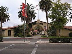
Government
In the California State Legislature, Brawley is in the 40th Senate District, represented by Democrat Ben Hueso, and the 56th Assembly District, represented by Democrat Eduardo Garcia.
In the United States House of Representatives, Brawley is in California's 51st congressional district, represented by Democrat Juan Vargas.
Brawley is in the 4th Imperial County Board of Supervisors District and is represented by Ryan Kelley.
Public safety
Brawley maintains its own police and fire departments.
Education
Economy
Major employers in Brawley include Pioneers Memorial Hospital, and Clinicas de Salud del Pueblo. Spreckels Sugar Company is located outside of Brawley.