
Type Highway | Length 85 km | |
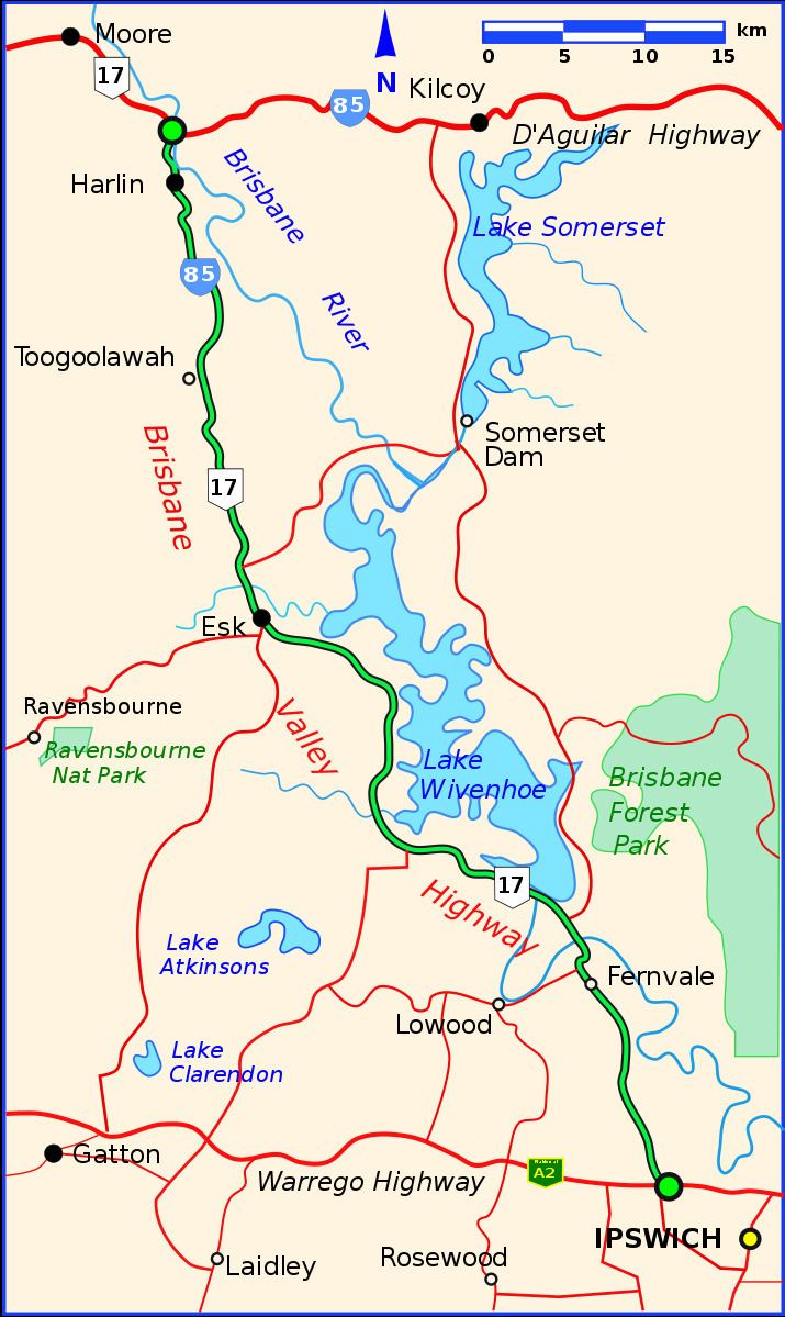 | ||
Major settlements Fernvale, Esk, Toogoolawah, Harlin | ||
Itb 100hd a trip from brisbane to tarong power station and back via brisbane valley highway
The Brisbane Valley Highway is a state highway in Queensland. It links the Warrego Highway near Ipswich and the D'Aguilar Highway about 4 kilometres (2 mi) north of Harlin. Its direction follows the approximate course of the Brisbane River. It is part of National Route 17, duplexing with the D'Aguilar Highway to Nanango and then becomes the Burnett Highway. State Route 85 is duplexed with the Brisbane Valley Highway from Esk to the D'Aguilar Highway.
Contents
- Itb 100hd a trip from brisbane to tarong power station and back via brisbane valley highway
- Map of Brisbane Valley Highway Queensland Australia
- List of towns along the Brisbane Valley Highway
- References
Map of Brisbane Valley Highway, Queensland, Australia
The highway crosses the Wivenhoe Dam about 9 kilometres (6 mi) north-west of Fernvale.
In the near future, the intersection with the Warrego Highway will be converted into a grade-separated interchange.
References
Brisbane Valley Highway Wikipedia(Text) CC BY-SA