
Population 315 (2011 census) Local time Saturday 10:34 PM | Postcode(s) 4306 County Cavendish Postal code 4306 | |
 | ||
Location 130 km (81 mi) NW of Brisbane33 km (21 mi) W of Kilcoy22 km (14 mi) E of Blackbutt Weather 24°C, Wind N at 8 km/h, 84% Humidity | ||
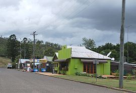
Moore is a town and locality in the Somerset Region in South East Queensland, Australia. Moore is 96 kilometres (60 mi) north-west of Brisbane. In the 2011 census, Moore and the surrounding area had a population of 315 people.
Contents
Map of Moore QLD 4306, Australia
Geography
Moore is situated at the base of the Balfour Range between Esk in the Brisbane River valley and Yarraman in the South Burnett. The Brisbane River passes through the locality from north to south passing to the east of the town centre. The D'Aguilar Highway runs from the south to the north-west of the locality. The western end of the locality is within the Benarkin State Forest.
In the town centre, there was a railway station on the Brisbane Valley railway line but that line is now closed.
History
The town was originally known as Stanley Gate and then as Mooretown. In July 1910 the town took the name of Moore from its railway station, which was named after John and William Moore, graziers of Colinton.
Moore Provisional School opened on 1 December 1904, becoming a state school in 1908. The school ceased operation on 31 December 2006 and was officially closed in December 2007. The school was sold for $77,000 in 2012.
Moore Post Office opened by September 1905 (a receiving office had been open from 1903).
Heritage listings
Moore has a number of heritage-listed sites, including: