
Type Highway Length 553 km | Formerroute number National Route 17 | |
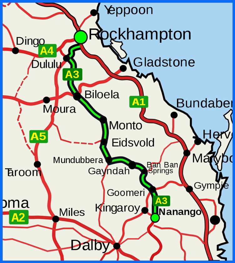 | ||
Route number(s) A3(Entire Route)Duplexes State Route 60(Biloela West - Biloela) State Route 49(Goomeri - Goomeri South) Major cities Major settlements Mount Morgan, Dululu, Biloela, Monto, Eidsvold, Mundubbera, Gayndah, Ban Ban Springs, Goomeri | ||
The Burnett Highway is an inland rural highway located in Queensland, Australia. The highway runs between its junction with the Bruce Highway just south of Rockhampton, and Nanango. Its length is approximately 542 kilometres. The highway takes its name from the Burnett River, which it crosses a number of times. The Burnett Highway provides the most direct link between the northern end of the New England Highway and Rockhampton. It is designated as a State Strategic Road by the Queensland Government.
Contents
Map of Burnett Hwy, Queensland, Australia
List of towns on the Burnett Highway
From north to south
History
In January 2013, Cyclone Oswald caused flood damage to the road and a partial closure, which took longer than a year to repair.
References
Burnett Highway Wikipedia(Text) CC BY-SA