
Population 534 (2011 census) Local time Friday 7:46 AM | Postcode(s) 4306 County Cavendish Postal code 4306 | |
 | ||
Weather 22°C, Wind W at 8 km/h, 91% Humidity | ||
Harlin is a small town in south east Queensland, Australia. The town is on the Brisbane Valley Highway and the Brisbane River, 131 kilometres (81 mi) north west of the state capital, Brisbane. At the 2011 census, Harlin and the surrounding area had a population of 534.
Contents
Map of Harlin QLD 4306, Australia
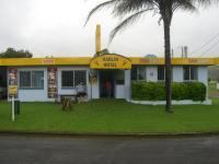
The town was marooned during the 2011 Floods. Over 40 travellers were stranded by the dangerous and rising flood waters of the Brisbane River and the Ivory and Maronghi Creeks. They were housed by the publicans and owners of the Harlin Hotel and the Caltex service station from 9 January 2011, until the flooded creeks and rivers subsided.
History
Harlin Post Office opened by September 1907 (a receiving office had been open from 1905) and closed in 1989.
Heritage listings
Harlin has a number of heritage-listed sites, including: