
Type Highway | Length 314 km | |
 | ||
Formerroute number (National Route A8/8) National Route M8 (1997-2014) National Route 8 (1955-1997)(Burrumbeet - Deer Park) | ||
The Western Highway is the Victorian part of the principal route linking the Australian cities of Melbourne and Adelaide with a length of approximately 314 kilometres (195 mi) of single carriageway then 156 kilometres (97 mi) of dual carriageway known as the Western Freeway. It is a part of the National Highway network and designated as National Highway A8 and M8. The western end continues in South Australia as the Dukes Highway, the next section of the Melbourne–Adelaide National Highway. The Western Freeway joins Melbourne's freeway network via the Western Ring Road, in the middle western suburbs of Melbourne.
Contents
- Map of Western Hwy Victoria Australia
- Route
- Timeline of duplication
- Deer Park Bypass
- Anthonys Cutting Realignment
- Armstrong deviation
- Future upgrades
- Towns
- References
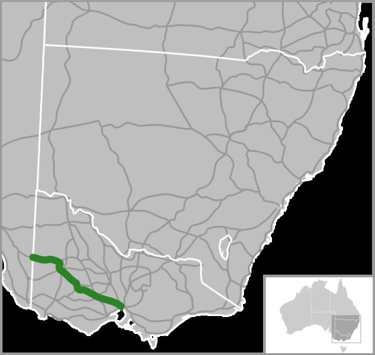
Map of Western Hwy, Victoria, Australia
The Western Highway is the second busiest national highway in Australia, in terms of freight movements, with over five million tonnes annually. It provides the critical link between the eastern seaboard and South Australia and Western Australia. The towns along the way, including Ballarat, Ararat, Stawell and Horsham, are major agricultural and manufacturing centres.
Plans are underway for the freeway to be extended west to Ararat, and eventually, to Stawell.
The Western Freeway subsumes and bypasses most sections of the older Western Highway. Bypassed sections of the former Western Highway that remain are generally designated sequentially from C801 to C805, or Metropolitan Route 8 (within suburban Melbourne).
The Melbourne section of the Western Highway is shown in the 1969 Melbourne Transportation Plan as part of the F12 Freeway corridor.
Route
The Western Highway begins at the Victorian–South Australian border, east of Bordertown. It is mainly a high quality single carriageway from there to just outside the Melbourne side of Beaufort, with adequate numbers of overtaking lanes. However, the highway passes through several agricultural centres, for example Horsham, Victoria, slowing down traffic significantly.
Just east of Beaufort, the Western Highway becomes the Western Freeway, adopting freeway standards with two lanes running each way, and begins bypassing most of the towns the old alignment of the highway used to serve.
The newest section of freeway standard dual carriageway (25 km in length) opened on 6 March 2015. This runs between the end of the Ballarat bypass between a new flyover/interchange with the C805 (Avenue of Remembrance, Burrumbeet) to just outside Beaufort (including a bypass of Trawalla) providing 156 kilometres (97 mi) of freeway standard road between Melbourne and Beaufort.
Plans are underway for the end of this freeway to be extended from the current terminus just outside Beaufort westward towards Ararat and eventually to Stawell. Part of the Beaufort to Ararat section is now under construction.
The dual carriageway continues towards Melbourne bypassing Ballarat, Ballan, Bacchus Marsh, Melton and Rockbank to the Western Ring Road. Major intersecting roads are grade-separated, however there remain minor intersections at-grade. Cycling is permitted on the sealed shoulder along most of the freeway.
Timeline of duplication
Deer Park Bypass
The Deer Park Bypass opened on 5 April 2009 in the western suburbs of Melbourne. The freeway links the Western Freeway at Ravenhall, and the Western Ring Road in Derrimut. This 9.3 kilometre freeway was estimated to cost A$333 million which also includes a grade separated interchange or a "full diamond" at Leakes Road in Rockbank.
The purpose of the freeway bypass is to move traffic off Ballarat Road, which leads to the Western Ring Road. Due to the strong population growth of about 8.7 per cent and subdivision in Deer Park and Sunshine, the surrounding suburbs and the seven traffic signals between the Western Ring Road and the start of the Western Freeway, substantial long and very frustrating delays were created for the 70,000 vehicles per day with 10 per cent of this consisting of heavy vehicles.
The bypass had been proposed since the completion of the Western Ring Road, the project stalled due to funding quarrels between the Federal and State Governments. In 2004, the Federal government announced that the Deer Park Bypass would be built as part of a $1.4 billion project "package grant" to Victoria. It was anticipated that more than 15 min of travel time would be saved when travelling through Deer Park, via Ballarat Road.
Construction started on the Deer Park bypass in August 2006, work being carried out as a joint venture by Leighton Contractors and VicRoads, in construction with two contracts. The first stage opened in December 2007.
It was announced on 4 March 2009 that the Deer Park Bypass would open in early April 2009, with the new freeway link on track to open more than eight months ahead of schedule.
On that day, Roads and Ports Minister Tim Pallas and Federal Member for Gorton Brendan O'Connor MP inspected works from the new bridge over the Ring Road at Sunshine West and Tim Pallas announced that the $331 million Deer Park Bypass would open to the public on Sunday 5 April 2009.
Anthony's Cutting Realignment
The section of road through Anthony's Cutting between Bacchus Marsh and Melton was one of the most dangerous sections of the route, and was not of modern freeway standard. The steep hills and tight curves along the 5 kilometre long stretch of road resulted in 21 serious crashes in the five years to 2010. More than 29,000 vehicles, including more than 4000 freight vehicles, travel the highway section daily. The new route opened to traffic on 27 June 2011, nine months ahead of schedule.
The project included:
The original project scope included a diamond interchange at Bulmans Road that has not been built, while the ramps at Hopetoun Park Road were not included but was later added. The extension of Woolpack Road has been delayed due to controversy over need to clear trees in the heritage listed Avenue of Honour at Bacchus Marsh.
Realignment of the road through this section had been proposed far back as 2001, when a group of 10 local councils said the realignment could cost just $65 million to build. By 2006 the cost was estimated to be $85 million, with federal Roads Minister Jim Lloyd stating that the project would receive serious consideration for funding in the 2009 AusLink document, subject to support from the State Government. Construction commenced in February 2010, funded by $160 million from the Australian Government and $40 million from the Victorian Government.
Armstrong deviation
In 2001 work started on a 4.2 kilometre long deviation at Armstrong (on the Adelaide side of Ararat), involving 200,000 cubic metres of earthworks and a new bridge over the main Melbourne–Adelaide railway. Previously high vehicles could not travel under the rail overpass and were forced to detour around it, in addition the poor road conditions led to a number of accidents and fatalities. Costing $6.1 million the work was completed by 2003.
Future upgrades
There are still several at-grade intersections on the "freeway", particularly in the areas near Rockbank and at Woodmans Hill just to the east of Ballarat.
Duplication of the Western Highway between Ballarat and Stawell was proposed to be completed between 2009 and 2014, to be funded by Auslink 2. At the end of 2016, parts of this are still in early planning, including the bypasses at Beaufort and Ararat.
The clearing of wide swathes of the ancient red gums by Vic Roads near Beaufort has resulted in community angst and public meetings are being held. Near Buangor, 74 km west of Ballarat, two women chained themselves to a red gum on 16 March 2015 for 4½ hours to draw attention to the issue. Mrs Isabel Mackenzie, a long-term resident of the area, said she was concerned at the environmental impact of trees that are hundreds of years old. Helen Lewers, said that VicRoads should reroute the highway between Buangor and Stawell to preserve the native roadside vegetation.
Towns
Towns along the freeway include: