
Population 224 (2006 census) Postcode(s) 3373 Postal code 3373 | Established 1839 LGA(s) Pyrenees Shire Founded 1839 Local time Wednesday 7:08 AM | |
 | ||
Location 154 km (96 mi) W of Melbourne41 km (25 mi) W of Ballarat52 km (32 mi) E of Ararat48 km (30 mi) S of Avoca Weather 13°C, Wind NE at 8 km/h, 73% Humidity | ||
Trawalla is a town in central Western Victoria, Australia, located on the Western Highway, 41 kilometres (25 mi) west of Ballarat and 154 kilometres (96 mi) west of Melbourne, in the Shire of Pyrenees. At the 2006 census, Trawalla and the surrounding agricultural area had a population of 224.
Map of Trawalla VIC 3373, Australia
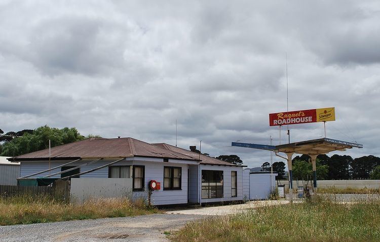
Trawalla sits at the headwaters of the Mount Emu Creek where it crosses the Western Highway. The Ararat railway line passes through the area. A railway station was in service at Trawalla but closed in the 1960s. A local primary school, a roadhouse and the minimum security prison farm HM Prison Langi Kal Kal, are the focal points of the area. The Moner balug clan of the Wathaurong Aboriginal people called the area, Trawalla which means 'wild water' or possibly 'much rain'.
In 1836 the district was traversed and noted by explorer Sir Thomas Mitchell after ascending Mount Cole. The first European settlers to arrive in the area were squatters, Kenneth William Kirkland, his wife Katherine (née Hamilton) and daughter Agnes Anna, and Katherine's brothers Robert and James McGregor Hamilton, who established sheep and cattle grazing runs. Trawalla Station, was established by Hamilton in 1838 and acquired by Adolphus Goldsmith three years later. After passing through several owners the property was taken over by Rear Admiral Bridges in 1887. It was under his ownership that Trawalla House was constructed. Trawalla Post Office opened on 3 December 1864 at the time of closer settlement and closed 13 July 1974.
After Bridges' death in 1917 a large part of the Trawalla estate was acquired and subdivided by the Commonwealth Government for the Soldier settlement scheme. Land was subdivided into 93 allotments with sizes from 250 acres to 680 acres. The land was deemed appropriate for grazing and farming.
The Langi Kal Kal pastoral run was subdivided for the same purpose after World War II in 1948.
Trawalla is the birthplace of Australia's ninth Prime Minister James Scullin. James Henry Scullin was born on 18 September 1876. He died in Melbourne on 28 January 1953. He married Sarah McNamara in 1907, but had no children. He was commonly known as Jim. He was the fifth of the nine children of John Scullin and Ann Logan, both immigrants from Derry, Ireland. His father, John Scullin had been a miner and later a platelayer on the railways. He attended small state schools, first at Trawalla and later at Mount Rowan near Ballarat. A memorial cairn is located close to where Scullin lived.