
Existed: 1934 – present Length 659.8 km | South end: US 90 in Prichard, AL AL SR 44 → Constructed 1934 | |
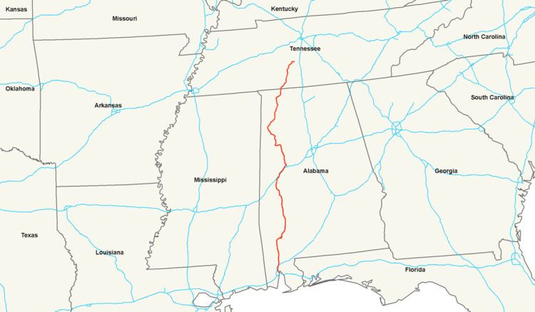 | ||
U.S. Route 43 (US 43) is a 410-mile-long (660 km) north–south United States Highway in the East South Central States of Alabama and Tennessee. It travels from Prichard, Alabama to Columbia, Tennessee. The highway's southern terminus is in Prichard, at an intersection with US 90. Its northern terminus is in Columbia, Tennessee, at an intersection with US 31/US 412/US 412 Bus.
Contents
Map of US-43, United States
In Alabama and Tennessee, all of the U.S. Highways in each state have one or more unsigned state highways designated along its length. US 43 travels concurrently with Alabama State Route 13 (SR 13) from its southern terminus to an intersection in southeastern Fayette County. For the rest of its length in the state, US 43 is concurrent with signed state highways. In Tennessee, US 43 travels concurrently with Tennessee State Route 6 (SR 6) along its entire length in the state. It also has an unsigned concurrency with SR 227 between Saint Joseph and Loretto.
Alabama
US 43, along with unsigned SR 13 which is concurrent with it, begins at an interchange with US 90 (New Bay Bridge Road; unsigned SR 16) in the extreme southeastern corner of Prichard, in Mobile County. It travels to the north-northwest and leaves Prichard and travels through a brief section of Mobile. The highway crosses over some railroad tracks and enters Chickasaw. It curves to the north and curves to the north-northeast. It then crosses over Chickasaw Creek on the R.B. Smallwood Sr. Memorial Bridge. Not long after, US 43 leaves Chickasaw and enters Saraland. It has an intersection with the eastern terminus of SR 158 (Industrial Parkway). It crosses over Norton Creek and intersects the northern terminus of SR 213 (Shelton Beach Road). A few thousand feet later, the highway enters Satsuma. It passes Satsuma High School and Satsuma Lions Park before crossing over Steele Creek. It curves to the north-northwest and has an interchange with Interstate 65 (I-65). US 43 leaves Satsuma and curves back to the north-northeast. It then travels through Creola. The highway then travels through Axis and curves to the north-northwest. The highway curves to the north and travels through Le Moyne. It intersects the eastern terminus of County Route 84 (CR 84; Salco Road). After crossing over Sisters Creek, the highway travels through Barry Village and Bucks. It crosses over Grady Hall Creek and travels through Chastang. It travels through Movico, the highway curves to the north-northeast and crosses over Cedar Creek. Almost immediately, it enters Mount Vernon. There, it intersects the eastern terminus of CR 96 (Citronelle Road). It curves to the north and crosses over Beaver Dam Creek before leaving Mount Vernon. The highway crosses over Borrow Creek and then has an interchange with ThyssenKrupp Drive. It enters the southern part of Calvert. While in the center part of Calvert, it crosses into Washington County.
Almost immediately, US 43 intersects the eastern terminus of CR 4 (Fairford Road). It curves to the north-northwest, leaves Calvert, and travels through rural areas of the county. The highway travels through Malcolm and curves back to the north-northwest before crossing over the Tombigbee River. It then enters McIntosh. The highway intersects CR 35 (John Johnston Road) just before passing Andrews Chapel, a historic log church. The two highways have an unsigned concurrency through the town. US 43 curves to the north and leaves McIntosh. After traveling through some rural areas of the county, it enters Deer Head, where it intersects the eastern terminus of CR 20 (Hawthorne Road). The highway curves to the north-northeast and then curves to the north-northwest before entering Wagarville. There, it intersects CR 6 and then the eastern terminus of SR 56. After beginning a curve to the northeast, it has a crossing of Bassett Creek. The highway curves to the east-northeast, before entering Leroy. It has a very brief unsigned concurrency with CR 34. Then, US 43 passes Leroy High School, curves back to the northeast, and passes the U.S. post office of Leroy. After leaving Leroy, the highway has a second crossing of the Tombigbee River on the Joe C. McCorquodale Bridge. At this crossing, it enters Clarke County.
US 43 curves to the east and intersects the southern terminus of SR 177 (Commerce Street). It curves to the east-southeast and enters Jackson. It then curves back to the northeast and intersects SR 69. The highway then intersects the northern terminus of SR 177 (College Avenue). Farther into the city is an intersection with the western terminus of CR 10 (Walker Springs Road). The highway curves to the north-northwest and leaves Jackson. It curves to the north-northeast and intersects the southern terminus of CR 3. Then, it intersects the eastern terminus of CR 16 (Toddtown Road). Just before entering Grove Hill, US 43 intersects the northern terminus of CR 29 (Allen Road). On the southern city limits of Grove Hill is an intersection with the southern terminus of SR 295 and CR 18 (Hebron Road). The highway curves to the north-northwest and has an interchange with US 84 (unsigned SR 12; Grove Hill Avenue). US 43 curves back to the north-northeast and briefly leaves the city limits of Grove Hill. On the northern edge of the city limits is an intersection with the northern terminus of SR 295 (North Jackson Street). The highway intersects the southern terminus of CR 17 (Chilton Road). US 43 enters Fulton, where it intersects the western terminus of SR 178. It intersects the eastern terminus of CR 9 and then leaves the town. It then enters Thomasville. It passes Alabama Southern Community College, Thomasville High School, Thomasville Middle School, and Thomasville Elementary School. Farther in the city is an intersection with the eastern terminus of SR 154 (Tallahatta Springs Road). Just before leaving Thomasville is an intersection with the southern terminus of SR 5. The highway winds its way through rural areas of the county and then enters Marengo County.
US 43 heads to the north-northwest and enters Dixons Mills. It intersects the northern terminus of CR 37. In the main part of the community. Here, it intersects SR 10. The highway curves to the north-northeast and intersects CR 6 (Deer Run Road). It then passes the U.S. post office for the community. After curving back to the north-northwest, the highway leaves the community. It winds its way in a northerly direction and intersects the western terminus of CR 55. After a crossing of Sweetwater Creek is an intersection with the eastern terminus of CR 16. The highway travels through Wayne and then intersects the western terminus of CR 30. US 43 continues its winding path through rural areas of the county. It intersects the southern terminus of CR 47. The highway has an intersection with the southern terminus of CR 33, before entering Linden. In the southern part of the city is a second intersection with SR 69. The two highways travel concurrently to the north. They cross over some railroad tracks of BNSF Railway. A very short distance later is a crossing of some railroad tracks of CSX. In downtown Linden, SR 28 (East Coats Avenue) joins the concurrency for about five blocks. The three highways pass Linden High School. At Cahaba Avenue, SR 28 splits off, while US 43 and SR 69 continue to the north. They curve to the northeast and leave Linden. They enter Providence. Here, they intersect CR 44. It joins the concurrency as an unsigned highway. Almost immediately, first SR 69 and then CR 44 split off. At this point, US 43 resumes a northward direction. It leaves Providence and travels within the northeast portion of Chickasaw State Park. The highway resumes its gradual twisting route to the north and then intersects the southern terminus of CR 1. It intersects the western terminus of CR 35. This intersection is just west of Old Spring Hill. US 43 curves back to the north. It curves again to the north-northwest and intersects the western terminus of CR 54. It then enters Demopolis. It crosses over some railroad tracks of BNSF Railway. Farther to the northwest, it begins a concurrency with US 80 (unsigned SR 8). They cross over the Whitfield Canal right at an intersection with the northern terminus of CR 21 (Jefferson Road). About one block later, US 43 turns right and resumes its northward direction. It crosses over some railroad tracks of Norfolk Southern Railway. At East Capitol Street, US 43 turns left and travels due west for two blocks. At North Walnut Avenue, the highway turns right and resumes a due north direction. It leaves Demopolis and crosses over two tributaries of the Black Warrior River before crossing over the river itself on the William Rufus King Bridge. At this crossing, the highway enters Greene County.
US 43 intersects the southern terminus of CR 18 (Steam Plant Road), which leads to Backbone Creek Boat Ramp and Demopolis Wildlife Management Area]. It crosses over two more tributaries of the Black Warrior River before intersecting the southern terminus of CR 11. The highway curves to the north-northeast. It then intersects the eastern terminus of CR 41 (Birdeye Park Road), which leads to Logan and Birdine cemeteries. US 43 crosses over some railroad tracks of BNSF Railway and curves to the north-northwest. It intersects the northern terminus of CR 18, which leads to the Greene County Electric Generating Plant. It curves to the northwest and enters Forkland. After an intersection with the southern terminus of CR 21 (McDaniel Drive), the highway intersects CR 20 (M.L. King Drive), which leads to Boligee. US 43 then intersects the southern terminus of CR 69 (A.L. Isaac Road) and the western terminus of CR 41 (Lloyd Chapel Road). Right after this intersection, US 43 passes the town hall for Forkland. A short distance later, it leaves the town and continues to the northwest. It intersects the eastern terminus of CR 42. It curves to the north-northwest and then intersects CR 148. It curves to the north-northeast and then enters Eutaw. It intersects CR 154. The two highways have an unsigned concurrency for one block. Farther into the city, US 43 begins a concurrency with SR 14 (Greensboro Street). The two highways travel to the northwest and cross over some railroad tracks of Norfolk Southern Railway. Then, they curve to the west and enter the main part of the city. At Morrow Avenue, US 43 and SR 14 intersect US 11 (Boligee Street; unsigned SR 7). The concurrency travels to the north on Morrow Avenue for one block. At Tuscaloosa Street, SR 14 splits off, while US 11 and US 43 turn right and travel to the east. The concurrency gradually curves to the north-northwest and leaves the city. The highways curve to the north-northeast, and intersect the western terminus of CR 231. After they intersect the southern terminus of CR 167 (Springfield Fire Tower Road), the intersect the southern terminus of CR 208 (M.L. King Highway), which leads to Green Track and Union. They intersect the southern terminus of CR 211, and then intersect the western terminus of CR 210. Just after crossing over Spencers Creek, they intersect the southern terminus of CR 217. They curve to the north-northwest and intersect the western terminus of CR 86 just before an interchange with I-20/I-59. Just after this interchange, the concurrency travels through Knoxville. After crossing over Little Buck Creek, the two highways enter Tuscaloosa County.
US 11 and US 43 continue to the north-northeast and intersect CR 67. It joins the concurrency as an unsigned highway. After CR 67 splits off onto Ralph Loop Road, the two U.S. highways travel just south of Ralph. They then intersect the eastern terminus of CR 19 (also part of Ralph Loop Road). Almost immediately is an intersection with the northern terminus of CR 75 (Shepherd Park Road). Just before crossing over Phillips Creek is an intersection with the southern terminus of CR 79 (Sylvan Loop Road). They then intersect the northern terminus of CR 79 (Sylvan Loop Road). In Fosters, they intersect the southern terminus of CR 10 (Gainesville Road) and the northern terminus of Holley Springs Lane. They intersect the western terminus of CR 44 (Martin Luther King Jr. Boulevard). Farther to the northeast, they enter Tuscaloosa. They intersect CR 16 (Joe Mallisham Parkway), which acts like a western bypass of the city. They curve to the east-southeast and intersect the eastern terminus of CR 27 (Old Sanders Ferry Road). They travel along the northern edge of Stillman College and then intersect CR 16 (Fosters Ferry Road/Stillman Boulevard). They have an interchange with I-359/SR 69 (Lurleen B. Wallace Boulevard). At this interchange, which is the northern terminus of I-359, US 11 turns right and follows I-359/SR 69 south, while US 43 turns left to follow SR 69 north. The two highways travel to the north-northwest and pass the historic Bama Theatre. They cross over the Black Warrior River on the Hugh R. Thomas Bridge and then enter Northport. They have an interchange with 5th Street. They curve to the north and intersect US 82 (McFarland Boulevard; unsigned SR 6). At this intersection, SR 69 continues to the north, while US 43 turns left onto US 82 for a brief concurrency. They travel to the northwest and curve to the west-southwest. At Main Avenue, the two highways split. US 43 resumes a northwesterly direction. It briefly leaves the city limits of Northport. After re-entering the city, it intersects the eastern terminus of CR 86 (Flatwoods Road). It curves to the northeast and intersects the southern terminus of SR 171. It curves to the north and intersects the northern terminus of CR 62 (Northcreek Boulevard) and the eastern terminus of Oak Meadow Drive. After curving to the north-northeast, it intersects the northern terminus of CR 84 (Charlie Shirley Road). It intersects the western terminus of CR 56 (Mitt Lary Road) and the northern terminus of Rose Boulevard. Right after this intersection, US 43 leaves Northport. It crosses over a southwestern arm of Lake Tuscaloosa just before intersecting CR 90 (Bone Camp Road). The two highways have a brief unsigned concurrency. CR 90 splits off onto Tierce Patton Road. This intersection is also the eastern terminus of Lakeland Hills Drive. US 43 curves to the north-northeast and crosses over part of Lake Tuscaloosa. After this crossing, the highway travels along the western edge of Binion Creek Landing Park. In Samantha, it intersects the western terminus of CR 80 (North Hagler Road). After curving back to the north-northwest, it intersects the southern terminus of CR 63 (Gorgas Road). It curves to the northwest and intersects CR 38 (Northside Road) on the southeastern edge of Northside High School. After a very brief unsigned concurrency with CR 40 (Campground Road/Sherman Road), it curves to the north-northwest and has another unsigned concurrency with CR 12 (Max Vintson Road/Etteca Road). After curving to the north-northeast, it intersects CR 55 (Doughty Road/Shiver De Freeze Road). US 43 travels to the north and enters Fayette County.
US 43 winds to the north-northeast and intersects the eastern terminus of CR 26. Just after this intersection is one with SR 18. At this intersection, US 43 ends its southern concurrency with SR 13 and begins a concurrency with SR 18. Also, SR 13 becomes a signed highway at this intersection. US 43 and SR 18 wind to the north-northeast just before intersecting the southern terminus of CR 132. After curving back to the north-northwest, they intersect the northern terminus of CR 132. The two highways enter Bankston. In that community, they intersect the southern terminus of CR 93 and then the southern terminus of CR 67. After leaving Bankston, they curve to the southwest and intersect the southern terminus of CR 101. They intersect the northern terminus of CR 91 before curving to the west-northwest. They intersect the southern terminus of CR 77 and then the southern terminus of CR 9. They curve to the west-southwest and travel through Stough. US 43 and SR 18 curve back to the southwest and intersect the eastern terminus of CR 81. A short distance later is the western terminus of CR 81. Just before curving to the west-northwest, they enter Rossland City, where they intersect CR 26. They intersect CR 53 just before crossing over the Sipsey River. Approximately 2,000 feet (610 m) after the river is the city limits of Fayette. In downtown Fayette, they intersect SR 171 (2nd Avenue Southeast). At this intersection, SR 18 continues to the west-northwest on Columbus Street West, and US 43 and SR 171 travel concurrently to the north-northeast on 2nd Avenue Northeast. They intersect the eastern terminus of CR 38. Then, they pass Bevill State Community College's Brewer Campus. Just after leaving Fayette, they intersect the southern terminus of CR 32. They intersect the southern terminus of CR 80. The two highways intersect the southern terminus of SR 129. They then intersect the western terminus of SR 102. They curve to the north-northwest and then briefly travel through the Fayette State Experiment Forest. They intersect the southern terminus of CR 87 before crossing over Stewart Creek. After intersecting the eastern terminus of CR 97 and the western terminus of Calvin Fowler Road, US 43 and SR 171 curve to a nearly due north direction. They intersect the western terminus of CR 34. The highways curve to the north-northeast and enter Winfield. They intersect the southern terminus of CR 147. They then have a very brief unsigned concurrency with CR 146. They curve to the northeast and have a one-block unsigned concurrency with CR 49. At this intersection, the highways temporarily leave Winfield. They begin a curve to the north-northwest and re-enter Winfield. They intersect the western terminus of CR 54 and then the western terminus of CR 88. On the northern side of this intersection is the Marion County line.
US 43 and SR 171 continue to the north-northwest and enter the main part of Winfield. They cross over some railroad tracks of BNSF Railway before intersecting SR 118 (Bankhead Highway) and the southern terminus of SR 253. US 43, SR 118, and SR 171 travel concurrently to the southeast. They intersect the eastern terminus of CR 28 and curve to the northwest. They intersect the northern terminus of CR 69. They cross over Luxapallila Creek before intersecting the western terminus of CR 4. They leave Winfield and enter Gu-Win. The highways intersect the southern terminus of CR 27. They then leave Gu-Win and enter Guin. They intersect the southern terminus of CR 21 before they curve to the west-southwest. They pass a 3M plant before they intersect the western terminus of SR 44 (7th Street). The highways intersect US 278 (unsigned SR 74) and the eastern terminus of SR 142 (11th Avenue West). At this intersection, SR 118 turns left onto US 278 west, and US 43 and SR 171 turn right onto US 278 east; the three highways travel to the north-northwest. The concurrency curves to the north-northeast and curve back to the north-northwest. They then intersect the western terminus of CR 50. They intersect the southern terminus of CR 54. Farther along is an intersection with the northern terminus of CR 58 (Frye Road) and the western terminus of Ash Street. They temporarily leave the city limits of Guin. Right after re-entering the city, they intersect the southern terminus of CR 45. They briefly travel through the northwestern part of the city before leaving it for good. Just over 1 mile (1.6 km) later, they intersect the southern terminus of CR 2. After entering Hamilton, they have an interchange with I-22/US 78/SR 4. Farther into the city, they intersect the northern terminus of CR 35 on the eastern edge of the city. They travel to the north and cross over the Buttahatchee River. They have an intersection with the western terminus of CR 42 and the eastern terminus of 10th Avenue Southwest. They curve to the north-northeast and intersect SR 17. At this intersection, SR 171 ends and SR 17 joins the US 43/US 278 concurrency. This intersection is on the southeastern edge of Hamilton High School. At Bexar Avenue West, US 278 turns right, while US 43 and SR 17 continue to the north-northeast. They intersect the southern terminus of CR 29 (Military Trail). They curve to the northeast before leaving Hamilton. The highways curve back to the north-northeast and intersect the southern terminus of SR 187. They then intersect the southern terminus of CR 41. The concurrency curves to the east-southeast and then heads to the northeast again. They enter Hackleburg. They curve to the east-northeast. In the main part of town is an intersection with SR 172 and the southern terminus of SR 253 (Clay Street). US 43 and SR 17 leave Hackleburg. They then enter Franklin County.
US 43 and SR 17 pass Dismals Canyon before intersecting the eastern terminus of CR 8, the southern terminus of CR 143, the western terminus of CR 51, and a brief unsigned concurrency with CR 16 (Gravel Hill Road/College Road; which leads to Phil Campbell and Northwest Shoals Community College's Phil Campbell campus), all in rapid succession. They intersect the southern terminus of CR 20. They then intersect CR 26. Approximately 1,000 feet (300 m) later is a second intersection with SR 13, which joins the concurrency. They intersect CR 22 and curve to the north. They intersect the eastern terminus of CR 64. Farther to the north is an intersection with the eastern terminus of CR 36. They curve to the northeast and then cross over CR 46 (Fletcher Road). They enter Russellville. They have a brief unsigned concurrency with CR 63 (Old Water Plant Road/Military Road). This intersection is also the western terminus of CR 42 (Walnut Gate Road). In the main part of the city, the highways have an interchange with SR 24. The three highways curve to the north-northwest and intersect the western terminus of CR 48 and the eastern terminus of Courtland Road Northeast. They curve to the north-northeast and intersect CR 56 (Lagrange Road). After a short departure from the city limits, the highways re-enter the city very briefly. After they leave the city again, they curve to the northeast. US 43, SR 13, and SR 17 have one more brief transit of a portion of the city before leaving it for good. They pass the King Drive-In theater, the oldest, continually-operating theater in the state. The theater is on the corner of the intersection with CR 60. The concurrency very gradually curves to the north-northeast and enter Colbert County.
US 43, SR 13, and SR 17 enter Littleville, which is the southern extent of The Shoals. They intersect the southern terminus of CR 18 (Ligon Springs Road). They have a brief unsigned concurrency with CR 55 (Osborn Hill Road/Jackson Highway). In the middle of town, they intersect CR 77 (Lynwood Avenue). After leaving Littleville, they begin paralleling some railroad tracks of Norfolk Southern Railway. They intersect the western terminus of CR 78 and curve to the north-northwest. They intersect the eastern terminus of CR 42 (Blue Road) and then intersect CR 52 (Spring Valley Road/Cook Lane) and pass the historic Belle Mont mansion. The concurrency curves to a nearly due north direction. They travel along the southeastern edge of Tuscumbia. Right after temporarily leaving Tuscumbia, they travel along the southwestern edge of Muscle Shoals. They have an intersection with US 72/US 72 Alt./unsigned SR 2/SR 20. At this intersection, US 72 Alt. reaches its western terminus, while US 72 and SR 20 join the US 43/SR 13/SR 17 concurrency. The five highways continue to the north, briefly travel through Tuscumbia proper before traveling along the Tuscumbia–Muscle Shoals city line. They leave Tuscumbia and then enter Muscle Shoals proper. They cross over some railroad tracks of Norfolk Southern Railway. Then, they intersect the western terminus of CR 24 (East 6th Street). On the west side of the intersection West 6th Street leads to Northwest Shoals Community College's North campus, downtown Tuscumbia, and Ivy Green, the childhood home of Helen Keller. On the Muscle Shoals–Sheffield city line, the highways intersect East 2nd Street. On the east side of the intersection, East 2nd Street carries the western terminus of SR 184. Right after this intersection, the concurrency travels along the northeastern edge of Sheffield. They pass administration offices of the Tennessee Valley Authority (TVA). The five-highway concurrency passes offices of the Alabama state troopers and then the TVA Muscle Shoals Reservation and Wilson Dam. The highways curve to the northwest and enter Sheffield proper. The five highways turn right onto North Jackson Highway and travel to the north. They curve to the north-northwest and leave the city limits of Sheffield. Then, they cross over the Tennessee River on the O'Neal Bridge and enter Lauderdale County.
The US 43/US 72/SR 13/SR 17/SR 20 concurrency immediately enters Florence. It has an incomplete interchange where SR 20 leaves the concurrency to the west-southwest on Coffee Road. There is no access from SR 20 to US 43 north/US 72 east/SR 13 north/SR 17 north. The highways turn right onto East Dr. Hicks Boulevard and travel to the east-northeast and then to the northeast. The four highways curve back to the east-northeast onto East Tennessee Street. They curve to the north-northwest and travel on an overpass over North Royal Avenue. They begin to curve to the northeast and travel on an overpass over Railroad Avenue, some railroad tracks of CSX, and an unnamed stream. Immediately after this overpass is an interchange with SR 157 (Helton Drive). At this interchange, SR 17 departs the concurrency and heads northwest with SR 157. US 43, US 72, and SR 13 pass University of North Alabama's North campus. They pass historic Sweetwater Mansion and curve to the east-northeast. After that, they intersect SR 133 (Cox Creek Parkway). A short distance later is an intersection with CR 61 (Middle Road). A few blocks later is an intersection with the southern terminus of CR 374 Just under 2,000 feet (610 m) later is an intersection with the southern terminus of CR 323 (Bailey Springs Road). The highways have an intersection with the southern terminus of CR 27, which leads to the Boy Scouts of America's Camp Westmoreland. One block later is an intersection with the northern terminus of CR 367 (Lakeview Drive). After they leave Florence, they cross over Shoal Creek on the Disabled American Veterans Memorial Bridge. Just west-southwest of Killen, US 72 continues to the east-northeast, while US 43 and SR 13 head to the northeast. The concurrency briefly travels along the northwest edge of Killen before they temporarily leave the town. A short distance later, they travel through the far northwestern corner of the city limits of Killen before leaving the town for good. They intersect the southern terminus of CR 63 and the northern terminus of Alabama Street. The concurrency curves to the north and have an unsigned concurrency with CR 170. One block later is an intersection with the southern terminus of CR 36. A short distance later, they intersect the western terminus of CR 396 and then CR 394 in close succession. Approximately 2,000 feet (610 m) later, they intersect CR 73. One block later is an intersection with the western terminus of CR 392. Approximately another 2,000 feet (610 m) later, is an intersection with the eastern terminus of CR 387. One block later is an intersection with the eastern terminus of CR 364 and the western terminus of SR 64. Approximately yet another 2,000 feet (610 m) later is an intersection with CR 34. Approximately 1,000 feet (300 m) later is a brief unsigned concurrency with CR 47, which leads to St. Florian. US 43 and SR 13 curve to the north-northeast and intersect CR 38. Approximately 1,500 feet (460 m) later is an intersection with CR 140. They then intersect the eastern terminus of CR 344 and then CR 8. Farther to the north-northeast is an intersection with CR 130 (South Old Military Road). Approximately 2,500 feet (760 m) later is an intersection with the northern terminus of CR 47. They cross over Shakerag Branch and travel another 2,500 feet (760 m) before reaching the Tennessee state line, where SR 13 ends.
Tennessee
US 43 enters Lawrence County and the city limits of Saint Joseph. The unsigned State Route 6 (SR 6) begins at the state line. In the main part of the city, US 43 begins an unsigned concurrency with SR 227 (Iron City Road). They curve to the northeast, leave Saint Joseph, and enter Loretto. There, SR 227 splits off to the southeast onto East Main Street. Then, US 43 intersects SR 98 (Rabbit Trail Road) in Leoma. It has an interchange with US 64 (unsigned SR 15; Lawrenceburg Highway) in Lawrenceburg. In downtown Lawrenceburg, US 43 intersects US 64 Bus. (Gaines Street). The highway briefly parallels the North Fork Buffalo River before beginning a curve to the north and crossing that river twice. Then, US 43 intersects SR 240 (Monument Road) and Spring Water Drive.
In Maury County, US 43 intersects SR 20. It intersects the southern terminus of SR 243 (South Main Street) in Mount Pleasant. It travels on an overpass over Mt. Joy Road and some railroad tracks. US 43 bypasses downtown by traveling through the western part of the city. It intersects SR 166 (1st Avenue). Then, it has an interchange with SR 243, which also leads to the Maury County Airport. It has an interchange with US 412 (unsigned SR 99) and the western terminus of US 412 Bus. (Hampshire Pike) in Columbia. At this interchange, US 43 and US 412 travel concurrently to the north-northeast. At an interchange with SR 50 (Williamsport Pike), the concurrency briefly re-enters the city before leaving again. The concurrency curves to the east-southeast and has an interchange with SR 7 (Santa Fe Pike). Then, they intersect US 31 and US 412 Bus (Nashville Highway). Here, US 43 ends, US 412 continues to the east-southeast on Bear Creek Pike, and SR 6 turns left onto US 31 north.
National Highway System
All of US 43, except for the approximately 18-mile-long (29 km) segment from the interchange with I-20/I-59 south of Knoxville to just northeast of its entering Tuscaloosa, is part of the National Highway System (NHS), a system of highways determined to be the most important for the nation's economy, mobility, and defense.
History
Prior to the completion of Corridor X in western Alabama, US 43 and US 278 shared a concurrency with US 78 between Guin and Hamilton. The highway used to extend up to Henderson, Kentucky. It was concurrent with I-24, I-65, the Pennyrile Parkway, and what is now present-day I-69. This part of US 43 was decommissioned when US 41 Alt. came into existence.
Future
Preliminary talks have indicated that Alabama state officials support a plan to upgrade US 43 to Interstate Highway standards from the Mobile metropolitan area to the I-20/I-59 interchange in Knoxville. However, no number has been specified. The plan is estimated to cost roughly $1.6 billion. The project is expected to help the economies of cities in the Black Belt by connecting communities in western Alabama, the Port of Mobile, I-65, and I-20/I-59.