
Congressional district 4th Area 1,676 km² Population 31,532 (2013) | Founded 1818 | |
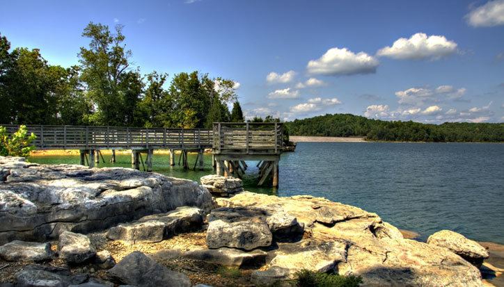 | ||
Website www.franklincountyal.org Rivers Little Bear Creek, Bear Creek, Spring Creek, Mann Branch Points of interest Dismals Canyon, RedBay city Water park and, City Lake Park | ||
Franklin County is a county of the U.S. state of Alabama. As of the 2010 census, the population was 31,704. Its county seat is Russellville. Its name is in honor of Benjamin Franklin, famous statesman, scientist, and printer. It is a dry county, although the city of Russellville is wet.
Contents
- Map of Franklin County AL USA
- History
- Colbert County
- Musical history
- Geography
- Adjacent Counties
- National protected area
- Major Highways
- Rail
- 2000
- 2010
- Education
- Cities
- Towns
- Census designated places
- Unincorporated communities
- References
Map of Franklin County, AL, USA
History
Franklin County was established on February 6, 1818.
Colbert County
Colbert County was originally established on February 6, 1867 after it split from Franklin County over political issues after the American Civil War. It was abolished eight months later by an Alabama constitutional convention and then reestablished on February 24, 1870.
Musical history
Many musicians and songwriters are from Franklin County including Billy Sherrill, Tammy Wynette, Ricky Pierce, Eddie Martin, Kerry Gilbert, and many others.
Geography
According to the U.S. Census Bureau, the county has a total area of 647 square miles (1,680 km2), of which 634 square miles (1,640 km2) is land and 13 square miles (34 km2) (2.0%) is water.
Adjacent Counties
National protected area
Major Highways
Rail
2000
As of the census of 2000, there were 31,223 people, 12,259 households, and 8,949 families residing in the county. The population density was 49 people per square mile (19/km2). There were 13,749 housing units at an average density of 22 per square mile (8/km2). The racial makeup of the county was 89.68% White (non-Hispanic), 4.21% Black or African American, 0.33% Native American, 0.11% Asian, 0.10% Pacific Islander, 4.62% from other races, and 0.96% from two or more races. 5.82% of the population were Hispanic or Latino of any race.
There were 12,259 households out of which 32.50% had children under the age of 18 living with them, 59.20% were married couples living together, 10.40% had a female householder with no husband present, and 27.00% were non-families. 24.50% of all households were made up of individuals and 12.10% had someone living alone who was 65 years of age or older. The average household size was 2.51 and the average family size was 2.97.
In the county, the population was spread out with 24.50% under the age of 18, 9.20% from 18 to 24, 28.00% from 25 to 44, 23.40% from 45 to 64, and 14.90% who were 65 years of age or older. The median age was 37 years. For every 100 females there were 96.40 males. For every 100 females age 18 and over, there were 92.80 males.
The median income for a household in the county was $27,177, and the median income for a family was $34,274. Males had a median income of $27,497 versus $18,631 for females. The per capita income for the county was $14,814. About 15.20% of families and 18.90% of the population were below the poverty line, including 24.60% of those under age 18 and 24.10% of those age 65 or over.
2010
As of the census of 2010, there were 31,704 people, 12,286 households, and 8,741 families residing in the county. The population density was 57 people per square mile (22km2). There were 14,022 housing units at an average density of 21.7 per square mile (8/km2). The racial makeup of the county was 83.0% White (non-Hispanic), 3.9% Black or African American, 0.7% Native American, 0.2% Asian, 0.0% Pacific Islander, 10.5% from other races, and 1.7% from two or more races. 14.9% of the population were Hispanic or Latino of any race.
There were 12,286 households out of which 30.0% had children under the age of 18 living with them, 53.5% were married couples living together, 12.3% had a female householder with no husband present, and 28.9% were non-families. 26.1% of all households were made up of individuals and 12.3% had someone living alone who was 65 years of age or older. The average household size was 2.56 and the average family size was 3.05
In the county, the population was spread out with 24.8% under the age of 18, 8.9% from 18 to 24, 25.8% from 25 to 44, 25.3% from 45 to 64, and 15.2% who were 65 years of age or older. The median age was 37.8 years. For every 100 females there were 99.7 males. For every 100 females age 18 and over, there were 104.3 males.
The median income for a household in the county was $33,942, and the median income for a family was $44,352. Males had a median income of $31,997 versus $22,747 for females. The per capita income for the county was $18,094. About 14.9% of families and 19.5% of the population were below the poverty line, including 26.2% of those under age 18 and 13.2% of those age 65 or over.
Education
There are two school systems in Franklin County; Russellville City Schools and Franklin County Schools.
Russellville City Schools include:
Franklin County Schools include:
There is also the Franklin County Career-Technical Center, located next to Belgreen High School.