
Country United States County Hale FIPS code 01-31720 Elevation 86 m Zip code 36744 Local time Thursday 9:48 PM | Time zone Central (CST) (UTC-6) GNIS feature ID 0157974 Area 6.2 km² Population 2,440 (2013) Area code 334 | |
 | ||
Weather 18°C, Wind S at 6 km/h, 75% Humidity | ||
Greensboro is a city in Hale County, Alabama, United States. At the 2000 census the population was 2,731. The city is the county seat of Hale County. It is part of the Tuscaloosa, Alabama Metropolitan Statistical Area.
Contents
- Map of Greensboro AL 36744 USA
- History
- Geography
- Demographics
- 2010 census
- Government and infrastructure
- Notable people
- Climate
- References
Map of Greensboro, AL 36744, USA
History
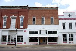
Greensboro was incorporated as a town in December 1823 as Greensborough. It was named in honor of American Revolutionary War general Nathanael Greene. The name was soon simplified to Greensboro. The community was known as Troy prior to incorporation. Several sites on the National Register of Historic Places are in or near Greensboro. These include Glencairn, the Greensboro Historic District, Magnolia Grove, the McGehee-Stringfellow House, Millwood, and the Payne House.
Geography
According to the U.S. Census Bureau, the city has a total area of 2.4 square miles (6.2 km2), of which 2.4 square miles (6.2 km2) are land and 0.42% is water.
Demographics
As of the census of 2000, there were 2,731 people, 1,026 households, and 688 families residing in the city. The population density was 1,146.5 people per square mile (443.0/km²). There were 1,142 housing units at an average density of 479.4 per square mile (185.3/km²). The racial makeup of the city was 38.30% White, 60.89% Black or African American, 0.04% Native American, and 0.77% from two or more races. 0.88% of the population were Hispanic or Latino of any race.
There were 1,026 households, of which 32.3% had children under the age of 18 living with them, 35.1% were married couples living together, 27.3% had a female householder with no husband present, and 32.9% were non-families. 31.2% of all households were made up of individuals and 14.6% had someone living alone who was 65 years of age or older. The average household size was 2.56 and the average family size was 3.21.
In the city, the population was spread out with 28.6% under the age of 18, 10.5% from 18 to 24, 20.9% from 25 to 44, 20.5% from 45 to 64, and 19.4% who were 65 years of age or older. The median age was 37 years. For every 100 females there were 86.8 males. For every 100 females age 18 and over, there were 74.6 males.
The median income for a household in the city was $22,930, and the median income for a family was $28,990. Males had a median income of $36,071 versus $23,224 for females. The per capita income for the city was $13,271. About 27.2% of families and 35.3% of the population were below the poverty line, including 47.1% of those under age 18 and 26.2% of those age 65 or over.
2010 census
As of the census of 2010, there were 2,497 people, 1,045 households, and 629 families residing in the city. The population density was 1,040.4 people per square mile (402.7/km²). There were 1,195 housing units at an average density of 497.9 per square mile (192.7/km²). The racial makeup of the city was 66.5% Black or African American, 32.0% White, 0.2% Native American, and 0.6% from two or more races. 0.5% of the population were Hispanic or Latino of any race.
There were 1,045 households, of which 25.6% had children under the age of 18 living with them, 30.4% were married couples living together, 25.2% had a female householder with no husband present, and 39.8% were non-families. 37.0% of all households were made up of individuals and 15.9% had someone living alone who was 65 years of age or older. The average household size was 2.31 and the average family size was 3.07.
In the city, the population was spread out with 24.9% under the age of 18, 7.9% from 18 to 24, 20.5% from 25 to 44, 26.8% from 45 to 64, and 19.9% who were 65 years of age or older. The median age was 42 years. For every 100 females there were 81.1 males. For every 100 females age 18 and over, there were 88.3 males.
The median income for a household in the city was $30,082, and the median income for a family was $36,379. Males had a median income of $28,869 versus $22,528 for females. The per capita income for the city was $16,277. About 19.0% of families and 23.8% of the population were below the poverty line, including 34.9% of those under age 18 and 23.7% of those age 65 or over.
Government and infrastructure
The City Of Greensboro has a mayor-council form of government.
Greensboro has a full-time police force with approximately 13 officers.
Greensboro has a volunteer fire department.
Greensboro is served by one public K-12 public school, Greensboro Public School with two campuses.
Greensboro has one private K-12 school, Southern Academy.
Notable people
Climate
The climate in this area is characterized by hot, humid summers and generally mild to cool winters. According to the Köppen Climate Classification system, Greensboro has a humid subtropical climate, abbreviated "Cfa" on climate maps.