
Country United States FIPS code 01-68352 Area 16.8 km² Zip code 36572 Local time Thursday 12:00 AM | Time zone Central (CST) (UTC-6) GNIS feature ID 0126426 Elevation 4 m Population 6,156 (2013) Area code 251 | |
 | ||
Weather 20°C, Wind NE at 8 km/h, 62% Humidity | ||
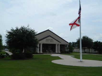
Satsuma is a city in Mobile County, Alabama, United States. At the 2000 census the population was 5,687. Known prior to 1915 as Fig Tree Island, the city was named after the Satsuma orange, which was successfully cultivated and grown in Alabama starting in 1878, a gift from Meiji, Japan. Satsuma is a part of the Mobile metropolitan statistical area.
Contents
- Map of Satsuma AL USA
- Geography
- History
- Demographics
- 2010 census
- Education
- Education before the Separation from Mobile
- References
Map of Satsuma, AL, USA
Geography
Satsuma is located at 30°51′16″N 88°3′16″W (30.854518, -88.054415).
According to the U.S. Census Bureau, the city has a total area of 6.5 square miles (17 km2), of which 6.5 square miles (17 km2) is land and 0.15% is water.
History
The area was inhabited for thousands of years by differing cultures of indigenous peoples.
Demographics
As of the census of 2000, there were 5,687 people, 2,017 households, and 1,688 families residing in the city. The population density was 873.1 people per square mile (337.3/km²). There were 2,107 housing units at an average density of 323.5 per square mile (125.0/km²). The racial makeup of the city was 93.72% White, 5.05% Black or African American, 0.55% Native American, 0.25% Asian, 0.16% from other races, and 0.28% from two or more races. 0.58% of the population were Hispanic or Latino of any race.
There were 2,017 households out of which 37.5% had children under the age of 18 living with them, 71.3% were married couples living together, 8.9% had a female householder with no husband present, and 16.3% were non-families. 14.8% of all households were made up of individuals and 6.8% had someone living alone who was 65 years of age or older. The average household size was 2.81 and the average family size was 3.10.
In the city, the population was spread out with 26.0% under the age of 18, 8.3% from 18 to 24, 28.0% from 25 to 44, 26.5% from 45 to 64, and 11.2% who were 65 years of age or older. The median age was 38 years. For every 100 females there were 96.2 males. For every 100 females age 18 and over, there were 91.3 males.
The median income for a household in the city was $50,496, and the median income for a family was $53,180. Males had a median income of $39,123 versus $24,851 for females. The per capita income for the city was $23,972. About 4.7% of families and 6.0% of the population were below the poverty line, including 8.0% of those under age 18 and 10.9% of those age 65 or over.
2010 census
As of the census of 2010, there were 6,168 people, 2,290 households, and 1,774 families residing in the city. The population density was 948.9 people per square mile (365.0/km²). There were 2,416 housing units at an average density of 371.7 per square mile (143.0/km²). The racial makeup of the city was 88.7% White, 7.9% Black or African American, 1.2% Native American, 0.6% Asian, 0.4% from other races, and 1.1% from two or more races. 1.1% of the population were Hispanic or Latino of any race.
There were 2,290 households out of which 31.0% had children under the age of 18 living with them, 61.8% were married couples living together, 11.5% had a female householder with no husband present, and 22.5% were non-families. 18.8% of all households were made up of individuals and 8.7% had someone living alone who was 65 years of age or older. The average household size was 2.67 and the average family size was 3.05.
In the city, the population was spread out with 23.8% under the age of 18, 7.5% from 18 to 24, 24.4% from 25 to 44, 29.4% from 45 to 64, and 14.9% who were 65 years of age or older. The median age was 40.7 years. For every 100 females there were 93.2 males. For every 100 females age 18 and over, there were 94.8 males.
The median income for a household in the city was $59,289, and the median income for a family was $63,333. Males had a median income of $46,938 versus $33,791 for females. The per capita income for the city was $25,087. About 0% of families and 0.7% of the population were below the poverty line, including 0% of those under age 18 and 1.5% of those age 65 or over.
Education
Satsuma is served by the Satsuma City School System, following the successful separation from the Mobile County Public School System in 2012.
Satsuma voted on April 12, 2011 to create its own school system. The Satsuma City School System is served by two schools, Robert E. Lee Elementary (K-6) and Satsuma High School (7-12).
Education before the Separation from Mobile
Before the Satsuma City School System was founded, the schools that served Satsuma included Robert E. Lee Primary School (Kindergarten through 2), Robert E. Lee Intermediate School (3 through 5), North Mobile County Middle School (6-8), Satsuma High School (9-12). Lee Primary, Lee Intermediate, and Satsuma High were in the city of Satsuma, while North Mobile County Middle was in Axis.
Before the Saraland City Schools system formed, Satsuma residents attended Adams Middle School in Saraland. In 2003, officials of Satsuma, Saraland, and Chickasaw contemplated forming the "Delta School District." Such a split would have required an act from the Alabama Legislature. In June 2006, the City of Saraland voted to break away from the Mobile County Public School System and form its own school system. On September 7, 2010 North Mobile County Middle School opened, replacing the role of Adams Middle School in Saraland, because residents outside of Saraland are no longer zoned to Adams Middle.
Satsuma residents considered leaving Mobile County schools since circa 2001. In 2010, the City of Satsuma began conducting a study on whether it can split from the Mobile County school system. Tom Williams, a council member of Satsuma, said he began considering splitting once Mobile County decided to situate the new middle school in Axis, 12 miles (19 km) from Satsuma, since students have longer bus rides to the school and that the school is further away from fire and police stations. The Mobile County government built the school outside of the Satsuma city limits so the city government would be unable to possess the school if it opted to secede.