
Length 428.1 km | Constructed 1926 | |
 | ||
Existed: October 1, 1926 – present Major cities | ||
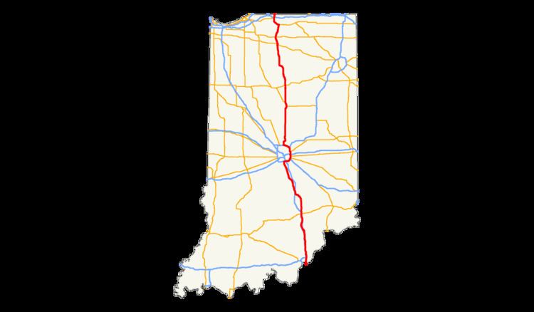
U.S. Route 31 (US 31) is a part of the United States Numbered Highway System that runs from Spanish Fort, Alabama, to the Mackinaw City, Michigan. In the U.S. state of Indiana, it is a State Road that enters the state via the George Rogers Clark Memorial Bridge between Louisville, Kentucky, and Clarksville, Indiana. The 266.02 miles (428.12 km) of US 31 that lie within Indiana serve as a major conduit. Some of the highway is listed on the National Highway System. Various sections are rural two-lane highway and urbanized four-lane divided expressway. The northernmost community along the highway is South Bend near the Michigan state line.
Contents
- Route description
- Jeffersonville to Columbus
- Columbus to Indianapolis
- Indianapolis to Michigan
- History
- Freeway upgrades for northern sections
- Hamilton County
- Kokomo
- Plymouth to South Bend
- References
US 31 was first designated as a US Highway in October 1926. A northern (from Rochester to South Bend) and very far south section (on old US 31 W into Louisville on the K&I Bridge) of the highway originally served as part of the Dixie Highway. US 31 was the Jackson Highway from Indianapolis to Seymour. US 31 replaced the original State Road 1 (SR 1) designation of the highway which dated back to the formation of the Indiana State Road system. SR 1 ran from Clarksville through Indianapolis to South Bend and ended at the Michigan state line.
Route description
Only the segment of US 31 that is north of Indianapolis is included as a part of the National Highway System (NHS). The NHS is a network of highways that are identified as being most important for the economy, mobility and defense of the nation. The highway is maintained by the Indiana Department of Transportation (INDOT) like all other U.S. Routes in the state. The department tracks the traffic volumes along all state highways as a part of its maintenance responsibilities using a metric called average annual daily traffic (AADT). This measurement is a calculation of the traffic level along a segment of roadway for any average day of the year. In 2010, INDOT figured that lowest traffic levels were the 3,690 personal vehicles and 160 commercial vehicles that used the highway daily near Memphis. The peak traffic volume was 168,770 personal vehicles and 18,090 commercial vehicles along the section of US 31 concurrent with Interstate 465 (I–465).
Jeffersonville to Columbus
US 31 overlaps I-65 in Jeffersonville, after crossing the George Rogers Clark Memorial Bridge from Kentucky. It then diverges as the access frontage lanes before splitting off north of Jeffersonville at Clarksville and proceeding to Indianapolis. US 31 was widened to two lanes in both directions for its length through Columbus in the early 2000s.
Columbus to Indianapolis
At I-465 on the south side of Indianapolis, US 31 is routed onto I-465 on the east side of the city. This is the closest approach the highway makes to downtown Indianapolis. Previously the northbound route of the highway through Indianapolis was on East Street, Madison Avenue, Delaware Street, North Street, and onto Meridian Street; southbound was on Meridian Street, North Street, Pennsylvania Street, Madison Avenue, and onto East Street.
Indianapolis to Michigan
US 31 exits I-465 (coincidentally at Exit 31) in southern Hamilton County, and continues northward, primarily as a divided highway. US 31 then passes through or near Carmel, Kokomo, Rochester, Plymouth, and Lakeville. As US 31 approaches South Bend, the route converges with US 20/St. Joseph Valley Parkway and proceeds west and then north, bypassing South Bend and proceeding into Michigan. (See U.S. Route 31 in Michigan.)
History
US 31 was signed into law by the Governor on March 7 of 1917, as Main Market Highway 1, and signs were installed on June 1 of that year. The name was changed to Indiana State Road 1 within a year when Indiana began the state road system. By 1924, most of the route was paved, leaving only from Columbus to Franklin and from Peru to Plymouth that was unpaved. On October 1, 1926, US 31 was designated along what was SR 1 at the time.
Freeway upgrades for northern sections
Three sections of US 31 in Northern Indiana between I-465 and US 20 have been or are being relocated or upgraded, part of the INDOT Major Moves Project designed to convert US 31 to Interstate-grade freeway from South Bend to Indianapolis. Funding has yet to be approved for the 78 miles of US 31 between these three segments except for an interchange at SR 28 in Tipton County, which opened November 22, 2016.
Hamilton County
The New US 31 Hamilton County project has upgraded US 31 to freeway standards from Interstate 465 near the Marion County line and Indianapolis to a point near SR 38 north of Westfield.
Kokomo
The Kokomo Corridor Project covered 14 miles (23 km) of new highway primarily in Howard County. The limited-access highway was built east of Kokomo and has five interchanges at SR 26, E. Boulevard (CR 100S), US 35/SR 22 (Markland Avenue), Touby Pike and US 35 north of Kokomo. Groundbreaking for the project occurred in the afternoon of September 17, 2008. This section of highway had been scheduled to be completed in December 2013 but it opened ahead of schedule with a ribbon-cutting ceremony on November 26, 2013. The former section of US 31 was redesignated as State Road 931.
Plymouth to South Bend
The US 31 Plymouth to South Bend project relocated US 31 on primarily new alignment from US 30 near Plymouth to US 20/St. Joseph Valley Parkway south of South Bend. Groundbreaking for the project occurred on September 17, 2008, only hours before the groundbreaking for the Kokomo stretch, and initial construction was in northern Marshall County. This section of highway opened on August 21, 2014, and a portion was dedicated as the Richard W. Mangus Memorial Highway, in honor of the local state representative who supported the freeway's construction, at the ribbon-cutting ceremony on August 27. As of the time of the freeway opening a designation for the state-maintained portion of the former route had not been decided but it was later designated as another segment of SR 931.