
Country United States Time zone Eastern (EST) (UTC-5) Local time Saturday 6:44 AM Mayor Andy Cook (R) | Founded 1834 Elevation 270 m Population 33,382 (2013) | |
 | ||
ZIP code 46074, 46032 (part), 46033 (part), 46062 (part) Weather 4°C, Wind N at 14 km/h, 89% Humidity | ||
Best towns for families westfield indiana
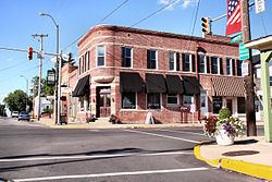
Westfield is a city in Hamilton County, Indiana, United States. In the year 2010 United States Census, the population was 30,068. Westfield is in the Indianapolis Metropolitan Area.
Contents
- Best towns for families westfield indiana
- Map of Westfield IN USA
- History
- Demographics
- 2010 census
- Grand Park
- Geography
- Notable people
- Schools
- References
Map of Westfield, IN, USA
History
Westfield was founded on May 6, 1834, by North Carolina Quakers—Asa Bales, Ambrose Osborne and Simon Moon. It is believed that the town was planned as a stop on the Underground Railroad with many families of the Religious Society of Friends and the Wesleyan Methodist Church supporting the cause. When the laws against aiding escaped slaves were made harsher, part of the Westfield Quaker Friends Meeting House split into the Anti-Slavery Friends meeting.
Westfield was incorporated as a town in 1848.
On January 1, 2008, Westfield was incorporated as a city, and Andy Cook was sworn in as Mayor. With recent annexations in southern Washington Township and rapid population growth in areas already occupied by the pre-existing town, the City government estimates Westfield's population to be at roughly 30,000 residents. Because of the growing size of the city, officials are planning a major revitalization of city's downtown. New additions to downtown Westfield are expected to include a new library and city hall.
Westfield recently annexed the community of Jolietville into its borders.
The Union High Academy Historic District was listed on the National Register of Historic Places in 1995.
In 2012, the city opened Grand Park Sports Complex which hosted the 2016 Big Ten Conference Men's Soccer Tournament.
Demographics
As of 2000 the median income for a household was $52,963; and for a family, $65,208. Males had a median income of $45,388; females, $26,864. The per capita income was $22,160. About 2.3% of families and 4.0% of the population were below the poverty line, including 2.5% of those under 18 years and 3.7% 65 years or over. The American Community Survey estimated the median household income in Westfield from 2007-2011 at $86,054 and the median family income at $96,374.
2010 census
As of the census of 2010, there were 30,068 people, 10,490 households, and 8,146 families residing in the town. The population density was 1,120.3 inhabitants per square mile (432.6/km2). There were 11,209 housing units at an average density of 417.6 per square mile (161.2/km2). The racial makeup of the town was 90.9% White, 2.2% African American, 0.2% Native American, 2.5% Asian, 2.6% from other races, and 1.6% from two or more races. Hispanic or Latino of any race were 5.8% of the population.
There were 10,490 households of which 47.0% had children under the age of 18 living with them, 64.9% were married couples living together, 9.3% had a female householder with no husband present, 3.4% had a male householder with no wife present, and 22.3% were non-families. 18.0% of all households were made up of individuals and 4.6% had someone living alone who was 65 years of age or older. The average household size was 2.85 and the average family size was 3.27.
The median age in the town was 33.7 years. 31.9% of residents were under the age of 18; 5.9% were between the ages of 18 and 24; 31.6% were from 25 to 44; 23.7% were from 45 to 64; and 6.8% were 65 years of age or older. The gender makeup of the town was 48.9% male and 51.1% female.
Grand Park
Grand Park is a 400-acre sports campus featuring 26 baseball and softball diamonds, 31 multipurpose fields for soccer, football, rugby, field hockey and lacrosse. An indoor soccer facility will open in July 2016 and an indoor basketball/volleyball facility is scheduled to open in 2016. Grand Park also features an abundance of green space and more than 10 miles of pedestrian/bicycle trails, including the largest trailhead on the Monon Corridor.
The park has experienced more than 830,000 visits as of October 2014 exceeding its first year projections.
Geography
Westfield is located at 40°1′56″N 86°7′44″W (40.032266, -86.129015).
According to the 2010 census, Westfield has a total area of 27.081 square miles (70.14 km2), of which 26.84 square miles (69.52 km2) (or 99.11%) is land and 0.241 square miles (0.62 km2) (or 0.89%) is water.