
Country United States Incorporated April 1, 1854 Highest elevation 3,807 ft (1,160 m) Population 525,491 (2013) County seat Modesto | Region San Joaquin Valley Named for Estanislao Area 3,924 km² Unemployment rate 9.8% (Apr 2015) | |
 | ||
Largest city Modesto (population and area) Rivers San Joaquin River, Stanislaus River, Tuolumne River Colleges and Universities California State University, Modesto Junior College, Computer Tutor Business, California Beauty School, Institute of Technology - Modesto Destinations Modesto, Oakdale, Turlock, Henry W Coe State, Patterson | ||
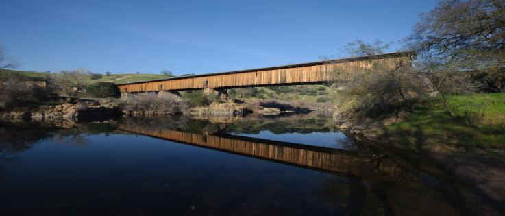
Amazing northern california ranch for sale the white diamond ranch stanislaus county california
Stanislaus County (/ˈstænᵻslɔːs/ or /ˈstænᵻslɔː/) is a county located in the Central Valley of the U.S. state of California. As of the 2010 census, the population was 514,453. The county seat is Modesto.
Contents
- Amazing northern california ranch for sale the white diamond ranch stanislaus county california
- Map of Stanislaus County CA USA
- Geography
- Flora and fauna
- National protected area
- Major highways
- Public transportation
- Airports
- Crime
- 2010
- 2000
- Metropolitan Statistical Area
- Government
- Voter registration statistics
- Overview
- Economy
- Education
- Media
- Population ranking
- References
Map of Stanislaus County, CA, USA
Stanislaus County comprises the Modesto Metropolitan Statistical Area.
The first European to see it was Gabriel Moraga in 1806. It was later named Rio Estanislao in honor of Estanislao, a mission-educated renegade Native American chief who led a band of Native Americans in a series of battles against Mexican troops until finally being defeated by General Mariano Vallejo in 1826. Estanislao was his baptismal name, the Spanish version of Stanislaus (Polish: Stanisław), itself the Latin version of the name of an 11th-century Polish Catholic Saint Stanislaus the Martyr.
Between 1843 and 1846, when California was a province of independent Mexico, five Mexican land grants totaling 113,135 acres (458 km2; 177 sq mi) were granted in Stanislaus County. Rancho Orestimba y Las Garzas, Rancho Pescadero and Rancho Del Puerto were located on the west side of the San Joaquin River, and Rancho Del Rio Estanislao and Rancho Thompson on the north side of the Stanislaus River. Additionally, in 1844 Salomon Pico received a Mexican land grant of 58,000 acres (235 km2; 91 sq mi) in the San Joaquin Valley, somewhere near the Stanislaus River and the San Joaquin River in what is now Stanislaus County. However, the grant was never confirmed by the Land Commission.
Stanislaus County was formed from part of Tuolumne County in 1854. The county seat was first situated at Adamsville, then moved to Empire in November, La Grange in December, and Knights Ferry in 1862, and was definitely fixed at the present location in Modesto in 1871.
As the price of housing has increased in the San Francisco Bay Area, many people who work in the southern reaches of the Bay Area have opted for the longer commute and moved to Stanislaus County for the relatively affordable housing.
Geography
According to the U.S. Census Bureau, the county has a total area of 1,515 square miles (3,920 km2), of which 1,495 square miles (3,870 km2) is land and 20 square miles (52 km2) (1.3%) is water.
Stanislaus County has historically been divided socially and economically by the north-flowing San Joaquin River, which provided a natural barrier to trade and travel for much of the county's history. Isolated from the main rail corridors through the county and the irrigation projects that generated much of the region's economic prosperity, the part of Stanislaus County west of the river (known to locals as the "West Side" of the county) has largely remained rural and economically dependent on agricultural activities. Because of its proximity to Interstate 5 and the California Aqueduct some towns within this area, including Patterson and Newman, have experienced tremendous growth and are being transformed into bedroom communities for commuters from the nearby San Francisco Bay Area, while others (including Westley and Crows Landing) have been almost entirely overlooked by development and remain tiny farming communities.
Flora and fauna
There are a number or rare and endangered species found in Stanislaus County. The Beaked Clarkia, (Clarkia rostrata), is listed as a candidate for the Federal Endangered Species List. It has only been found in blue oak-gray pine associations in the foothills of the Sierra Nevada, a habitat which occurs at moderately high elevations. Colusa Grass, (Neostapfsia colusana) is listed as endangered by the State. It is restricted to vernal pools. (Torrey, 1989)
National protected area
Major highways
Public transportation
Airports
Modesto City-County Airport has a number of scheduled passenger flights. Other (general aviation) airports around the county include Oakdale Airport, Patterson Airport, and Turlock Airpark.
Crime
The following table includes the number of incidents reported and the rate per 1,000 persons for each type of offense.
2010
The 2010 United States Census reported that Stanislaus County had a population of 514,453. The racial makeup of Stanislaus County was 337,342 (65.6%) White, 14,721 (2.9%) African American, 5,902 (1.1%) Native American, 26,090 (5.1%) Asian (1.5% Indian, 1.1% Filipino, 0.7% Cambodian, 0.5% Chinese, 0.3% Vietnamese, 0.3% Laotian, 0.1% Japanese, 0.1% Korean, 0.1% Cambodian), 3,401 (0.7%) Pacific Islander, 99,210 (19.3%) from other races, and 27,787 (5.4%) from two or more races; Hispanic or Latino of any race were 215,658 persons (41.9%); 37.6% of Stanislaus County is Mexican, 0.6% Puerto Rican, 0.5% Salvadoran, 0.2% Nicaraguan, and 0.2% Guatemalan.
(Note - the US Census Bureau says "Hispanics may be of any race, so also are included in applicable race categories", which means Hispanics are counted twice; once in whatever race they report, once as Hispanic. That in turn means the numbers will add up to be 215,658 (the number of Hispanics) higher than the 514,453 total population.)
2000
As of the census of 2000, there were 446,997 people, 145,146 households, and 109,585 families residing in the county. The population density was 299 people per square mile (116/km²). There were 150,807 housing units at an average density of 101 per square mile (39/km²). The racial/ethnic makeup of the county was 69.3% White, 2.6% Black, 4.2% Asian, 1.3% Native American, 0.3% Pacific Islander, 16.8% from other races, and 5.4% from two or more races. 31.7% of the population were Hispanic or Latino of any race. 8.4% were of German, 6.3% English, 6.0% American, 5.5% Irish, and 5.1% Portuguese ancestry according to Census 2000. 67.8% spoke English, 23.7% Spanish, 1.5% Syriac, and 1.3% Portuguese as their first language.
There were 145,146 households out of which 41.20% had children under the age of 18 living with them, 56.0% were married couples living together, 13.7% had a female householder with no husband present, and 24.5% were non-families. 19.4% of all households were made up of individuals and 7.9% had someone living alone who was 65 years of age or older. The average household size was 3.03 and the average family size was 3.47.
In the county, the population was spread out with 31.1% under the age of 18, 9.8% from 18 to 24, 29.0% from 25 to 44, 19.5% from 45 to 64, and 10.4% who were 65 years of age or older. The median age was 32 years. For every 100 females there were 96.8 males. For every 100 females age 18 and over, there were 93.4 males.
The median income for a household in the county was $40,101, and the median income for a family was $44,703. Males had a median income of $36,969 versus $26,595 for females. The per capita income for the county was $16,913. About 12.3% of families and 16.0% of the population were below the poverty line, including 20.5% of those under age 18 and 8.8% of those age 65 or over.
Metropolitan Statistical Area
The United States Office of Management and Budget has designated Stanislaus County as the Modesto, CA Metropolitan Statistical Area. The United States Census Bureau ranked the Modesto, CA Metropolitan Statistical Area as the 103rd most populous metropolitan statistical area of the United States as of July 1, 2012.
The Office of Management and Budget has further designated the Modesto, CA Metropolitan Statistical Area as a component of the more extensive Modesto-Merced, CA Combined Statistical Area, the 62nd most populous combined statistical area and the 71st most populous primary statistical area of the United States as of July 1, 2012.
As more cities in the county are becoming exurbs of the San Francisco Bay Area, urban planner and academic Wendell Cox wrote that the Office of Management and Budget could add Stanislaus County to the San Jose-San Francisco-Oakland, CA Combined Statistical Area in the future.
Government
The Government of Stanislaus County is defined and authorized under the California Constitution and law as a general law county. The County government provides countywide services such as elections and voter registration, law enforcement, jails, vital records, property records, tax collection, public health, and social services. In addition the County serves as the local government for all unincorporated areas.
The County government is composed of the elected five-member Board of Supervisors, several other elected offices including the Sheriff-Coroner, District Attorney, Assessor, Auditor-Controller, Treasurer-Tax Collector, and Clerk-Recorder, and numerous county departments and entities under the supervision of the Chief Executive Officer. As of January 2013 the members of the Stanislaus County Board of Supervisors were:
Voter registration statistics
Cities by population and voter registration
Overview
Stanislaus is a generally Republican county in Presidential and congressional elections. In 2012, however, Barack Obama won the county with 49.9 percent of the vote. The last Democrat to win a majority in the county was Jimmy Carter in 1976, although Barack Obama won a plurality in 2012 and 2008, as did Bill Clinton in both 1992 and 1996. Just like the neighbouring Merced County, Stanislaus is considered a bellwether county. It voted for the winning candidate for president in every election from 1972-2016.
In the United States House of Representatives, Stanislaus County is in California's 10th congressional district, represented by Republican Jeff Denham.
In the California State Senate, Stanislaus is split between 3 legislative districts:
In the California State Assembly, Stanislaus is split between the 12th Assembly District, represented by Republican Heath Flora, and the 21st Assembly District, represented by Democrat Adam Gray.
On November 4, 2008 Stanislaus County voted 67.9% for Proposition 8 which amended the California Constitution to ban same-sex marriages.
Economy
Agriculture is Stanislaus County's number one industry, with almonds being the primary agricultural product.
Education
The California State University, Stanislaus is a campus in the California State University located in Turlock.
The Yosemite Community College District covers a 4,500 square mile area and serves a population over 550,000 encompassing all of two counties (Stanislaus and Tuolumne) and parts of 4 others (Calaveras, Merced, San Joaquin and Santa Clara). It is composed of 2 colleges: Modesto Junior College in Modesto and Columbia College in Sonora in Tuolumne County to the northeast.
There is also a Kaplan College campus in Modesto, an ITT Technical Institute campus in Lathrop in San Joaquin County to the northeast, and a San Joaquin Valley College campus in Modesto.
Media
Population ranking
The population ranking of the following table is based on the 2010 census of Stanislaus County.
† county seat