
Country United States Population 14,074 (2013) Area code Area codes 442 and 760 | State California Founded 1861 Highest elevation 14,252 ft (4,344 m) | |
 | ||
Rivers Rock Creek, Lower Rock Creek, Desert Creek Points of interest Destinations | ||
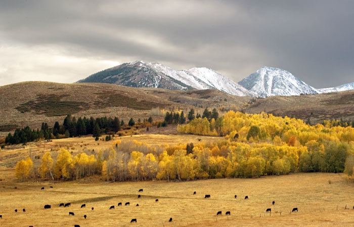
U s highway 395 hyperlapse mono county california may 22 2015
Mono County /ˈmoʊnoʊ/(MOH-noh) is a county located in the east central portion of the U.S. state of California. As of the 2010 census, the population was 14,202. making it the fifth-least populous county in California. The county seat is Bridgeport. The county is located east of the Sierra Nevada between Yosemite National Park and Nevada.
Contents
- U s highway 395 hyperlapse mono county california may 22 2015
- Map of Mono County CA USA
- History
- Geography
- National protected areas
- 2010
- 2000
- Overview
- Crime
- Major highways
- Public transportation
- Airports
- Population ranking
- References
Map of Mono County, CA, USA
The only incorporated town in the county is Mammoth Lakes, which is located at the foot of Mammoth Mountain. Other locations, such as June Lake, are also famous as skiing and fishing resorts. Located in the middle of the county is Mono Lake, a vital habitat for millions of migratory and nesting birds. The lake is located in a wild natural setting, with pinnacles of tufa arising out of the salty and alkaline lake.
Also located in Mono County is Bodie, the official state gold rush ghost town, which is now a California State Historic Park.
History
Mono County was formed in 1861 from parts of Calaveras, Fresno and Mariposa counties. Parts of the county's territory were given to Inyo County in 1866.
The county is named after Mono Lake which, in 1852, was named for a Native American Paiute tribe, the Mono people, who historically inhabited the Sierra Nevada from north of Mono Lake to Owens Lake. The tribe's western neighbors, the Yokut, called them monachie, meaning "fly people" because they used fly larvae as their chief food staple and trading article.
Archeologists know almost nothing about the first inhabitants of the county, as little material evidence has been found from them. The Kuzedika, a band of Paiute, had been there many generations by the time the first anglophones arrived. The Kuzedika were hunter-gatherers and their language is a part of the Shoshone language.
Geography
According to the U.S. Census Bureau, the county has a total area of 3,132 square miles (8,110 km2), of which 3,049 square miles (7,900 km2) is land and 83 square miles (210 km2) (2.6%) is water.
National protected areas
2010
The 2010 United States Census reported that Mono County had a population of 14,202. The racial makeup of Mono County was 11,697 (82.4%) White, 47 (0.3%) African American, 302 (2.1%) Native American, 192 (1.4%) Asian, 11 (0.1%) Pacific Islander, 1,539 (10.8%) from other races, and 414 (2.9%) from two or more races. Hispanic or Latino of any race were 3,762 persons (26.5%).
2000
As of the census of 2000, there were 12,853 people, 5,137 households, and 3,143 families residing in the county. The population density was 4/sq mi (1.5/km2). There were 11,757 housing units at an average density of 4/sq mi (1.5/km2). The racial makeup of the county was 84.2% White, 0.5% Black or African American, 2.4% Native American, 1.1% Asian, 0.1% Pacific Islander, 9.5% from other races, and 2.3% from two or more races. 17.7% of the population were Hispanic or Latino of any race. 13.4% were of German, 12.6% Irish and 11.4% English ancestry according to Census 2000. 84.0% spoke English and 15.1% Spanish as their first language.
There were 5,137 households out of which 28.7% had children under the age of 18 living with them, 50.6% were married couples living together, 6.5% had a female householder with no husband present, and 38.8% were non-families. 26.6% of all households were made up of individuals and 4.3% had someone living alone who was 65 years of age or older. The average household size was 2.43 and the average family size was 2.98.
In the county, the population was spread out with 23.0% under the age of 18, 10.3% from 18 to 24, 33.4% from 25 to 44, 25.6% from 45 to 64, and 7.6% who were 65 years of age or older. The median age was 36 years. For every 100 females there were 121.8 males. For every 100 females age 18 and over, there were 126.8 males.
The median income for a household in the county was $44,992, and the median income for a family was $50,487. Males had a median income of $32,600 versus $26,227 for females. The per capita income for the county was $23,422. About 6.3% of families and 11.5% of the population were below the poverty line, including 12.2% of those under age 18 and 1.9% of those age 65 or over.
Overview
Mono used to be a Republican-leaning county in Presidential and congressional elections but has become more of a Democratic county in recent elections since going for John Kerry by an extremely slim margin of seven votes in 2004. In 2008, Barack Obama did substantially better, receiving 739 more votes (a 13.3 percent margin) than Republican candidate John McCain. Prior to 2004, the only Democrats to ever win a majority or plurality in Mono County had been Franklin Roosevelt in 1940, 1936 and 1932, Woodrow Wilson in 1916 and 1912 and William Jennings Bryan in 1896.
In November 2008, Mono County was one of just three counties in California's interior in which voters rejected Proposition 8 to ban gay marriage. The county's voters rejected Proposition 8 by 55.5 percent to 44.5 percent. The other interior counties in which Proposition 8 failed to receive a majority of votes were neighboring Alpine County and Yolo County.
Mono County is in California's 8th congressional district, represented by Republican Paul Cook.
In the state legislature Mono is in the 5th Assembly district, which is held by Republican Frank Bigelow, and the 8th Senate district, which is held by Republican Tom Berryhill.
Crime
The following table includes the number of incidents reported and the rate per 1,000 persons for each type of offense.
Major highways
Public transportation
Eastern Sierra Transit Authority operates intercity bus service along U.S. 395, as well as local services in Mammoth Lakes. Service extends south to Lancaster, California (Los Angeles County) and north to Reno, Nevada.
Yosemite Area Regional Transit System (YARTS) also runs along U.S. 395 from Mammoth Lakes to Lee Vining before entering Yosemite National Park.
Airports
General aviation airports in Mono County include Bryant Field near Bridgeport, Mammoth Yosemite Airport and Lee Vining Airport. In December 2008, Mammoth Yosemite Airport began commercial air service to Los Angeles International Airport on a seasonal (December to April) basis; the service is provided by Horizon Air, and is subsidized by Mammoth Mountain Ski Resort.
Population ranking
The population ranking of the following table is based on the 2010 census of Mono County.
† county seat