
Existed: 1934 – present Constructed 1934 | Length 245.5 km | |
 | ||
Restrictions: Segment through Tioga Pass closed in winter | ||
State Route 120 (SR 120) is located in northern California. It runs from the San Joaquin Valley near Lathrop through Yosemite National Park, to its end at U.S. Route 6 in Mono County, eastern California.
Contents
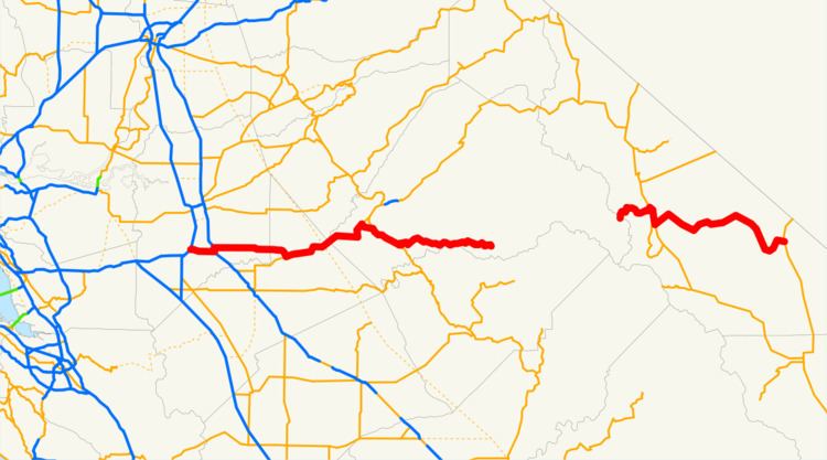
Map of CA-120, California, USA
Route description
This route is part of the California Freeway and Expressway System and is eligible for the State Scenic Highway System. However, it is not officially designated by Caltrans as a scenic highway.
SR 120 begins as a freeway intersecting Interstate 5 to extend Interstate 205 through Manteca. In east Manteca the freeway ends at SR 99 and becomes a highway which continues to head east through Escalon, Oakdale and other various small towns. East of Oakdale there are no highly populated areas for 90 miles (144 km) as it heads into the foothills of the Sierra Nevada and into Yosemite National Park. After leaving Crane Flat within Yosemite, it is known as Tioga Pass Road (or often simply Tioga Road), and it retains that name as it travels through Tuolumne Meadows and over Tioga Pass at an elevation of 9,945-foot on its 59-mile (95 km) journey to its intersection with U.S. Route 395, at Lee Vining. After a jog to the south along US 395, it continues east as Mono Mills Road, skirting the south end of Mono Lake and providing access to the Mono Lake South Tufa as well as the historical site of Mono Mills before cresting Sagehen Summit and ending with the intersection of U.S. Route 6 at Benton. Both the portions through Yosemite National Park and the stretch south of Mono Lake are subject to winter closure. Usually the highway is open through Tioga Pass by the Memorial Day weekend at the end of May, and typically closes for the winter sometime in November.
History
During the Gold Rush, SR 120 was originally known as Big Oak Flat Road, after the village of Big Oak Flat through which it passes in the Sierra foothills. It was a pack trail from Stockton which became popular with prospectors about 1849. By 1874 it was a wagon road which extended to the Yosemite Valley.
In 1921, the California State Assembly authorized San Joaquin County to transfer the county road connecting Manteca with then-Route 5 (now I-5) at Mossdale to the state. It was numbered Route 66, as was a 1933 extension from Manteca east to Route 13 in Oakdale. Also in 1933, Route 40 was extended east from Mono Lake to Route 76 (US 6) at Benton. The route from Manteca to Benton was marked as Sign Route 120 in 1934, and was soon extended west to Mossdale, replacing what had been part of U.S. Route 99W.
Priest grades
West of Priest is a section of highway with over one hundred curves and hairpin turns, known as the "New Priest Grade." With a 4% grade, it opened in 1915 and was built by a group of local volunteers who desired an alternative to the very steep (17%) Old Priest Grade. Today, both grades are paved and drivers can save three minutes by choosing the more direct old grade. There is a 7,500-pound weight limit on the old grade.
Major intersections
Except where prefixed with a letter, postmiles were measured on the road as it was in 1964, based on the alignment that existed at the time, and do not necessarily reflect current mileage. R reflects a realignment in the route since then, M indicates a second realignment, L refers an overlap due to a correction or change, and T indicates postmiles classified as temporary (for a full list of prefixes, see the list of postmile definitions). Segments that remain unconstructed or have been relinquished to local control may be omitted. The numbers reset at county lines; the start and end postmiles in each county are given in the county column.